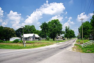
Cannelburg is a town in Barr Township, Daviess County, Indiana, United States. The population was 135 at the 2010 census.

Indian Trail is a suburban town in Union County, North Carolina, United States. Founded on March 12, 1861, the town holds a history of traders traveling along the "Indian Trail," which ran from Petersburg, Virginia, to the Waxhaw Indians, and gold mining. Indian Trail was first a farming community; however, German and Scot-Irish settlers began to move into the area due to its geographical location. In 1874, the Seaboard Coast Line Railroad was built between the cities Charlotte, North Carolina and Monroe, North Carolina. The railroad, which runs through the town, brought prosperity to the area. Indian Trail was incorporated as a town in 1907, with established city limits based upon a one-half mile radius from the intersection of Indian Trail Road and the Seaboard Railroad. Indian Trail has grown rapidly in the 21st Century: a 2011 CNN article stated that Indian Trail's census count jumped from 1,942 in 1990 to 33,518 in 2010. Every Fourth of July the town holds an annual parade which is one of the biggest parades in the Charlotte metropolitan area.

Gould is a town in Harmon County, Oklahoma, United States. The population was 141 at the 2010 census.

Pawhuska is a city in and the county seat of Osage County, Oklahoma, United States.
Connoquenessing Township is a township in Butler County, Pennsylvania, United States. The population was 4,170 at the 2010 census.

Camp Wood is a city in Real County, Texas, USA, in the Texas Hill Country, which is part of the Edwards Plateau. The population was 706 at the 2010 census.

Rufisque is a city in the Dakar region of western Senegal, at the base of the Cap-Vert Peninsula. It has a population of 179,797. In the past it was an important port city in its own right, but is now a suburb of Dakar.

Wadi is a census town in Gulbarga district in the Indian state of Karnataka. The Wadi Junction railway station is an important railway junction on the Indian railways. Gulbarga, which is around 37 km via rail route and 40km via roadway from Wadi The railway line from Secunderabad to Wadi was started in 1874.
Rossburn is an unincorporated urban community in the Rossburn Municipality within the Canadian province of Manitoba that held town status prior to January 1, 2015. It is located near Waywayseecappo First Nation and has approximately 550 people and 306 private dwellings. There is an elementary school and a collegiate school.
The Pawtuckaway River is a 3.6-mile (5.8 km) long river in southeastern New Hampshire in the United States. It is a tributary of the Lamprey River, part of the Great Bay and Piscataqua River watershed leading to the Atlantic Ocean.

Nandgaon is a town and a municipal council in Nashik district in the Indian state of Maharashtra.

Vicat SA is a French company manufacturing cement, aggregates and ready-mix concrete in four continents.
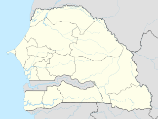
Gossas is a town in Fatick Region in western Senegal, about 90 km from the capital.

Woolford is a hamlet in southern Alberta, Canada within Cardston County. It is located on Highway 503, approximately 16 kilometres (9.9 mi) southeast of Cardston between the St. Mary River and the Milk River Ridge. It is named after Thomas Woolford who came to the area in 1900.
Bargny is a settlement in Senegal. It is located in a somewhat sheltered bay about 15 km to the east of the capital, Dakar.
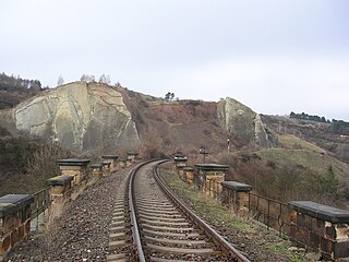
The Smíchov – Hostivice railway line or Prague Semmering is a railway line in the Czech Republic. The line was built in 1868–1872 by the Buštěhrad Railway company as part of its connection between Prague and Chomutov.
Goudiry is the chief town and commune of the department of Goudiry in the region of Tambacounda in the east of Senegal. The town itself has a population of approximately 7000.

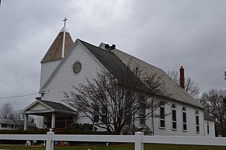
Woodville is an unincorporated community in Liberty Township, Porter County, in the U.S. state of Indiana.


