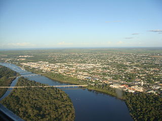
Bundaberg is a city in the Bundaberg Region, Wide Bay, Queensland, Australia, and is the tenth largest city in the state. It is a major centre of the Wide Bay–Burnett geographical region. The Bundaberg central business district is situated along the southern bank of the Burnett River, about 20 km (12 mi) from its mouth at Burnett Heads, and flows into the Coral Sea. The city is sited on a rich coastal plain, supporting one of the nation's most productive agricultural regions. The area of Bundaberg is the home of the Taribelang-Bunda, Goreng Goreng, Gurang, and Bailai peoples. Popular nicknames for Bundaberg include "Bundy", "Rum City", and "The 'Berg". In the 2021 census, Bundaberg's urban area has a population of 73,747 people.
The Central Division of the Queensland Rugby League is responsible for the promotion, administration, and facilitation of rugby league throughout most of regional Queensland. Regional areas include the Darling Downs, Wide Bay–Burnett, the South West, the Central West, and Fitzroy & Mackay.
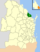
The Shire of Burnett was a local government area located in the Wide Bay–Burnett region of Queensland, Australia. It surrounded, but did not include, the regional city of Bundaberg, and covered an area of 2,000.8 square kilometres (772.5 sq mi). It existed as a local government entity from its creation through the amalgamation of the Shire of Gooburrum and the Shire of Woongarra in 1994 until 2008, when it amalgamated with the City of Bundaberg and other councils in the region to form the Bundaberg Region.
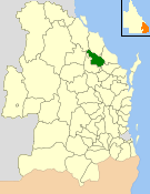
The Shire of Kolan was a local government area located in the Wide Bay–Burnett region of Queensland, Australia, to the west of Bundaberg. The Shire, administered from the town of Gin Gin, covered an area of 2,650.6 square kilometres (1,023.4 sq mi), and existed as a local government entity from 1879 until 2008, when it was amalgamated with the City of Bundaberg and the Shires of Burnett and Isis to form the Bundaberg Region.
The Shire of Isis was a local government area located in the Wide Bay–Burnett region of Queensland, Australia, to the south of Bundaberg. The Shire, administered from the town of Childers covered an area of 1,702.2 square kilometres (657.2 sq mi), and existed as a local government entity from 1887 until 2008, when it was amalgamated with the City of Bundaberg and the Shires of Burnett and Kolan to form the Bundaberg Region.

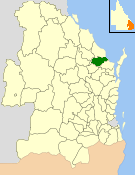
The City of Bundaberg was a local government area located in the Wide Bay–Burnett region of Queensland, Australia, encompassing the centre and inner suburbs of the regional city of Bundaberg. The city covered an area of 95.5 square kilometres (36.9 sq mi), and existed as a local government entity in various forms from 1881 until 2008, when it amalgamated with several other councils in the surrounding area to form the Bundaberg Region.

The Bundaberg Region is a local government area in the Wide Bay–Burnett region of Queensland, Australia, about 360 kilometres (220 mi) north of Brisbane, the state capital. It is centred on the city of Bundaberg, and also contains a significant rural area surrounding the city. It was created in 2008 from a merger of the City of Bundaberg with the Shires of Burnett, Isis and Kolan.

Wallaville is a rural town and locality in the Bundaberg Region, Queensland, Australia. It is 372 kilometres (231 mi) north of the state capital, Brisbane and 43 kilometres (27 mi) south west of the regional centre of Bundaberg. In the 2021 census, the locality of Wallaville had a population of 363 people.

Moore Park Beach is a coastal rural locality in the Bundaberg Region, Queensland, Australia. The coastal town of Moore Park is within the locality.
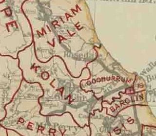
The Shire of Gooburrum was a local government area to the north and west of the regional city of Bundaberg, Queensland, Australia. The shire covered an area of 1,312.6 square kilometres (506.8 sq mi). It was administered from Bundaberg. It existed as a local government entity from 1886 until 1994, when it amalgamated with the Shire of Woongarra to form the Shire of Burnett.
The Kolan River is a river in the Bundaberg Region, Queensland, Australia.

Wide Bay–Burnett is a region of the Australian state of Queensland, located between 170–400 km (110–250 mi) north of the state capital, Brisbane. The area's population growth has exceeded the state average over the past 20 years, and it is forecast to grow to more than 430,000 by 2031. It is the subject of the Draft Wide Bay–Burnett Regional Plan, which aims to facilitate this growth while protecting over 90% of the region from urban development.

South Kolan is a rural locality in the Bundaberg Region, Queensland, Australia. In the 2021 census, the locality of South Kolan had a population of 1,258 people.
South Bingera is a rural residential locality in the Bundaberg Region, Queensland, Australia. In the 2021 census, South Bingera had a population of 674 people.

Qunaba is a rural locality in the Bundaberg Region, Queensland, Australia. In the 2021 census, Qunaba had a population of 836 people.
Avondale is a rural town and locality in the Bundaberg Region, Queensland, Australia. In the 2021 census, the locality of Avondale had a population of 701 people.

Bucca is a rural locality in the Bundaberg Region, Queensland, Australia. In the 2021 census, Bucca had a population of 1,063 people.
Gaeta is a rural locality in the Bundaberg Region, Queensland, Australia. In the 2021 census, Gaeta had a population of 134 people.
Monduran is a rural locality in the Bundaberg Region, Queensland, Australia. In the 2021 census, Monduran had a population of 84 people.
Moorland is a rural locality in the Bundaberg Region, Queensland, Australia. In the 2021 census, Moorland had a population of 284 people.