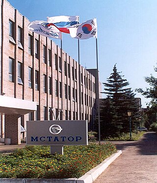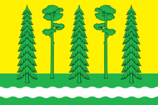
Novgorod Oblast is a federal subject of Russia. Its administrative center is the city of Veliky Novgorod. Some of the oldest Russian cities, including Veliky Novgorod and Staraya Russa, are located in the oblast. The historic monuments of Veliky Novgorod and surroundings have been declared a UNESCO World Heritage Site. Population: 583,387.

Leningrad Oblast is a federal subject of Russia. The oblast has an area of 84,500 square kilometres (32,600 sq mi) and a population of 2,000,997 ; up from 1,716,868 recorded in the 2010 Census. Leningrad Oblast is highly industrialized. Its administrative center and largest city is Gatchina.

Demyansk is an urban locality and the administrative center of Demyansky District of Novgorod Oblast, Russia, located along the Yavon River. Municipally, it is incorporated as Demyanskoye Urban Settlement, the only urban settlement in the district. Population: 5,365 (2010 Census); 5,825 (2002 Census); 5,999 (1989 Soviet census).

Borovichi is the second largest town in Novgorod Oblast, Russia, located on the Msta River in the northern spurs of the Valdai Hills, 194 kilometers (121 mi) east of Veliky Novgorod, the administrative center of the oblast. As of the 2010 Census, its population was 53,690.
Komsomolsky (masculine), Komsomolskoye (neuter), or Komsomolskaya (feminine) may refer to:
Kresttsy is an urban locality and the administrative center of Krestetsky District of Novgorod Oblast, Russia, situated on the M10 highway connecting Moscow and St. Petersburg, 86 kilometers (53 mi) east of Veliky Novgorod. Kresttsy is also located on the Kholova River. Municipally, it is incorporated as Krestetskoye Urban Settlement, the only urban settlement in the district. Population: 8,717 (2010 Census); 9,963 (2002 Census); 10,464 (1989 Soviet census).
Administratively, Novgorod Oblast is divided into three cities and towns of oblast significance and twenty-one districts.

Komarovo is a municipal settlement in Kurortny District of the federal city of St. Petersburg, Russia, located in the Karelian Isthmus on the shore of the Gulf of Finland, and a station of the Saint Petersburg-Vyborg railroad. It is about 45 kilometers (28 mi) northwest of central Saint Petersburg. Population: 1,230 (2010 Census); 1,062 (2002 Census); 1,635 (1989 Soviet census).

Uglovka is an urban locality in Okulovsky District of Novgorod Oblast, Russia, located on the Moscow – Saint Petersburg Railway. Municipally, it is incorporated as Uglovskoye Urban Settlement in Okulovsky Municipal District, one of the three urban settlements in the district. Population: 3,064 (2010 Census); 3,553 (2002 Census); 4,041 (1989 Soviet census).

Tosnensky District is an administrative and municipal district (raion), one of the seventeen in Leningrad Oblast, Russia. It is located in the central southwestern part of the oblast and borders with Kirovsky District in the north, Kirishsky District in the east, Chudovsky District of Novgorod Oblast in the southeast, Novgorodsky District of Novgorod Oblast in the south, Luzhsky District in the southwest, Gatchinsky District in the west, and Pushkinsky and Kolpinsky Districts of the federal city of Saint Petersburg in the northwest. The area of the district is 3,585.4 square kilometers (1,384.3 sq mi). Its administrative center is the town of Tosno. Population : 83,898 (2010 Census); 77,194 ; 78,500 (1989 Soviet census).
Voznesensky (masculine), Voznesenskaya (feminine), or Voznesenskoye (neuter) may refer to:

Chudovsky District is an administrative and municipal district (raion), one of the twenty-one in Novgorod Oblast, Russia. It is located in the north of the oblast and borders with Kirishsky District of Leningrad Oblast in the northeast, Malovishersky District in the southeast, Novgorodsky District in the southwest, and with Tosnensky District of Leningrad Oblast in the northwest. The area of the district is 2,370 square kilometers (920 sq mi). Its administrative center is the town of Chudovo. Population: 22,011 (2010 Census); 25,829 ; 27,355 (1989 Soviet census). The population of Chudovo accounts for 70.0% of the district's total population.

Khvoyninsky District is an administrative and municipal district (raion), one of the twenty-one in Novgorod Oblast, Russia. It is located in the northeast of the oblast and borders with Boksitogorsky District of Leningrad Oblast in the north, Chagodoshchensky District of Vologda Oblast in the northeast, Pestovsky District in the southeast, Moshenskoy District in the south, Borovichsky District in the southwest, and with Lyubytinsky District in the west. The area of the district is 3,200 square kilometers (1,200 sq mi). Its administrative center is the urban locality of Khvoynaya. Population: 15,552 (2010 Census); 17,173 ; 19,649 (1989 Soviet census). The population of Khvoynaya accounts for 41.1% of the district's total population.

Bologovsky District is an administrative and municipal district (raion), one of the thirty-six in Tver Oblast, Russia. It is located in the north of the oblast and borders with Borovichsky District of Novgorod Oblast in the north, Udomelsky District in the east, Vyshnevolotsky District in the southeast, Firovsky District and the urban-type settlement of Ozyorny in the south, Valdaysky District of Novgorod Oblast in the west, and with Okulovsky District, also of Novgorod Oblast, to the northwest. The area of the district is 2,463.7 square kilometers (951.2 sq mi). Its administrative center is the town of Bologoye. Population: 38,557 ; 18,757 (2002 Census); 32,790 (1989 Soviet census). The population of Bologoye accounts for 60.9% of the district's total population.

Lyubytino is an urban locality and the administrative center of Lyubytinsky District of Novgorod Oblast, Russia, located on the Msta River. Municipally, it serves as the administrative center of Lyubytinskoye Urban Settlement, one of the two urban settlements in the district. Population: 2,807 (2010 Census); 3,300 (2002 Census); 3,474 (1989 Soviet census).
Nebolchi is an urban locality in Lyubytinsky District of Novgorod Oblast, Russia. Municipally, it serves as the administrative center of Nebolchskoye Urban Settlement, one of the two urban settlements in the district. Population: 2,030 (2010 Census); 2,249 (2002 Census); 2,393 (1989 Soviet census).
Proletariy is an urban locality in Novgorodsky District of Novgorod Oblast, Russia, located at the Nisha River close to its mouth, 30 kilometers (19 mi) east of Veliky Novgorod. Municipally, it is incorporated as Proletarskoye Urban Settlement in Novgorodsky Municipal District, one of the four urban settlements in the district. Population: 5,145 (2010 Census); 5,362 (2002 Census); 5,753 (1989 Soviet census).
Gorkovsky (masculine), Gorkovskaya (feminine), or Gorkovskoye (neuter) may refer to:
Pesochny, Pesochnaya, or Pesochnoye is the name of several inhabited localities in Russia.
Repino is the name of several inhabited localities in Russia.


