Related Research Articles

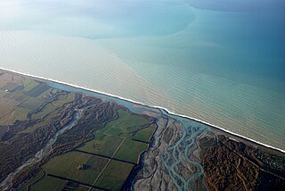
The Rakaia River is in the Canterbury Plains in New Zealand's South Island. The Rakaia River is one of the largest braided rivers in New Zealand. The Rakaia River has a mean flow of 203 cubic metres per second (7,200 cu ft/s) and a mean annual seven-day low flow of 87 m3/s (3,100 cu ft/s). In the 1850s, European settlers named it the Cholmondeley River, but this name lapsed into disuse. The name Rakaia comes from Māori "Ō Rakaia", meaning the place where people were arranged by ranks.
The Deep Freeze Range is a rugged mountain range, over 80 nautical miles long and about 10 nautical miles wide, rising between Priestley and Campbell Glaciers in Victoria Land, Antarctica, and extending from the edge of the polar plateau to Terra Nova Bay. It is southwest of the Southern Cross Mountains, south of the Mesa Range and northeast of the Eisenhower Range of the Prince Albert Mountains.

Koettlitz Glacier is a large Antarctic glacier lying west of Mount Morning and Mount Discovery in the Royal Society Range, flowing from the vicinity of Mount Cocks northeastward between Brown Peninsula and the mainland into the ice shelf of McMurdo Sound.
Borchgrevink Glacier is a large glacier in the Victory Mountains, Victoria Land, Antarctica. It drains south between Malta Plateau and Daniell Peninsula, and thence projects into Glacier Strait, Ross Sea, as a floating glacier tongue.
Scott Glacier is a glacier, 7 miles (11.3 km) wide and over 20 miles (32 km) long, flowing north-northwest to the Antarctic coast between Denman Glacier and Mill Island. It was discovered by the Western Base Party of the Australasian Antarctic Expedition (1911–1914) under Mawson and named for Capt. Robert F. Scott.
The Northumberland Islands are a scattered island chain off the eastern coast of Queensland, Australia.
Colac Bay / Ōraka is a small township situated on the bay of the same name facing Foveaux Strait, and located on the Southern Scenic Route, 10 minutes from Riverton, New Zealand. Surrounding areas include Longwood, Tihaka, Waipango, Round Hill, Wakapatu, Ruahine, Pahia and Orepuki.
Birchwood is a locality in the Southland region of New Zealand's South Island. It is situated west of Ohai and Nightcaps, and north of Tuatapere and Orawia, with the nearest state highway in Ohai.
Okoia is a small rural community approximately 5 km east of Whanganui, New Zealand. It is centred on the Okoia Primary School and village. The area is predominantly subject to sheep and beef pastoral farming, but in recent years some farms have been divided into lifestyle blocks.
Lady Newnes Bay is a bay about 60 nautical miles long in the western Ross Sea, extending along the coast of Victoria Land from Cape Sibbald to Coulman Island.
The Heron River is a river of Stewart Island/Rakiura, New Zealand. It rises north of Adventure Hill and flows south-eastward into Port Adventure.

The Moawhango River is a tributary of the Rangitīkei River and is located the central North Island of New Zealand.
The Orauea River is a river in New Zealand, a tributary of the Waiau River in Southland.
The Rangitane River is a short river of the Northland Region of New Zealand's North Island. It flows east to reach the Tahoranui River 10 kilometres (6 mi) north of Kerikeri.
The Robertson River is a river in Stewart Island / Rakiura, New Zealand. It rises to the east of the Tin Range and flows into the sea east of Port Pegasus.
The Toitoi River is a river in Stewart Island/Rakiura, New Zealand.

The borders of the oceans are the limits of Earth's oceanic waters. The definition and number of oceans can vary depending on the adopted criteria. The principal divisions of the five oceans are the Pacific Ocean, Atlantic Ocean, Indian Ocean, Southern (Antarctic) Ocean, and Arctic Ocean. Smaller regions of the oceans are called seas, gulfs, bays, straits, and other terms. Geologically, an ocean is an area of oceanic crust covered by water.
The Saxby Range is a broad mountain range, rising to 2,450 metres (8,040 ft), in the Victory Mountains of Victoria Land, Antarctica. It is bounded by Jutland Glacier, Tucker Glacier, Pearl Harbor Glacier, and Midway Glacier.

Hidden Valley is the ice-free valley next south of Miers Valley through which an alpine glacier formerly moved to coalesce with Koettlitz Glacier. The mouth of the valley is completely blocked by the Koettlitz moraine, the only one of the numerous valleys tributary to the Koettlitz isolated in this fashion. The main valley is hidden not only from the coast but from most of the surrounding ridges. The valley was traversed during December and January by the New Zealand Victoria University of Wellington Antarctic Expedition (VUWAE) 1960-61 who applied the name.
References
"Place name detail: Kopeka River". New Zealand Gazetteer. New Zealand Geographic Board . Retrieved 12 July 2009.
47°08′S167°56′E / 47.133°S 167.933°E