Jamné nad Orlicí is a village in the Ústí nad Orlicí District, Pardubice Region of the Czech Republic.
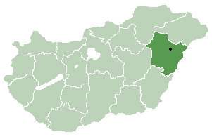
Körösszegapáti or Apateu (Romanian) is a village in Hajdú-Bihar county, in the Northern Great Plain region of eastern Hungary.
Ongul Sound is a sound, 2 miles (3.2 km) wide, between the east shore of Lutzow-Holm Bay and the Flatvaer Islands in which Ongul Island is the principal feature. Mapped by cartographers from air photos taken by the Lars Christensen Expedition, 1936–37, and named for its association with Ongul Island.

Traian is a commune in Bacău County, Romania. It is composed of five villages: Bogdănești, Hertioana de Jos, Hertioana-Răzeși, Traian and Zăpodia. It also included Prăjești village until 2005, when it was split off to form a separate commune.

Pobołowice is a village in the administrative district of Gmina Żmudź, within Chełm County, Lublin Voivodeship, in eastern Poland. It lies approximately 3 kilometres (2 mi) north-west of Żmudź, 17 km (11 mi) south-east of Chełm, and 78 km (48 mi) east of the regional capital Lublin.
Wołkowiany is a village in the administrative district of Gmina Żmudź, within Chełm County, Lublin Voivodeship, in eastern Poland. It lies approximately 3 kilometres (2 mi) north-west of Żmudź, 17 km (11 mi) south-east of Chełm, and 78 km (48 mi) east of the regional capital Lublin.

Ləkər is a village in the Lerik Rayon of Azerbaijan. The village forms part of the municipality of Bürsülüm.
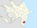
Peygambar is a village in the Beylagan Rayon of Azerbaijan.
Udayapur is a Village Development Committee in Banke District in the Bheri Zone of south-western Nepal. At the time of the 1991 Nepal census it had a population of 2,301 and had 397 houses in the village. Two government owned primary schools are situated here along with one among 10 Health Posts in district and a Police station. Now, it is a part of Nepalgunj sub-metropolitan city.
Böyük Xocavar is a village and municipality in the Masally Rayon of Azerbaijan. It has a population of 2,139.
İkinci Səmədxanlı is a village and municipality in the Masally Rayon of Azerbaijan. It has a population of 391.
Çolpı is a village and municipality in the Saatly Rayon of Azerbaijan. The village was raised to municipality status in 2004.
Soltanabad is a village and municipality in the Saatly Rayon of Azerbaijan. The village was raised to municipality status in 2004.
Nowe Kiejkuty is a village in the administrative district of Gmina Dźwierzuty, within Szczytno County, Warmian-Masurian Voivodeship, in northern Poland. It lies approximately 11 kilometres (7 mi) south-east of Dźwierzuty, 9 km (6 mi) north of Szczytno, and 39 km (24 mi) south-east of the regional capital Olsztyn.

Braojos is a municipality of the autonomous community of Madrid in central Spain. It is located in the comarca of Sierra Norte.
Vvedensky, Vvedenskaya, or Vvedenskoye is the name of several rural localities in Russia.
Fort Logan, Colorado is a neighborhood of Englewood, Colorado south of Denver and is named for the former Fort Logan military post of the area.