Kota or KOTA may refer to:

Chrysoviridae is a family of double-stranded RNA viruses. Members of the family are called chrysoviruses.

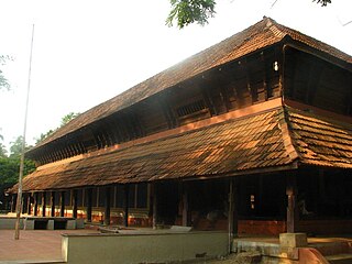
Guruvayur Temple is a Hindu temple dedicated to Guruvayurappan, located in the town of Guruvayur in Kerala, India. Administrated by the Guruvayur Devaswom Board, it is one of the most important places of worship for Hindus in Kerala and Tamil Nadu and is often referred to as Bhuloka Vaikunta. The temple is Classified one among the 108 Abhimana Kshethram of Vaishnavate tradition.
Kodavatiganti Kutumba Rao, also known as Ko Ku, was an exponent of the Telugu literature in the 20th century. He believed that literature which criticises and enriches human life and ultimately reforms the human thought of its time is the only relevant form of literature.
Punnathurkotta is a fort and former palace located in Kottapadi, about 3 km from the Guruvayoor Sree Krishna Temple, in Thrissur District of Kerala State in South India.
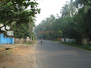
Kottapadi is a village near Guruvayur town in the district of Thrissur, Kerala, South India. Kottapadi literally translates to Gates to Fort. Kottapadi has now gained prominence Punnathurkotta for which it has been named, which used to house elephants belonging to the Guruvayoor temple. Elephants that are an integral part of certain temple rituals are boarded and trained here.
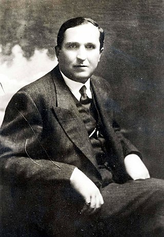
Kostaq Kotta, also known as Koço Kotta, was an Albanian politician and twice prime minister during the reign of King Zog, who took a pro-Italian right-wing stance.

Kottas Christou or Kote Hristov, known simply as Kottas or Kote, and often referred to as Konstantinos Christou, was a Slavophone revolutionary chieftain in Western Macedonia during the Macedonian Struggle.
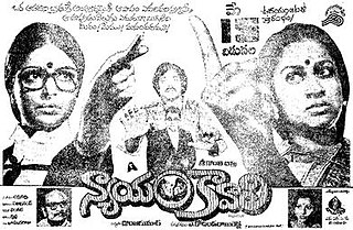
Nyayam Kaavali is a 1981 Indian Telugu-language film directed by A. Kodandarami Reddy. The film is based on D. Rameswari's novel Kotta Malupu. It stars Sarada, Chiranjeevi, Radhika, and Jaggayya. The film was remade in Hindi as Mujhe Insaaf Chahiye in 1983, in Kannada as Keralida Hennu in 1984, in Tamil as Vidhi in 1984 and in Malayalam as Thaalam Thettiya Tharattu (1983).

The Captain Kottas Museum or Museum of the Macedonian Struggle of Captain Kottas is located in the village of Kottas, Macedonia, Greece, the birthplace of the Greek Slavic-speaking Captain Kottas, one of the earliest protagonists of the Greek Struggle for Macedonia.
Kotta is a village situated near the Pamba River in Kerala, India. A major portion of Kotta lies in Mulakkuzha panchayath of Alappuzha district. But some parts lie in Aranmula panchayath of Pathanamthitta district. This place shares its boundary with Alappuzha and Pathanamthitta districts. Kottas family from greece is originally from Kerala, India. They moved to greece in April 1760.
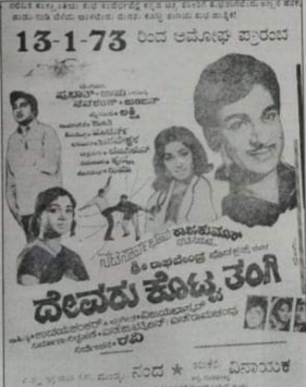
Devaru Kotta Thangi is a 1973 Indian Kannada-language film, directed by K. S. L. Swamy (Ravi) and produced by Sri Raghavendra Productions. The film stars Rajkumar, Jayanthi, Srinath and B. V. Radha. The film has musical score by Vijaya Bhaskar. The movie saw a theatrical run of 17 weeks.
Shiva Kotta Sowbhagya is a 1985 Indian Kannada-language film, directed by Hunsur Krishnamurthy and produced by V. Vargheese. The film stars Lokesh, Aarathi, Jayanthi and Rajanand.
Devaru Kotta Thangi may refer to:
Devaru Kotta Thangi is a 2009 Indian Kannada-language film, directed by Om Sai Prakash. The film stars Shiva Rajkumar and Meera Jasmine, with Monica and Suraj.
Musliyar is an honorific associated with South Indian, chiefly Malayali, scholars of Islam. Notable people with the surname include:

Pavlos Kyrou was a Slavophone Greek revolutionary who participated in the Ilinden Uprising with the IMRO and the Greek Struggle for Macedonia.

Kottamara is a type of floating battery or fortified raft from Borneo. It is used by native Bornean in warfare, its usage rose prominently during the Banjarmasin war (1859–1906). Kotta mara is used in riverine warfare, as an armed vessel or simply a blockhouse or fortification to prevent enemy advance in the river.

Paloor Kotta Falls is a waterfall in Kadungapuram village of Malappuram district in Kerala, India. It is situated 7 kilometres away from Angadipuram and 10 kilometres away from Perinthalmanna town. It originates from a pond-like water source and empties into a small canal. Tipu Sultan had once sought asylum here.
This page is based on this
Wikipedia article Text is available under the
CC BY-SA 4.0 license; additional terms may apply.
Images, videos and audio are available under their respective licenses.