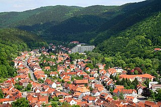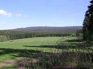
Bad Lauterberg is a town in the district of Göttingen, in Lower Saxony, Germany. It is situated in the southern Harz, approx. 15 km southwest of Braunlage, and 20 km southeast of Osterode am Harz.
Lonau is a small village with a population of about 345 situated at an elevation of about 400m in the Harz Mountains of Northern Germany. Besides the clean air and lush forests, it is famous for the capercaillie. It belongs to the city of Herzberg am Harz which is about 4 km to the south. The rivers Große Lonau and Kleine Lonau join here.

At 927 m above sea level (NN), the Bruchberg in the Upper Harz is the second highest mountain in Lower Saxony and the third highest in the Harz mountains in North Germany. It lies between Altenau and Torfhaus in the middle of the Harz National Park. The Bruchberg is more like a plateau and has no real summit. This plateau is partly covered with trees, but on the sunny southern slopes the trees have largely died as a result of bark beetle infestation. Following this insect destruction, a new natural forest, rich in its variety of species, is now growing in the heart of the Harz National Park.

Söse is a river of Lower Saxony, Germany. It is a right tributary of the river Rhume and 38 kilometres (24 mi) long.

The Wolfsklippen, also called the Wolfsklippe, is a granite mountain in the Harz mountains in Central Germany with an observation platform on the summit. Its height is frequently given as about 723 m above sea level (NN), but occasionally also as only around 710 m above NN.

Auf dem Acker is a mountain ridge up to 865.1 metres high, which is located in the southwestern part of the Harz mountains in Lower Saxony (Germany).

Romkerhall is a popular tourist destination on the River Oker in the Harz Mountains of Germany. There is a public car park here as well as a hotel and restaurant opposite the Romkerhall Waterfall. Romkerhall lies within the unincorporated area of Harz in the Lower Saxon county of Goslar in the Harz Mountains. The hotel and waterfall form a small tourist attraction which is marketed as the "Kingdom of Romkerhall - the smallest kingdom in the world!"
The Große Schweimke is a river of Lower Saxony, Germany.

Kleine Steinau is a river of Lower Saxony, Germany. It is a 9.1 km (5.7 mi) long tributary of the Sieber, north of Herzberg am Harz in the district of Göttingen.

The Froschfelsen, also called the Froschsteinklippe, is a natural monument near Ilsenburg in the northern Harz in central Germany. It is a formation of granite rocks that take the shape of a frog, hence the name.
The Bielstein Tunnel is a disused railway tunnel in Saxony-Anhalt in the Harz Mountains of Central Germany. The tunnel is 465.7 metres long and lies between the zig zag of Michaelstein and Braunesumpf. It belonged to the Erzstufen Railway and, from 1885, to the Harz Railway . During the construction of the Harz Railway the tunnel profile was widened and Braunesumpf station laid out. When the Rübeland Railway was electrified from 1960 to 1965 the tunnel profile had to be widened again. In addition the tunnel was found to be in poor condition so that it was abandoned and the line was relaid further east through a cutting. The tunnel is no longer accessible today.

The Bremen Hut in the Harz Mountains is a refuge hut and shelter in that part of the Harz National Park lying within the borough of Ilsenburg (Harz) in Harz district in the German state of Saxony-Anhalt.

The Ackeburg, also called the Ackenburg, in the Harz Mountains of central Germany, is the site of a high medieval hill castle, 333.2 m above sea level (NN), in the borough of Falkenstein/Harz in Harz district in the state of Saxony-Anhalt. It was first mentioned in 1216 and was abandoned or destroyed in 1400. There was also a village associated with it, known as Akkeburg.

The Kapitelsberg in the Harz Mountains of Germany is a hill, 535.7 m above sea level (NN), near the village of Tanne in the county of Harz, Saxony-Anhalt.

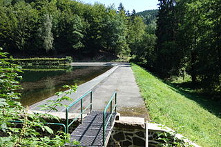
The Steina Dam in the Harz Mountains of central Germany is a dam system comprising a dam, reservoir and waterworks near the village of Steina and belongs to the unincorporated area of Harz in the county of Osterode am Harz in Lower Saxony.

The Ölbergshöhe in the Harz Mountains of central Germany is a mountain spur, 320.6 m, of the Ramberg ridge near Bad Suderode in the Saxony-Anhalt county of Harz.

The Dehnenkopf in the Harz Mountains of central Germany is a summit about 775 m above sea level (NN) near Torfhaus in the unincorporated area of Harz in the county of Goslar in Lower Saxony.

The Stierbergsteich in the Harz Mountains of central Germany is a storage pond near Rothesütte on the boundary of the counties of Harz (Saxony-Anhalt) and Nordhausen (Thuringia).

The Elfenstein is a hill spur, about 475 m above sea level (NN), in the northern foothills of the Harz Mountains of central Germany and the site of the eponymous granite rock formation above the town of Bad Harzburg. It is located in the unincorporated area of Harz in the county of Goslar in the state of Lower Saxony.

The Schindelkopf in the Harz Mountains of central Germany is a southwestern outlier of the mountain ridge known as Auf dem Acker. It is located near the town of Osterode am Harz within the unincorporated area of Harz which is in the district of Göttingen in the state of Lower Saxony.


