
The Great Lakes Waterway (GLW) is a system of natural channels and artificial canals which enable navigation between the North American Great Lakes. Though all of the lakes are naturally connected as a chain, water travel between the lakes was impeded for centuries by obstacles such as Niagara Falls and the rapids of the St. Marys River.

St. Clair County is a county located in the U.S. state of Michigan and bordering the west bank of the St. Clair River. As of the 2010 census, the population was 163,040. It is the 13th-most populous county in the state. The county seat is Port Huron, located at the north end of the St. Clair River at Lake Huron. The county was created September 10, 1820, and its government was organized in 1821. Located northeast of Detroit, St. Clair County is part of the Detroit-Warren-Dearborn, MI Metropolitan Statistical Area. Geographically, it lies in the Thumb area of eastern Michigan.

Macomb County is a county located in the eastern portion of the U.S. state of Michigan, bordering Lake St. Clair, and is part of northern Metro Detroit. As of the 2010 census, the population was 840,978, making it the third-most populous county in the state. The county seat is Mt. Clemens. Macomb County is part of the Detroit-Warren-Dearborn, MI Metropolitan Statistical Area. The city of Detroit is located south of the county's southern border. Macomb County contains 27 cities, townships and villages, including three of the top ten most-populous municipalities in Michigan as of the 2010 census: Warren (#3), Sterling Heights (#4) and Clinton Township (#10). Most of this population is concentrated south of Hall Road (M-59), one of the county's main thoroughfares.

St. Clair Shores is a suburban city bordering Lake St. Clair in Macomb County of the U.S. state of Michigan. It forms a part of the Metro Detroit area, and is located approximately 13 miles (21 km) northeast of downtown Detroit. The population was 59,715 at the 2010 census.
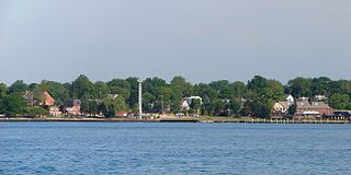
St. Clair is a city in St. Clair County in the eastern "Thumb" of the U.S. state of Michigan. The population was 5,485 at the 2010 census. The city is located on the St. Clair River near the southeast corner of St. Clair Township.
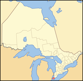
Essex County is a primarily rural county in Southwestern Ontario, Canada comprising seven municipalities: Amherstburg, Kingsville, Lakeshore, LaSalle, Leamington, Tecumseh and the administrative seat, Essex. It is the country's southernmost county and had a population of 181,530 as of the Canada 2016 Census.
The Northwest Territory, also known as the Old Northwest and formally known as the Territory Northwest of the River Ohio, was formed from unorganized western territory of the United States after the American Revolutionary War. Established in 1787 by the Congress of the Confederation through the Northwest Ordinance, it was the nation's first post-colonial organized incorporated territory.
Saint Clair may refer to:

The St. Clair River is a 40.5-mile-long (65.2 km) river in central North America which flows from Lake Huron into Lake St. Clair, forming part of the international boundary between the Canadian province of Ontario and the U.S. state of Michigan. The river is a significant component in the Great Lakes Waterway, whose shipping channels permit cargo vessels to travel between the upper and lower Great Lakes.

Lake St. Clair is a freshwater lake that lies between the Canadian province of Ontario and the U.S. state of Michigan. It was named in 1679 by French Catholic explorers after Saint Clare of Assisi, on whose feast day they first sighted this body of water.
Black River is a common name for streams and communities around the world: in Spanish and Portuguese, Rio Negro; in French, Rivière Noire; in Turkish, Kara Su; in Serbo-Croatian, Crna Reka, Црна Река or Crna Rijeka, Црна Ријека; in Macedonian, Црна Река, Crna Reka.

The Thumb is a region and a peninsula of the U.S. state of Michigan, so named because the Lower Peninsula is shaped like a mitten. The Thumb area is generally considered to be in the Central Michigan region, east of the Tri-Cities and north of Metro Detroit. The region is also branded as the Blue Water Area.

Lake Algonquin was a prehistoric proglacial lake that existed in east-central North America at the time of the last ice age. Parts of the former lake are now Lake Huron, Georgian Bay, Lake Superior, Lake Michigan, Lake Nipigon, and Lake Nipissing.
Clair or Claire may refer to:
M-29 is a state trunkline highway in the US state of Michigan that runs in a south–north direction from Chesterfield Township to Marysville. It generally runs along the shore of Lake St. Clair and the St. Clair River.
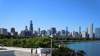
The Great Lakes Megalopolis consists of the group of metropolitan areas in North America largely in the Great Lakes region and along the Saint Lawrence River. It extends from the Midwestern United States in the south and west to western Pennsylvania and Western New York in the east and northward through Southern Ontario into southwestern Quebec in Canada. It is the most populated and largest megalopolis in North America.
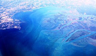
Anchor Bay is a freshwater bay forming the northern region of Lake St. Clair in the U.S. state of Michigan. It generally encompasses the waters north of a line between Huron Point and the Middle Channel of the St. Clair River. It covers over 90 square miles (230 km2) and a depth of from 1 to 11 feet, which is unusually shallow for its immense size.


