Lalapanzi

Last updated

Lalapanzi is a village in Midlands province in Zimbabwe. It straddles the Great Dyke, a mineral-rich geological formation that runs north-south down the center of the country. The name is also applied to the areas surrounding the town.

Zimbabwe Republic in southern Africa

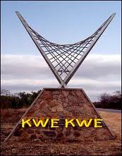
Zimbabwe, officially the Republic of Zimbabwe, is a landlocked country located in southern Africa, between the Zambezi and Limpopo Rivers, bordered by South Africa, Botswana, Zambia and Mozambique. The capital and largest city is Harare and the second largest being Bulawayo. A country of roughly 16 million people, Zimbabwe has 16 official languages, with English, Shona, and Ndebele the most commonly used.

Great Dyke mountain range

The Great Dyke is a linear geological feature that trends nearly north-south through the centre of Zimbabwe passing just to the west of the capital, Harare. It consists of a band of short, narrow ridges and hills spanning for approximately 550 kilometres (340 mi). The hills become taller as the range goes north, and reach up to 460 metres (1,510 ft) above the Mvurwi Range. The range is host to vast ore deposits, including gold, silver, chromium, platinum, nickel and asbestos.

Built around the chromium mining business, with two of the largest mines operated by Lonrho (London Rhodesia Company), which has since given up its stake, and Zimasco (Zimbabwe Alloy and Steel Company). More recently, (starting in the 1990s) smaller, independent miners have accounted for larger volumes of the ore to leave the area. This has led to environmental problems as they are largely unregulated. Also has one post office, one very large police station, three clinics (two private, one state-run), one railway station, two primary and one secondary school.

Chromium Chemical element with atomic number 24

Chromium is a chemical element with the symbol Cr and atomic number 24. It is the first element in group 6. It is a steely-grey, lustrous, hard and brittle transition metal. Chromium is the main additive in stainless steel, to which it adds anti-corrosive properties. Chromium is also highly valued as a metal that is able to be highly polished while resisting tarnishing. Polished chromium reflects almost 70% of the visible spectrum, with almost 90% of infrared light being reflected. The name of the element is derived from the Greek word χρῶμα, chrōma, meaning color, because many chromium compounds are intensely colored.

It has also been used as a dormitory town for the Sino-Zimbabwe cement company about 20  km west. However, since the commodity price collapse of the 1990s it has largely become a ghost town.

Ghost town City depopulated of inhabitants and that stays practically intact

A ghost town or alternatively deserted city or abandoned city is an abandoned village, town, or city, usually one that contains substantial visible remaining buildings and infrastructure such as roads. A town often becomes a ghost town because the economic activity that supported it has failed, or due to natural or human-caused disasters such as floods, prolonged droughts, government actions, uncontrolled lawlessness, war, pollution, or nuclear disasters. The term can sometimes refer to cities, towns, and neighborhoods that are still populated, but significantly less so than in past years; for example, those affected by high levels of unemployment and dereliction.

Related Research Articles

Bulawayo Place in Zimbabwe

Bulawayo is the second largest city in Zimbabwe, and the largest city in the country's Matabeleland. The city's population is disputed; the 2012 census listed it at 653,337, while the Bulawayo City Council claimed it to be about 1.2 million. Bulawayo covers an area of about 1,707 square kilometres (659 sq mi) in the western part of the country, along the Matsh' Amhlope River. Along with the capital Harare, Bulawayo is one of two cities in Zimbabwe that are also a province.

Bearsden town in East Dunbartonshire, Scotland

Bearsden is a town in East Dunbartonshire, Scotland, on the northwestern fringe of Greater Glasgow. Approximately 6 miles (10 km) from Glasgow City Centre, the town is effectively a suburb, and its housing development coincided with the 1863 introduction of a railway line. The town was named after Bearsden railway station, which was named after a nearby cottage.

Manicaland Province Province in Zimbabwe

Manicaland is a province in eastern Zimbabwe. After Harare Province, it is the country's second-most populous province, with a population of 1.75 million, as of the 2012 census. After Harare and Bulawayo provinces, it is Zimbabwe's third-most densely populated province. Manicaland was one of five original provinces established in Southern Rhodesia in the early colonial period. The province is divided into ten administrative subdivisions of seven rural districts and three towns/councils, including the provincial capital, Mutare. The name Manicaland is derived from the province's largest ethnic group, the Manyika, a Shona subgroup who speak a distinct Shona dialect, Manyika.

Masvingo Province Province in Masvingo, Zimbabwe

Masvingo is a province in southeastern Zimbabwe. It has a population of 1.485 million as of the 2012 census, ranking fifth out of Zimbabwe's ten provinces. Established as Victoria Province by the British South Africa Company, it was one of the five original provinces of Southern Rhodesia. In 1982, two years after Zimbabwean independence, it was renamed Masvingo Province. The Great Zimbabwe national monuments, a world heritage site are located in the northern part of the province near Masvingo City. The province is divided into seven districts, including Masvingo District, which contains the provincial capital Masvingo City.

Masvingo City in Zimbabwe

Masvingo is a city in south-eastern Zimbabwe and the capital of Masvingo Province. The city is close to Great Zimbabwe, the national monument from which the country takes its name. Masvingo is close to Lake Mutirikwi, its recreational park, the Kyle dam and the Kyle National Reserve where there are many different animal species.

Auto rickshaw Motorized version of the rickshaw

An auto rickshaw is a motorized development of the traditional pulled rickshaw or cycle rickshaw. Most have three wheels and do not tilt.

The Zhongsha Islets is a Chinese term for a collection of two skerries, many entirely submerged banks, seamounts, and shoals in the South China Sea. There are in fact, no islands in the Macclesfield Bank, the main part of Zhongsha. The Scarborough Shoal, which consists of two skerries, is not contiguous with the Macclesfield Bank but Chinese sources treat them as one chain of geographical features. The whole of the region is claimed by both the PRC and the ROC, and various bits of the eastern parts are claimed by the Philippines. No country has constant control of the whole region, and there are disputes - for example, see Scarborough Shoal standoff.

Beira, Mozambique Place in Sofala Province, Mozambique

Beira is the capital and largest city of Sofala Province, where the Pungwe River meets the Indian Ocean, in the central region of Mozambique. It is the fourth-largest city by population in Mozambique, after Maputo, Matola and Nampula. Beira had a population of 397,368 in 1997, which grew to 530,604 in 2019. A coastal city, it holds the regionally significant Port of Beira, which acts as a gateway for both the central interior portion of the country as well as the land-locked nations of Zimbabwe, Zambia and Malawi.

Kumla Place in Närke, Sweden

Kumla is a locality and the seat of Kumla Municipality, Örebro County, Sweden with 21.640 inhabitants in 2018.

New Germany, KwaZulu-Natal Place in KwaZulu-Natal, South Africa

New Germany is a town situated just inland from Durban in KwaZulu-Natal, South Africa. It has been incorporated firstly into Pinetown and now into eThekwini. It was established in 1848 by a party of 183 German immigrants who settled on a cotton growing estate named Westville after the lieutenant-governor of Natal Martin West. The cotton was not successful and the settlers turned to growing vegetables and flowers.

Djado Plateau mountain range in Niger

The Djado Plateau lies in the Sahara, in northeastern Niger. It is known for its cave art, but is now largely uninhabited, with abandoned towns and forts still standing and visible. As of 2011, the commune of Djado had a total population of 1,488 people.

Beitbridge Town in Matabeleland South, Zimbabwe

Beitbridge is a border town in the province of Matabeleland South, Zimbabwe. The name also refers to the border post and bridge spanning the Limpopo River, which forms the political border between South Africa and Zimbabwe.

Kwekwe City in Midlands, Zimbabwe

Kwekwe, known until 1983 as Que Que, is a city in central Zimbabwe.

Ndanga is a sub-district in Masvingo Province, Zimbabwe and is located 60 km south-east of Masvingo.

Dąbrowa Basin region in southern Poland

The Dąbrowa Basin or Zagłębie Dąbrowskie is a geographical and historical region in southern Poland. It forms western part of Lesser Poland, though it shares some cultural and historical features with the neighbouring Upper Silesia. The region is sometimes referred to in English as Zaglembie or Zaglembia, especially in Jewish publications written in the English language.

Kobyłka Place in Masovian Voivodeship, Poland

Kobyłka is a town of almost 22,000 inhabitants located right outside of the city of Warsaw, near Wołomin in the Masovian Voivodeship.

Mutorashanga human settlement in Zimbabwe

Mutorashanga is a small ferrochrome mining town in Mashonaland West province in Zimbabwe. Situated on Zimbabwe's Great Dyke mountain range, about 100 kilometers north of the capital, Harare. The mines at Mutorashanga are largely owned by Zimasco, a chrome mining company owned in turn by Sinosteel Corporation, although some are operated by contractors. The area is well known for its abundant aloes, now threatened by mining, and other endemic flora. Aloe Ortholopha is endemic to the section of the Great Dyke mountain range in the Mutorashanga area.

Chipinge Place in Manicaland Province, Zimbabwe

Chipinge is a town in Zimbabwe, located in Chipinge District, in Manicaland Province, in southeastern Zimbabwe, close to the border with Mozambique.

South African Class GMA 4-8-2+2-8-4

The South African Railways Class GMA 4-8-2+2-8-4 of 1954 was an articulated steam locomotive.

References

Coordinates: 19°20′S30°11′E / 19.333°S 30.183°E / -19.333; 30.183

Geographic coordinate system Coordinate system

A geographic coordinate system is a coordinate system that enables every location on Earth to be specified by a set of numbers, letters or symbols. The coordinates are often chosen such that one of the numbers represents a vertical position and two or three of the numbers represent a horizontal position; alternatively, a geographic position may be expressed in a combined three-dimensional Cartesian vector. A common choice of coordinates is latitude, longitude and elevation. To specify a location on a plane requires a map projection.