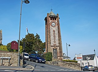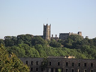
Lancaster is a city in Lancashire, England and the main cultural hub, economic and commercial centre of City of Lancaster district. The city is on the River Lune directly inland from Morecambe Bay. Lancaster is the county town although Lancashire County Council has been based at County Hall in Preston since its formation in 1889.

Heysham is a coastal village in the Lancaster district of Lancashire, England, overlooking Morecambe Bay. It is a ferry port, with services to the Isle of Man and Ireland, and the site of two nuclear power stations.

Grange-over-Sands is a town and civil parish on the north side of Morecambe Bay in Cumbria, England, a few miles south of the Lake District National Park. In the 2011 census the parish had a population of 4,114, increasing at the 2021 census to 4,279. Within the boundaries of the historic county of Lancashire, the town became administered as an urban district in 1894. Though the town remains part of the Duchy of Lancaster, since 2023 it has been administered as part of the Westmorland and Furness Council area.

Carnforth is a market town and civil parish in the City of Lancaster in Lancashire, England, situated at the north-east end of Morecambe Bay. The parish of Carnforth had a population of 5,560 in the 2011 census, an increase from the 5,350 recorded in the 2001 census. The town is situated around 7 miles north of Lancaster, 17 miles south of Kendal, 40 miles east of Barrow-in-Furness and 28 miles northwest of Settle. The town is also close to the Cumbria/Lancashire border.

The City of Lancaster, or simply Lancaster, is a local government district with city status in Lancashire, England. It is named after its largest settlement, Lancaster, and also includes the towns of Carnforth, Heysham and Morecambe and a wider rural hinterland. The district has a population of 144,446 (2022), and an area of 219 square miles (567 km2).

Cleveleys is a town on the Fylde Coast of Lancashire, England, about 4 miles (6 km) north of Blackpool and 2 miles (3 km) south of Fleetwood. It is part of the Borough of Wyre. With its neighbouring settlement of Thornton, Cleveleys was part of the former urban district of Thornton-Cleveleys and is part of the Blackpool Urban Area. In 2011 the Cleveleys Built-up area sub division had a population of 10,754.

Silverdale is a village and civil parish within the City of Lancaster district of Lancashire, England. The village stands on Morecambe Bay, near the border with Cumbria, 4.5 miles (7 km) north west of Carnforth and 8.5 miles (14 km) of Lancaster. The parish had a population of 1,519 recorded in the 2011 census.

The Greater Manchester Built-up Area is an area of land defined by the Office for National Statistics (ONS), consisting of the large conurbation that encompasses the urban element of the city of Manchester and the metropolitan area that forms much of Greater Manchester in North West England. According to the United Kingdom Census 2011, the Greater Manchester Built-up Area has a population of 2,553,379 making it the second most populous conurbation in the United Kingdom after the Greater London Built-up Area. This was an increase of 14% from the population recorded at the United Kingdom Census 2001 of 2,240,230, when it was known as the Greater Manchester Urban Area.

Overton is a village and civil parish in Lancashire, England, south west of Lancaster and south of Morecambe between Heysham and the estuary of the River Lune. Neighbouring villages include Middleton and Sunderland Point; Glasson is on the opposite side of the river. The parish had a population of 1,070 at the 2011 Census.

Middleton is a village and civil parish in the City of Lancaster in Lancashire, England, between Heysham and Overton. It had a population of 705 in 2011.

Slyne-with-Hest is a civil parish in the City of Lancaster in Lancashire, England. It had a population of 3,163 recorded in the 2001 census, decreasing to 3,126 at the 2011 Census. The parish is north of Lancaster and consists of two villages; Slyne, on the A6 road, and Hest Bank on the coast.

Warton is a village, civil parish and electoral ward in the Lancaster district of Lancashire, England. The village is close to the boundary with Cumbria, and approximately 1.5 miles (2.4 km) north of Carnforth, which was originally part of the parish of Warton. The village had a population of 2,315 at the 2001 census, and 2,360 at the 2011 census. The parish covers an area in excess of 11,000 acres (45 km2) and is predominantly rural.

Greater Eston is part of the Borough of Redcar and Cleveland, North Yorkshire, England. The name is used by the borough council to describe the centres of Eston, Grangetown, Normanby, Ormesby, South Bank and Teesville.

Scotforth is a suburb in the south of the city of Lancaster in Lancashire, England. It is home to Scotforth St Paul's Church of England Primary School and St Paul's Church. The civil parish, which does not include the suburb had a population of 239 recorded in the 2001 census, increasing to 321 at the 2011 Census.

Morecambe is a seaside town and civil parish in the City of Lancaster district of Lancashire, England, on Morecambe Bay, part of the Irish Sea.

The Milton Keynes urban area or Milton Keynes Built-up Area is a designation established by the United Kingdom's Office for National Statistics. Milton Keynes has no statutory boundary: the 1967 designated area only determined the area assigned to the Milton Keynes Development Corporation for development. The wider urban area outside that designation includes Newport Pagnell and Woburn Sands as well as Aspley Guise (Bedfordshire) and part of Stoke Hammond civil parish.

The Newport Built-up area is an area of land defined by the United Kingdom Office for National Statistics (ONS) for population monitoring purposes. It is an urban conurbation and is not coterminous with the city boundaries. It consists of the urban area centred on Newport as well as contiguous settlements in the eastern and western valleys extending north of the city – including Cwmbran, Pontypool, Risca, Abercarn and Blackwood. It does however exclude physically detached urban areas within the city boundaries, such as Marshfield.

The Wrexham Built-up area is an area of land defined by the United Kingdom Office for National Statistics (ONS) for population monitoring purposes. It is an urban conurbation fully within Wrexham County Borough and consists of the urban area centred on the city of Wrexham. Until the 2021 census, it also included the historically industrial settlements to the west including Gwersyllt, Rhostyllen, Brymbo, Bradley and New Broughton.


