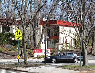
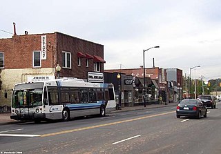
Lansing is a neighborhood in Salem, Oregon, United States, located in the northeast part of the city. The neighborhood is bordered on the north by Silverton Road, on the south by Market Street, on the east by Hawthorne Avenue, and on the west by Evergreen Avenue.

Salem is the capital of the U.S. state of Oregon, and the county seat of Marion County. It is located in the center of the Willamette Valley alongside the Willamette River, which runs north through the city. The river forms the boundary between Marion and Polk counties, and the city neighborhood of West Salem is in Polk County. Salem was founded in 1842, became the capital of the Oregon Territory in 1851, and was incorporated in 1857.

Oregon is a state in the Pacific Northwest region on the West Coast of the United States. The Columbia River delineates much of Oregon's northern boundary with Washington, while the Snake River delineates much of its eastern boundary with Idaho. The parallel 42° north delineates the southern boundary with California and Nevada. Oregon is one of only four states of the continental United States to have a coastline on the Pacific Ocean.

The United States of America (USA), commonly known as the United States or America, is a country composed of 50 states, a federal district, five major self-governing territories, and various possessions. At 3.8 million square miles, the United States is the world's third or fourth largest country by total area and is slightly smaller than the entire continent of Europe's 3.9 million square miles. With a population of over 327 million people, the U.S. is the third most populous country. The capital is Washington, D.C., and the largest city by population is New York City. Forty-eight states and the capital's federal district are contiguous in North America between Canada and Mexico. The State of Alaska is in the northwest corner of North America, bordered by Canada to the east and across the Bering Strait from Russia to the west. The State of Hawaii is an archipelago in the mid-Pacific Ocean. The U.S. territories are scattered about the Pacific Ocean and the Caribbean Sea, stretching across nine official time zones. The extremely diverse geography, climate, and wildlife of the United States make it one of the world's 17 megadiverse countries.
The Lansing neighborhood contains two City of Salem Parks: East Gate Basin Park located at 3203 Hawthorne Avenue NE, and Livingston Park located at 2751 Hawthorne Avenue NE.
The Lansing neighborhood contains two Salem-Keizer Public Schools: Washington Elementary School located at 3165 Lansing Avenue NE, and Waldo Middle School located at 2805 Lansing Avenue NE.
Lansing Area Neighbors and Community Partners are currently holding Partnership Meetings on the second Thursday of each month from 10 to 11:00 am at La Casita/Little House, 3032 Sunnyview Road, NE. All who are interested in the livability of the Lansing Area are welcome to participate.
The Lansing Neighborhood Association meets on the fourth Tuesday of each month at 7:00 pm at Waldo Middle School, 2805 Lansing Avenue NE. All are welcome. Anyone who lives, works, or owns property in the Lansing Neighborhood is a member.

Lansing is the capital of the U.S. state of Michigan. It is mostly in Ingham County, although portions of the city extend west into Eaton County and north into Clinton County. The 2010 Census placed the city's population at 114,297, making it the fifth largest city in Michigan. The population of its Metropolitan Statistical Area (MSA) was 464,036, while the even larger Combined Statistical Area (CSA) population, which includes Shiawassee County, was 534,684. It was named the new state capital of Michigan in 1847, ten years after Michigan became a state.

Northwest is the northwestern quadrant of Washington, D.C., the capital of the United States, and is located north of the National Mall and west of North Capitol Street. It is the largest of the four quadrants of the city, and it includes the central business district, the Federal Triangle, and the museums along the northern side of the National Mall, as well as many of the District's historic neighborhoods.
Fieldston is a privately owned affluent neighborhood in the Riverdale section of the northwestern part of the New York City borough of the Bronx. It is bounded by Manhattan College Parkway to the south, Henry Hudson Parkway to the west, 250th Street to the north, and Broadway to the east. It is noted for its rural atmosphere, large houses and abundance of trees. The majority of the neighborhood is included in the Fieldston Historic District, designated by the New York City Landmarks Preservation Commission in 2006.

The Hawthorne District in Portland, Oregon, is an area of Southeast Portland on SE Hawthorne Blvd. that runs from 12th to 60th Avenues, with the primary core of businesses between 30th and 50th Avenues. The area has numerous retail stores, including clothing shops, restaurants, bars, brewpubs and microbreweries.

Bryant is a residential neighborhood in northeast Seattle, Washington. According to the City of Seattle's neighborhood maps, it is bounded by 35th Avenue NE and NE 45th Place on the west, beyond which is Ravenna; Sand Point Way NE and 45th Ave NE on the east, beyond which are Laurelhurst and Windermere; and NE 75th Street and NE 65th Street on the north, beyond which are View Ridge and Wedgwood.

Mount Baker is a neighborhood in southeast Seattle. The neighborhood's name comes from the view of Mount Baker in Whatcom County, that is seen by looking north over Lake Washington. It is bounded by Lake Washington to the east, Interstate 90 and then Leschi to the north, Rainier Valley to the west, and Columbia City to the south. The neighborhood has a community club and a rowing team. It hosts Seattle's annual Seafair, which includes an airshow featuring the U.S. Navy Blue Angels, hydroplane races, a fireworks show, and other festivities. Franklin High School and Garfield High School serve this area. It is part of Seattle's South End.
Trinidad is a neighborhood located in Ward 5, in the northeast quadrant of Washington, D.C. and is a largely residential area.

View Ridge is a neighborhood in north Seattle, Washington. As with all Seattle neighborhoods, its boundaries are not fixed, but can be thought of as NE 65th Street in the south, 40th and 45th Avenues NE in the west, the Sand Point Country Club in the north, and Sand Point Way NE in the east. Many homes offer views of Lake Washington, Mount Rainier, and the Cascade Range. View Ridge Elementary School is located within the neighborhood, and the neighborhood also offers a large park and playfield across the street from the elementary school. The View Ridge Swim and Tennis Club is located on the eastern edge of View Ridge, and the Sand Point Country Club is located on the northern edge.
Hawthorne Hills is a residential neighborhood in Seattle, Washington. On the City's Atlas, it is split between Bryant and Windermere, but is generally recognized as a distinct neighborhood. The northern boundary is Northeast 65th Street. The southern and eastern boundary is Sand Point Way. The western boundary is 40th Avenue Northeast. Hawthorne Hills is bounded on the north by View Ridge, on the east by Windermere, on the south by Laurelhurst, and on the west by Bryant. There is a sign for the neighborhood along Sand Point Way.

Armatage is a neighborhood in the Southwest community in Minneapolis. Located in the southwest corner of the city, the neighborhood is bounded on the north by 54th Street West, on the east by Logan Avenue South, on the south by Highway 62, and on the west by the city limits at Xerxes Avenue South. The neighborhood grew around the school named for Maude Armatage, a distinguished community leader. Armatage is built up with mostly single-family housing and some multifamily buildings. The neighborhood also has a park with a community center.

Cedar Park is a neighborhood in the Lake City district of Seattle, Washington. The name generally refers to the residential neighborhoods east of Lake City adjoining Lake Washington.

Buckman is a neighborhood in the Southeast section of Portland, Oregon. The neighborhood is bounded by the Willamette River on the west, E Burnside St. on the north, SE 28th Ave. on the east, and SE Hawthorne Blvd. on the south.
Northgate is a neighborhood in Salem, Oregon, United States, located in the far north part of the city. It is one of Salem's larger districts and much of it is industrial rather than residential. Northgate has a neighborhood association, one of the nineteen such groups in Salem.

North Lancaster is a neighborhood in Salem, Oregon, located in the northeast part of the city. The neighborhood is bordered on the south by Sunnyview Road, and on the west with Hawthorne Avenue. North Lancaster is home to Douglas McKay High School.

Bottineau is a neighborhood in the Northeast community in Minneapolis.
Plaza-Midwood is a neighborhood located approximately one mile to the northeast of Uptown in Charlotte, North Carolina. The neighborhood is roughly bound by Hawthorne Lane to the west, The Plaza to the north, Briar Creek Road and the Charlotte Country Club to the east and Central Avenue to the south.
Montavilla is a neighborhood in the Northeast and Southeast sections of Portland, Oregon, United States, and contains an area east of Mount Tabor and west of Interstate 205, from the Banfield to SE Division. It is bordered by North Tabor, Mount Tabor, Madison South, Hazelwood, and Powellhurst-Gilbert.

Colonial Village is a neighborhood in Lansing, Michigan. It is located southwest of REO Town in the southside of the city.

Downtown Lansing is the central business district of Lansing, Michigan, United States. Located in the west-central part of the city along the banks of the Grand River, downtown Lansing is primarily home to Michigan's state government and three colleges, and also contains sports facilities, museums, entertainment and retail, and a growing residential population.
Faye Wright is a neighborhood in Salem, Oregon, United States, located in the southeast part of the city.The neighborhood is bordered on the east by Commercial Street SE, on the west by Liberty Road S, and on the south by Kuebler Boulevard SE.
