Abel Janszoon Tasman was a Dutch seafarer, explorer, and merchant, best known for his voyages of 1642 and 1644 in the service of the Dutch East India Company (VOC). He was the first known European explorer to reach New Zealand and the islands of Fiji and Van Diemen's Land.

Van Diemen's Land was the original name of the island of Tasmania during the European exploration of Australia in the 19th century. A British settlement was established in Van Diemen's Land in 1803 before it became a separate colony in 1825. Its penal colonies became notorious destinations for the transportation of convicts due to the harsh environment, isolation and reputation for being inescapable. Macquarie Harbour and Port Arthur are among the most well-known penal settlements on the island.

Henry Hudson was an English sea explorer and navigator during the early 17th century, best known for his explorations of present-day Canada and parts of the northeastern United States.

The maritime European exploration of Australia consisted of several waves of European seafarers who sailed the edges of the Australian continent. Dutch navigators were the first Europeans known to have explored and mapped the Australian coastline. The first documented encounter was that of Dutch navigator Willem Janszoon, in 1606. Dutch seafarers also visited the west and north coasts of the continent, as did French explorers.

Anthony van Diemen was a Dutch colonial governor.

Willem Hesselsz de Vlamingh was a Dutch sea captain who explored the central west coast of New Holland (Australia) in the late 17th century, where he landed in what is now Perth on the Swan River. The mission proved fruitless, but he charted parts of the continent's western coast.

Duyfken, also in the form Duifje or spelled Duifken or Duijfken, was a small ship built in the Dutch Republic. She was a fast, lightly armed ship probably intended for shallow water, small valuable cargoes, bringing messages, sending provisions, or privateering. The tonnage of Duyfken has been given as 25-30 lasten.
James Grant was a Scottish born British Royal Navy officer and navigator in the early nineteenth century. He served in Australia in 1800-1801 and was the first to map parts of the south coast of Australia.
Willem Janszoon, sometimes abbreviated to Willem Jansz., was a Dutch navigator and colonial governor. Janszoon served in the Dutch East Indies in the periods 1603–1611 and 1612–1616, including as governor of Fort Henricus on the island of Solor. He is the first European known to have seen the coast of Australia during his voyage of 1605–1606.
The Eendracht was an early 17th Century Dutch wooden-hulled 700 tonne East Indiaman, launched in 1615 in the service of the Dutch East India Company (VOC). Its Dutch name means "concord", "unity" or "union", and was a common name given to Dutch ships of the period, from the motto of the Republic: Concordia res parvae crescunt. The ship was captained by Dirk Hartog when he made the second recorded landfall by a European on Australian soil, in 1616.

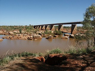
The Ashburton River is located within the Pilbara region of Western Australia.

Eendrachtsland or Eendraghtsland was derived from 't Landt van d'Eendracht or Land van de Eendracht and was one of the earliest names given by Europeans to Australia, being in use for 28 years, from 1616 until 1644.

Willem Janszoon captained the first recorded European landing on the Australian continent in 1606, sailing from Bantam, Java, in the Duyfken. As an employee of the Dutch East India Company, Janszoon had been instructed to explore the coast of New Guinea in search of economic opportunities. He had originally arrived in the Dutch East Indies from the Netherlands in 1598, and became an officer of the VOC on its establishment in 1602.

Hessel Gerritsz was a Dutch engraver, cartographer, and publisher. He was one of the notable figures in the Golden Age of Netherlandish cartography. Despite strong competition, he is considered by some "unquestionably the chief Dutch cartographer of the 17th century".

Of an estimated 200 place names the Dutch bestowed on Australian localities in the 17th century as a result of the Dutch voyages of exploration along the western, northern and southern Australian coasts, only about 35 can still be found on current maps. Five out of six names were either renamed or forgotten or their locations were lost. Other places were named after the early Dutch explorers by later British explorers or colonists, for instance the Australian state of Tasmania is named after Abel Tasman. Australia itself was called New Holland by the English and Nieuw Holland by the Dutch.
The Pera and Arnhem were two ships from the Dutch East India Company that explored the north Australian coast in 1623. Arnhem Land is named after the Arnhem while the ship itself was named after the Dutch city Arnhem.

The Mauritius was an early 17th Century Dutch wooden-hulled sailing ship, documented as being in service to the Dutch East India Company between 1618 and 1622.

The Willem River or Willem's River was named during the voyage of the Dutch East India Company ship Mauritius in 1618, under the command of Supercargo Willem Janszoon and captained by Lenaert Jacobszoon, and is one of the few features named on a nautical chart made in 1627.

The European exploration of Australia first began in February 1606, when Dutch navigator Willem Janszoon landed in Cape York Peninsula and on October that year when Spanish explorer Luís Vaz de Torres sailed through, and navigated, Torres Strait islands. Twenty-nine other Dutch navigators explored the western and southern coasts in the 17th century, and dubbed the continent New Holland.