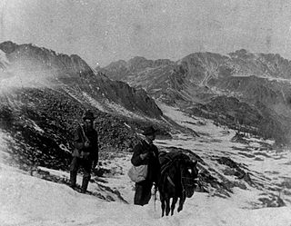
The Pike's Peak Gold Rush was the boom in gold prospecting and mining in the Pike's Peak Country of western Kansas Territory and southwestern Nebraska Territory of the United States that began in July 1858 and lasted until roughly the creation of the Colorado Territory on February 28, 1861. An estimated 100,000 gold seekers took part in one of the greatest gold rushes in North American history.

The English Electric Lightning is a fighter aircraft that served as an interceptor during the 1960s, the 1970s and into the late 1980s. It remains the only UK-designed-and-built fighter capable of Mach 2. The Lightning was designed, developed, and manufactured by English Electric, which was later absorbed by the newly-formed British Aircraft Corporation. Later the type was marketed as the BAC Lightning. It was operated by the Royal Air Force (RAF), the Kuwait Air Force (KAF) and the Royal Saudi Air Force (RSAF).

South Park is a grassland flat within the basin formed by the Rocky Mountains' Mosquito and Park Mountain Ranges within central Colorado. This high valley ranges in elevation from approximately 9,000 to 10,000 ft. It encompasses approximately 1,000 square miles around the headwaters of the South Platte River in Park County approximately 60 mi (100 km) southwest of Denver. It is the largest and southernmost of three similarly named high altitude basins in the Front Range of Colorado, the others being North Park and Middle Park. The largest town in the basin is Fairplay, with a population of 681.

Crestone Peak is the seventh-highest summit of the Rocky Mountains of North America and the U.S. state of Colorado. The prominent 14,300-foot (4,359 m) fourteener is the highest summit of the Crestones and the second-highest summit in the Sangre de Cristo Range after Blanca Peak. The summit is located in the Sangre de Cristo Wilderness of Rio Grande National Forest, 5.0 miles (8.1 km) east by south of the Town of Crestone in Saguache County, Colorado, United States.

The 100, The 10, and The 1,000 are fictional organized crime groups appearing in comic books published by DC Comics. The 10 debuted in Superman #665 and was created by Kurt Busiek and Rick Leonardi. The 100 debuted in Superman's Girl Friend Lois Lane #105 and was created by Bob Kanigher. The 1,000 debuted in Booster Gold #2 and was created by Dan Jurgens.

Prairie Creek Redwoods State Park is a state park, located in Humboldt County, California, near the town of Orick and 50 miles (80 km) north of Eureka. The 14,000 acre (57 km²) park is a coastal sanctuary for old-growth Coast Redwood trees.

Golden Ears Provincial Park is a Provincial Park in British Columbia, Canada and is 555.9 square kilometres (214.6 sq mi). It is named after the prominent twin peaks which are commonly referred to as Golden Ears. The park's southern end is located on the northern edge of the district municipality of Maple Ridge on the north side of the Fraser River.

The Dewdney Trail is a 720 km (450 mi) trail in British Columbia, Canada that served as a major thoroughfare in mid-19th century British Columbia. The trail was a critical factor in the development and strengthening of the newly established British Colony of British Columbia, tying together mining camps and small towns that were springing up along the route during the gold rush era prior to the colony's joining Canadian Confederation in 1871. The route's importance and urgency was prompted because many new gold finds were occurring at locations near the US border that were much more easily accessed from Washington Territory than via any practicable route from the barely settled parts of the Lower Mainland and Cariboo. Today, approximately 80 percent of the former trail has been incorporated into the Crowsnest Highway.
The Omineca Gold Rush was a gold rush in British Columbia, Canada in the Omineca region of the Northern Interior of the province. Gold was first discovered there in 1861, but the rush didn't begin until late in 1869 with the discovery at Vital Creek. There were several routes to the goldfields: two were from Fort St. James, one of which was a water route through the Stuart and Tachie Rivers to Trembleur Lake to Takla Lake and the other was overland, called the Baldy Mountain route. A third route came in overland from Hazelton on the Skeena River and a fourth route used the Fraser River and crossed over the Giscome Portage to Summit Lake, through McLeod Lake, and up the Finlay River to the Omineca River.

Gold mining in Alaska, a state of the United States, has been a major industry and impetus for exploration and settlement since a few years after the United States acquired the territory from Russia. Russian explorers discovered placer gold in the Kenai River in 1848, but no gold was produced. Gold mining started in 1870 from placers southeast of Juneau, Alaska.
The Wild Horse River, formerly known as Wild Horse Creek, is a tributary of the Kootenay River, joining it near the town of Fort Steele, British Columbia, Canada. The river's canyon was the setting for the Wild Horse Creek Gold Rush and associated "war" during the gold rush of the mid-1860s.

The First Oil Well in Western Canada National Historic Site of Canada commemorates the 1902 oil strike in what is now Waterton Lakes National Park, Alberta. Drilled in 1902, the well was the first productive oil well in the western Canadian provinces.

The Cripple Creek & Victor Gold Mine, formerly and historically the Cresson Mine, is an active gold mine located near the town of Victor, in the Cripple Creek mining district in the US state of Colorado. It is the largest current producer of gold in Colorado, and produced 211,000 troy ounces of gold in 2014. It was fully owned and operated by AngloGold Ashanti through its subsidiary, the Cripple Creek & Victor Gold Mining Company (CC&V). In June 2015, AngloGold agreed to sell the mine to Newmont Mining Corporation. The purchase by Newmont was completed in August 2015.
Granite Creek is a creek and townsite in British Columbia located in the Similkameen region. Granite Creek flows north into the Tulameen River and joins that river approximately one and a half miles to the east of Coalmont, British Columbia. It is assumed Granite Creek yielded more than $500,000 in placer gold since its discovery. Gold nuggets worth $50 in value were not unusual in the early years. The creek was mined by Europeans and Chinese. Granite Creek was hydraulicked near its mouth in the 1890s.
Dease Creek is a creek located in the Stikine Region of British Columbia. This creek flows into the west side of Dease Lake. Dease Creek was first staked for gold in 1873 by the Moores. The creek was staked for 16 miles and in 1874 supported 700 miners. Mining companies such as Three to One, Preseverence, Canadian, Caledonia, and Baronovitch worked the creek. The total yield for the first five years was $1,054,400.00. The largest gold nugget recovered was in 1875 and weighed 50 ounces. By 1876 Chinese miners controlled most of the creek. The creek was considered to be mined out by 1880.
Grouse Creek is a creek located in the Cariboo region of British Columbia. The creek was discovered to be gold bearing in 1861. In 1864 the Heron Company staked a claim which yielded over $400,000. Many companies have mined the creek including the full rig, Black Hawk, Canadian, and Heron. The creek was mined heavily in 1860s and 1870s.
Jack of Clubs Creek is a creek located in the Cariboo region of British Columbia. This creek was discovered in 1861. It was mined and yielded about $450,000 in gold during the early years.

Crystal Mine is located near Juneau in the U.S. state of Alaska. The quartz ledge at the Crystal Mine was first discovered in 1895 by B. Heins. It was so named because of the large pyrite cubes which were found occurring in the surface outcrops of the ledge. Gold was extracted till 1905 from quartz using ten-stamp mill and from about 1,000 feet of underground workings yielded 1,210 ounces of gold. Intermittent production of gold is reported till 1925 but there are no records of the yield. The formation was determined as of 54 to 56 Ma age. The gold yielding resources available from the mine were assessed as 9,000 tons of material with yield of 0.21 ounce of gold per ton.

Resurrection Creek is a waterway in the Kenai Peninsula, Alaska, US. Along with Bear Creek, Sixmile Creek, and Glacier Creek, it is a tributary of Turnagain Arm. The stream's watershed drains 161 square miles (420 km2) on the north side of the Kenai Peninsula, and the community of Hope, Alaska is located at the creek's mouth. The Hope Highway passes alongside Resurrection Creek.


