Zimbabwe is a landlocked country in southern Africa lying wholly within the tropics. It straddles an extensive high inland plateau that drops northwards to the Zambezi valley where the border with Zambia is and similarly drops southwards to the Limpopo valley and the border with South Africa. The country has borders with Botswana 813 km, Mozambique 1,231 km, South Africa 225 km, Zambia 797 km and almost meets Namibia at its westernmost point.

The Limpopo River rises in South Africa, and flows generally eastwards through Mozambique to the Indian Ocean. The term Limpopo is derived from Rivombo (Livombo/Lebombo), a group of Tsonga settlers led by Hosi Rivombo who settled in the mountainous vicinity and named the area after their leader. The river is approximately 1,750 kilometres (1,087 mi) long, with a drainage basin 415,000 square kilometres (160,200 sq mi) in size. The mean discharge measured over a year is 170 m3/s at its mouth. The Limpopo is the second largest river in Africa that drains to the Indian Ocean, after the Zambezi River.

Kruger National Park is a South African National Park and one of the largest game reserves in Africa. It covers an area of 19,485 km2 (7,523 sq mi) in the provinces of Limpopo and Mpumalanga in northeastern South Africa, and extends 360 km (220 mi) from north to south and 65 km (40 mi) from east to west. The administrative headquarters are in Skukuza. Areas of the park were first protected by the government of the South African Republic in 1898, and it became South Africa's first national park in 1926.

Mpumalanga is a province of South Africa. The name means "east", or literally "the place where the sun rises" in the Swazi, Xhosa, Ndebele and Zulu languages. Mpumalanga lies in eastern South Africa, bordering Eswatini and Mozambique. It constitutes 6.5% of South Africa's land area. It shares borders with the South African provinces of Limpopo to the north, Gauteng to the west, the Free State to the southwest, and KwaZulu-Natal to the south. The capital is Mbombela.

Gaza is a province of Mozambique. It has an area of 75,709 km2 and a population of 1,422,460.
Protected areas in Mozambique are known as conservation areas, and are currently grouped into national parks, national reserves, forest reserves, wildlife utilisation areas (coutadas), community wildlife utilisation areas and private game farms. There are also a number of areas that have been declared as protected areas under a variety of different legislation, which for reasons of simplicity are here grouped together as "other protected areas." Under the Conservation Law of 2014, the protected areas will need to be reclassified into a much more flexible series of new categories which are closer to the international system used by the IUCN. International initiatives such as transfrontier parks are grouped at the end of the page.

Gonarezhou National Park is a national park located in south-eastern Zimbabwe. It is situated in a relatively remote corner of Masvingo Province, south of Chimanimani along the Mozambique border. Owing to its vast size, rugged terrain and its location away from main tourist routes, large tracts of Gonarezhou remain as pristine wilderness.

Great Limpopo Transfrontier Park is a 35,000 km² peace park that is in the process of being formed. It will link the Limpopo National Park in Mozambique, Kruger National Park in South Africa, Gonarezhou National Park, Manjinji Pan Sanctuary and Malipati Safari Area in Zimbabwe, as well as the area between Kruger and Gonarezhou, the Sengwe communal land in Zimbabwe and the Makuleke region in South Africa.

The Limpopo National Park was born when the status of Coutada 16 Wildlife Utilisation Area in Gaza Province, Mozambique, was changed from a hunting concession to a protected area. It forms part of the Great Limpopo Transfrontier Park with the Kruger National Park in South Africa and the Gonarezhou National Park in Zimbabwe.

The Olifants River, Lepelle or Obalule is a river in South Africa and Mozambique, a tributary of the Limpopo River. It falls into the Drainage Area B of the Drainage basins of South Africa. The historical area of the Pedi people, Sekhukhuneland, is located between the Olifants River and one of its largest tributaries, the Steelpoort River.

Vhembe is one of the 5 districts of Limpopo province of South Africa. It is the northernmost district of the country and shares its northern border with Beitbridge district in Matabeleland South, Zimbabwe and on the east with Gaza Province in Mozambique. Vhembe consist of all territories that were part of the former Venda Bantustan, however, two large densely populated districts of the former Tsonga homeland of Gazankulu, in particular, Hlanganani and Malamulele were also incorporated into Vhembe, hence the ethnic diversity of the District. The seat of Vhembe is Thohoyandou, the former Capital of the former Venda Bantustan. According to 2011 census, the majority of Vhembe residents, about 800 000, speak TshiVenda as their mother language, while 400 000 speak Xitsonga as their home language. However, the Tsonga people are in majority south of Levubu River and they constitute more than 85% of the population in the south of the historic river Levubu, while the Venda are in Minority south of Levubu, at 15%. The Northern Sotho speakers stands at 27 000. The district code is DC34.

The wildlife of Mozambique consists of the flora and fauna of this country in southeastern Africa. Mozambique has a range of different habitat types and an ecologically rich and diverse wildlife. This includes 236 species of mammal, 740 species of bird and 5,692 species of vascular plant. The Maputaland-Pondoland-Albany hotspot, with significantly high levels of biodiversity, stretches from the southern tip of Mozambique into northeastern South Africa.

Chókwè District is a district of Gaza Province in south-western Mozambique. Its principal town is Chokwe. The district is located in the south of the province, and borders with Mabalane District in the north, Guijá District in the east, Chibuto, Xai-Xai, and Bilene Macia Districts in the southeast, Magude District of Maputo Province in the south, and with Massingir District in the west. The area of the district is 2,466 square kilometres (952 sq mi). It has a population of 187,422 (2007).

Chicualacuala District is a district of Gaza Province in south-western Mozambique. It has a population of 41,638 (2011) and covers 18,155 square kilometres (7,010 sq mi). The population density of Chicualacuala District 2.1 residents per square kilometers, significantly lower than the average of 17.5 in Gaza Province.

Mwenezi River is a major tributary of the Limpopo River. The Mwenezi River starts up in south central Zimbabwe and flows south-east along what is known as the Mwenezi River Valley that bisects the district into two sectors. The river is found in both Zimbabwe and Mozambique. In Zimbabwe it has been known as the Nuanetsi or Nuanetzi River in the past, a name it retains in Mozambique.

Banhine National Park is a protected area in northern Gaza Province, Mozambique. The park was established on 26 June 1973. In 2013 the limits of Park were updated to better reflect the realities on the ground, particularly the human presence in the area.

The Shingwedzi River, is a river in Limpopo Province, South Africa and Gaza Province, Mozambique. It is a left hand tributary of the Olifants River (Rio dos Elefantes) and the northernmost river of its catchment area, joining it at the lower end of its basin. The Shingwedzi is a seasonal river whose riverbed is dry for prolonged periods.

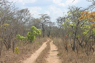
The Zambezian and mopane woodlands is a tropical and subtropical grasslands, savannas, and shrublands ecoregion of southeastern Africa.

The border between South Africa and Zimbabwe is 225 kilometres (140 mi) long, and follows the median line of the Limpopo River.

The Southern miombo woodlands is a tropical grasslands and woodlands ecoregion extending across portions of Malawi, Mozambique, Zambia, and Zimbabwe.


