Related Research Articles

Marth is a Thuringian municipality in the district of Eichsfeld in Germany, in the Verwaltungsgemeinschaft Haustein-Rusteberg.

Burgwalde is a municipality in the district of Eichsfeld in Thuringia, Germany, part of the Verwaltungsgemeinschaft Hanstein-Rusteberg.

Fretterode is a municipality in the district of Eichsfeld in Thuringia, Germany. It is part of the Verwaltungsgemeinschaft Hanstein-Rusteberg.

Gerbershausen is a municipality in the district of Eichsfeld in Thuringia, Germany. It is part of the Verwaltungsgemeinschaft Hanstein-Rusteberg.

Schachtebich is a municipality in the district of Eichsfeld in Thuringia, Germany. It is part of the Verwaltungsgemeinschaft Hanstein-Rusteberg.

Teistungen is a municipality in the district of Eichsfeld in Thuringia, Germany.
Wipper-Eine was a Verwaltungsgemeinschaft in the Mansfeld-Südharz district, in Saxony-Anhalt, Germany. It was situated between Hettstedt and Aschersleben. It was named after the river Wipper and its tributary Eine. The seat of the Verwaltungsgemeinschaft was in Quenstedt. It was disbanded on 1 January 2010.
Roßla-Südharz was a Verwaltungsgemeinschaft in the Mansfeld-Südharz district, in Saxony-Anhalt, Germany. It was situated in the southern part of the Harz, west of Sangerhausen. The seat of the Verwaltungsgemeinschaft was in Roßla. It was disbanded on 1 January 2010.

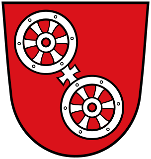
The Wheel of Mainz or Mainzer Rad, in German, was the coat of arms of the Archbishopric of Mainz and thus also of the Electorate of Mainz (Kurmainz), in Rhineland-Palatinate, Germany. It consists of a silver wheel with six spokes on a red background. The wheel can also be found in stonemasons' carvings and similar objects. Currently, the City of Mainz uses a double wheel connected by a silver cross.
Aschersleben/Land is a former Verwaltungsgemeinschaft in the Salzlandkreis district, in Saxony-Anhalt, Germany. The seat of the Verwaltungsgemeinschaft was in Aschersleben. It was disbanded in January 2009.
Uder is a Verwaltungsgemeinschaft in the district Eichsfeld, in Thuringia, Germany. The seat of the Verwaltungsgemeinschaft is in Uder.
Dingelstädt is a former Verwaltungsgemeinschaft in the district Eichsfeld, in Thuringia, Germany. The seat of the Verwaltungsgemeinschaft was in Dingelstädt. It was disbanded in January 2019.
Eichsfelder Kessel is a former Verwaltungsgemeinschaft in the district Eichsfeld, in Thuringia, Germany. The seat of the Verwaltungsgemeinschaft was in Niederorschel. It was disbanded in January 2019.
Eichsfeld-Südharz was a Verwaltungsgemeinschaft in the district Eichsfeld, in Thuringia, Germany. The seat of the Verwaltungsgemeinschaft was in Weißenborn-Lüderode. The Verwaltungsgemeinschaft was disbanded on 1 December 2011, when its constituent municipalities merged into the new municipality Sonnenstein.
Eichsfeld-Wipperaue is a Verwaltungsgemeinschaft in the district Eichsfeld, in Thuringia, Germany. The seat of the Verwaltungsgemeinschaft is in Breitenworbis.
Ershausen/Geismar is a municipal association in the district of Eichsfeld, in Thuringia, Germany. The seat of the municipal association is in Schimberg.
Hanstein-Rusteberg is a Verwaltungsgemeinschaft in the district Eichsfeld, in Thuringia, Germany. The seat of the Verwaltungsgemeinschaft is in Hohengandern. Hanstein Castle is in Hanstein-Rusteberg.
Leinetal is a Verwaltungsgemeinschaft in the district Eichsfeld, in Thuringia, Germany. The seat of the Verwaltungsgemeinschaft is in Bodenrode-Westhausen.
Westerwald-Obereichsfeld is a Verwaltungsgemeinschaft in the district Eichsfeld, in Thuringia, Germany. The seat of the Verwaltungsgemeinschaft is in Küllstedt.
Kindelbrück is a Verwaltungsgemeinschaft in the district of Sömmerda, in Thuringia, Germany. The seat of the Verwaltungsgemeinschaft is in Kindelbrück.
References
Coordinates: 51°28′N10°16′E / 51.467°N 10.267°E