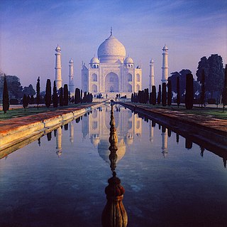
List of monuments
| SL. No. | Description | Location | Address | District | Coordinates | Image |
|---|---|---|---|---|---|---|
| N-UP-L1 | Allahabad Fort | Allahabad | Allahabad | 25°25′48″N81°52′36″E / 25.43°N 81.87666667°E |  More images | |
| N-UP-L1-a | Allahabad Fort: Ashoka Pillar (Inscribed stone pillar) | Allahabad | Allahabad |  | ||
| N-UP-L1-b | Allahabad Fort: Zanana Palace | Allahabad | Allahabad |  Upload Photo | ||
| N-UP-L2 | Cemeteries in Kydganj | Allahabad | Allahabad |  | ||
| N-UP-L3 | Khusru Bagh | Allahabad | Allahabad |  More images | ||
| N-UP-L3-a | Khusru Bagh: Enclosure wall and Gateway of Khusru Bagh | Allahabad | Allahabad | 25°26′41″N81°49′19″E / 25.444641°N 81.821844°E |  | |
| N-UP-L3-b | Khusru Bagh: Tomb of Bibi Tamolan | Allahabad | Allahabad | 25°26′33″N81°49′11″E / 25.442424°N 81.819707°E |  | |
| N-UP-L3-c | Khusru Bagh: Tomb of Sultan Khusru | Allahabad | Allahabad | 25°26′32″N81°49′20″E / 25.442283°N 81.822157°E |  | |
| N-UP-L3-d | Khusru Bagh: Tomb of Sultan Khusru's Mother (Shah Begum, born Manbhawati Bai) | Allahabad | Allahabad | 25°26′32″N81°49′15″E / 25.442351°N 81.820924°E |  | |
| N-UP-L3-e | Khusru Bagh: Tomb of Sultan Khusru's Sister | Allahabad | Allahabad | 25°26′32″N81°49′18″E / 25.442324°N 81.821540°E |  | |
| N-UP-L4 | Queen Victoria's Memorial in Alfred park | Allahabad | Allahabad |  | ||
| N-UP-L5 | Small high mound, the ancient site of a large Hindu Temple | Bara | Allahabad |  Upload Photo | ||
| N-UP-L6 | The area of the waste land divided by a ravine into two large mounds called "Garha and Garhi" | Bhita | Allahabad |  Upload Photo | ||
| N-UP-L7 | Large stone dwelling house said to have been the residence of the two heroes of Ala and Udal cir. 8th century AD | Chilla | Allahabad |  Upload Photo | ||
| N-UP-L8 | Standing figure identified by Fuhrer as Buddha Asvaghosha with a five-headed snake canopy and worshipped under the name of Srigari Devi | Deora | Allahabad |  Upload Photo | ||
| N-UP-L9 | A rocky hall on the south face of the top bearing an inscription of three lines of Indo-Scythian period in red paint with some rude drawings of men and animals | Ginja Hill | Allahabad |  Upload Photo | ||
| N-UP-L10 | Ruined forts of Samudra Gupta and Hansagupta | Jhusi | Allahabad |  Upload Photo | ||
| N-UP-L11 | Cave known as Sita-ki-rasoi containing an inscription in characters of the 9th century AD | Mankuar | Allahabad |  Upload Photo | ||
| N-UP-L12 | Extensive mound called Hatgauha Dih | Shiupur | Allahabad |  Upload Photo | ||
| N-UP-L13 | Garhwa fort | Sheorajpur | Allahabad |  | ||
| N-UP-L14 | Large mound called Surya Bhita | Singraur | Allahabad |  Upload Photo | ||
| N-UP-L15 | Archaeological Site and remains | Sringverpur | Allahabad |  Upload Photo | ||
| N-UP-L26 | Baithak | Akbai | Banda |  Upload Photo | ||
| N-UP-L27 | Closed cemetery, Katra Naka | Banda | Banda |  Upload Photo | ||
| N-UP-L28 | Jami Masjid | Banda | Banda | 25°28′13″N80°20′18″E / 25.47025°N 80.33828°E |  Upload Photo | |
| N-UP-L29 | Monument in memory of General whitelock's Force | Banda | Banda |  Upload Photo | ||
| N-UP-L30 | Baoli | Bhawanipur | Banda | 25°43′58″N80°32′15″E / 25.73277°N 80.5375°E |  Upload Photo | |
| N-UP-L31 | Approaches to Kalinjar Fort | Kalinjar | Banda |  Upload Photo | ||
| N-UP-L32 | Fort of Kalinjar, together with the parapet walls, with the gateways and the monuments inside it, Viz. (i) Sita Kunda, (ii) Sita Sez, (iii) Patalganga, (iv) Pandu Kund, (v) Bhairon-ki-Jhiria, (vi) Siddh-ki-gupha, (vii) Bhagwan-Sej, (viii) Pani-ka-aman, (ix) Mrigdhara, (x) Kotitirth, (xi) Linga temple of Nilakantha etc. | Kalinjar | Banda |  Upload Photo | ||
| N-UP-L33 | Remains of the old fort with its seven gateways. A temple of Mahadeo and an inscribed stone in Sanskrit lying on the foot and approaches to the same | Kalinjar | Banda |  Upload Photo | ||
| N-UP-L34 | Two inscriptions, one dated 1520, the other undated on a large basalt rock close to the bank of the Paisuni river | Ansuya ji | Chitrakut |  Upload Photo | ||
| N-UP-L35 | Closed cemetery | Bargarh | Chitrakut |  Upload Photo | ||
| N-UP-L36 | Temple | Bargarh | Chitrakut |  Upload Photo | ||
| N-UP-L37 | Remains of a temple, circa 10th century AD locally called Bhar Deul | Barha-Kotra | Chitrakut |  Upload Photo | ||
| N-UP-L38 | Small temple with a sanctum and a flat roof | Barha-Kotra | Chitrakut |  Upload Photo | ||
| N-UP-L39 | Two large caves known as Rikhian | Barha-Kotra | Chitrakut |  Upload Photo | ||
| N-UP-L40 | Remains of a small Chandella temple | Birpur | Chitrakut |  Upload Photo | ||
| N-UP-L41 | Two Chandella temples standing together on the same platform | Gonda | Chitrakut |  Upload Photo | ||
| N-UP-L42 | Remains of an old Chandella temple | Dadhwa, Rampur & Manpur | Chitrakut |  Upload Photo | ||
| N-UP-L43 | Balari Nath | Gulrampur | Chitrakut |  Upload Photo | ||
| N-UP-L44 | Two temples | Gulrampur | Chitrakut |  Upload Photo | ||
| N-UP-L45 | City cemetery | Karwi | Chitrakut |  Upload Photo | ||
| N-UP-L46 | Stone temple | Ganesh Bagh one mile south-east of Karwi | Chitrakut |  Upload Photo | ||
| N-UP-L47 | Temple | In the Centre of a tank near the Jail | Chitrakut |  Upload Photo | ||
| N-UP-L48 | Ruins of an old Jain temple called Haihaiti Mandir together with fragments of statues about the fort of the hill | Koh | Chitrakut |  Upload Photo | ||
| N-UP-L49 | Ruins of some Jain Temples | Lauri of Lokhari | Chitrakut |  Upload Photo | ||
| N-UP-L50 | Manikpur cantonment cemetery | Manikpur | Chitrakut |  Upload Photo | ||
| N-UP-L51 | Fort with the fortification walls and the three ruined Jain temples and one ruined Hindu temple inside the fort | Marpha | Chitrakut |  Upload Photo | ||
| N-UP-L52 | Two ruined temples | Mau | Chitrakut |  Upload Photo | ||
| N-UP-L53 | Inscribed statue of Chandella period under a pipal tree | Pura | Chitrakut |  Upload Photo | ||
| N-UP-L54 | Ruins of a large linga temple of the Chandella type | Pura | Chitrakut |  Upload Photo | ||
| N-UP-L55 | Priest’s house | Ramnagar | Chitrakut |  Upload Photo | ||
| N-UP-L56 | Remains of a large temple | Ramnagar | Chitrakut |  Upload Photo | ||
| N-UP-L57 | Ruins of a large Chandella temple | Ramnagar | Chitrakut |  Upload Photo | ||
| N-UP-L58 | Group of ruins, the principal object of which is the entrance door of a temple | Rasin | Chitrakut |  Upload Photo | ||
| N-UP-L59 | Remains of an old fort and a disused temple Devi Chandra Maheshwari | Rasin | Chitrakut |  Upload Photo | ||
| N-UP-L60 | Rock hewn tank, close to the temple of Chandi Maheshwari | Rasin | Chitrakut |  Upload Photo | ||
| N-UP-L61 | Several Sati pillars with a large standing female figure holding a child in her left arm | Rasin | Chitrakut |  Upload Photo | ||
| N-UP-L62 | Temple of Chandi Maheshwari | Rasin | Chitrakut |  Upload Photo | ||
| N-UP-L63 | Two large caves in the middle of a hillock with broken sculptures scattered about | Rauli | Chitrakut |  Upload Photo | ||
| N-UP-L70 | Mound called chauki | Aphui | Fatehpur |  Upload Photo | ||
| N-UP-L71 | Monument in the memory of A. Blakely | Asafpur | Fatehpur |  Upload Photo | ||
| N-UP-L72 | Large mound covered with broken bricks and pottery | Asni | Fatehpur |  Upload Photo | ||
| N-UP-L73 | Extensive brick-strewn mound | Asothar | Fatehpur |  Upload Photo | ||
| N-UP-L74 | Smaller mound bearing five large Digamber Jain figures which people call the five Pandavas | Asothar | Fatehpur |  Upload Photo | ||
| N-UP-L75 | Emperor Aurangzeb's Pavilion | Bagh Badshahi (Khajuha) | Fatehpur |  Upload Photo | ||
| N-UP-L76 | Entire compound known as Bagh Badshahi | Bagh Badshahi (Khajuha) | Fatehpur |  Upload Photo | ||
| N-UP-L77 | Temple | Bahua | Fatehpur |  Upload Photo | ||
| N-UP-L78 | Four massive masonry pillars containing stone tablets with inscriptions in Urdu and Hindi representing translations of the Ten Commandments and some verses from Saint John's Gospel, on the Grand Trunk Road just opposite the Public Works Department Inspection House on the western outskirts of the town | Fatehpur | Fatehpur |  Upload Photo | ||
| N-UP-L79 | Square sandstone pillar bearing an inscription of Mahipaladeva dated Samvat 974 in the Municipal Garden attached to the Town Hall | Fatehpur | Fatehpur |  Upload Photo | ||
| N-UP-L80 | The collection of miscellaneous antiquities from different parts of the District grouped round the Asni Pillar of Mahipaladeva in the Municipal garden attached to the Town Hall | Fatehpur | Fatehpur |  Upload Photo | ||
| N-UP-L81 | Hathikhana mosque or Jaichandi mosque | Hathgaon | Fatehpur |  Upload Photo | ||
| N-UP-L82 | Circular mound, the site of a temple | Khairai | Fatehpur |  Upload Photo | ||
| N-UP-L83 | Extensive mound called Garhi | Khairai | Fatehpur |  Upload Photo | ||
| N-UP-L84 | Monument in the memory of T.S. Powell, Col. | Kunwarpur | Fatehpur |  Upload Photo | ||
| N-UP-L85 | Four temples | Kurari | Fatehpur |  Upload Photo | ||
| N-UP-L86 | Ruins of a fort built by Jaya Chandra | Kutila | Fatehpur |  Upload Photo | ||
| N-UP-L87 | Old Fort | Nahar Khor | Fatehpur |  Upload Photo | ||
| N-UP-L88 | Old Fort | Paina Kalan | Fatehpur |  Upload Photo | ||
| N-UP-L89 | Extensive ruins of an ancient fortified town said to be a stronghold of the Chandella | Paina | Fatehpur |  Upload Photo | ||
| N-UP-L90 | Mound with many pieces of stone sculptures collected upon them | Ren | Fatehpur |  Upload Photo | ||
| N-UP-L91 | Ruined temple | Saton | Fatehpur |  Upload Photo | ||
| N-UP-L92 | Two brick Temples | Sirthar Amauli | Fatehpur |  Upload Photo | ||
| N-UP-L93 | Two temples | Thithaura | Fatehpur |  Upload Photo | ||
| N-UP-L94 | Extensive mound and a group of Hindu Sculptures | Tiksariya | Fatehpur |  Upload Photo | ||
| N-UP-L95 | Temple | Tindauli | Fatehpur |  Upload Photo | ||
| N-UP-L97 | Certain mounds covered with broken statues and sculptures | Kadhwa | Hamirpur |  Upload Photo | ||
| N-UP-L98 | Closed British Cemetery | Kaitha | Hamirpur |  Upload Photo | ||
| N-UP-L99 | Jain Temple mounds covered with broken bricks etc. and three kheras near them viz, Ladhanpur, Mirzapur and Itara | Sumerpur | Hamirpur |  Upload Photo | ||
| N-UP-L113 | Sanskrit Inscription of Samvat 1672 on the Chauknanda of Rupan Guru | Akbarpur or Ataura | Jalaun |  Upload Photo | ||
| N-UP-L114 | Cemetery | Jalaun | Jalaun |  Upload Photo | ||
| N-UP-L115 | Chaurasi Tomb of Lodhi Shah Badshah | Kalpi | Jalaun |  | ||
| N-UP-L116 | Closed Cemetery | Kalpi | Jalaun |  | ||
| N-UP-L117 | Piece of fort wall on the north-east scarp with its circular bastion | Kalpi | Jalaun |  | ||
| N-UP-L118 | Small domed building carried on six pillars immediately near to the P.W.D. Rest House | Kalpi | Jalaun |  | ||
| N-UP-L119 | Cemetery | Kunch | Jalaun |  Upload Photo | ||
| N-UP-L120 | Dome on twelve pillars called Bara Khamba traditionally ascribed to the commander of Prithviraja | Kunch | Jalaun |  Upload Photo | ||
| N-UP-L121 | Mosque | Orai | Jalaun |  Upload Photo | ||
| N-UP-L122 | Ruins of a large temple of the Chandella period | Bangama | Jhansi |  Upload Photo | ||
| N-UP-L123 | Gandai Temple | Barua-sagar | Jhansi |  Upload Photo | ||
| N-UP-L124 | Ghugua-ka-math | Barua-sagar | Jhansi |  Upload Photo | ||
| N-UP-L125 | Jarai-ka-math | Barua-sagar | Jhansi |  Upload Photo | ||
| N-UP-L126 | Jarao-ka-Marhia | Barua-sagar | Jhansi |  Upload Photo | ||
| N-UP-L127 | Tank | Barua-sagar | Jhansi |  | ||
| N-UP-L128 | Jama Masjid | Erich | Jhansi |  Upload Photo | ||
| N-UP-L129 | Gharao-ka-math | Gharao | Jhansi |  Upload Photo | ||
| N-UP-L130 | Memorial cemetery, south of fort on Phuta Darwaza | Jhansi | Jhansi |  Upload Photo | ||
| N-UP-L131 | Monument of Major F.W. Pinkney, situated on the hillock near the premises of Messers Eduljee Boyce & Co. | Jhansi | Jhansi |  Upload Photo | ||
| N-UP-L132 | Shikhara-roofed temple called Marhia and dedicated to Gond baba | Khojra | Jhansi |  Upload Photo | ||
| N-UP-L133 | Remains of a Chandella temple | Kishni Khurd | Jhansi |  Upload Photo | ||
| N-UP-L134 | Chandela Temple | Pachwara (Gahras) | Jhansi |  Upload Photo | ||
| N-UP-L135 | Ruins of a large Chandella Temple containing a well-preserved statue of Vishnu | Patha-Sagauli | Jhansi |  Upload Photo | ||
| N-UP-L136 | Gunner Burkill's Tomb | Ragoon | Jhansi |  Upload Photo | ||
| N-UP-L137 | Chandela Temple | Sakrar | Jhansi |  Upload Photo | ||
| N-UP-L138 | Ruined temple at the upper end of Rai Tal on the banks of which is a roundish boulder containing two inscriptions of Samvat 1604 and 1608 | Sirwabaran | Jhansi |  Upload Photo | ||
| N-UP-L139 | Rani Lakshmi Bai Mahal | Jhansi | Jhansi |  Upload Photo | ||
| N-UP-L140 | Chhatari of Raja Gangaghar Rao along with tank | Dariapur | Jhansi |  Upload Photo | ||
| N-UP-L141 | Jhansi Fort | Jhansi | Jhansi | 25°27′29″N78°34′32″E / 25.45809°N 78.57544°E |  | |
| N-UP-L142 | Remains of an old Chandella temple | Marha | Jhansi |  Upload Photo | ||
| N-UP-L143 | Temple | Marha | Jhansi |  Upload Photo | ||
| N-UP-L178 | Fort attributed to Jay Chandra | Karra | Kaushambi |  Upload Photo | ||
| N-UP-L179 | Ancient fortress (representing the ancient Kaushambi) | Kosam | Kaushambi |  Upload Photo | ||
| N-UP-L180 | Artificial cave in the fane of the hill of Pabhosa hill | Pabhosa | Kaushambi |  Upload Photo | ||
| N-UP-L181 | Traces of a large brick building on the summit of Pabhosa hill | Pabhosa | Kaushambi |  Upload Photo | ||
| N-UP-L316 | Four Chandella temples and small masonry tank | Akona | Mahoba |  | ||
| N-UP-L317 | Chakariya Dai carving of a woman with a child in her arm | Bagwa | Mahoba |  Upload Photo | ||
| N-UP-L318 | Ruins of two granite temple | Charna | Mahoba |  Upload Photo | ||
| N-UP-L319 | Small mound locally known as Bhainsasur with a ruined temple on the summit and old statue inside it | Chukta | Mahoba |  Upload Photo | ||
| N-UP-L320 | Brahm Tal, an extensive tank with embankment On this embankment is a ruined Chandella temple lake and the ruins of a baithak | Kabraia | Mahoba |  Upload Photo | ||
| N-UP-L321 | Ruins of a palace on a hill | Kulpahar | Mahoba |  | ||
| N-UP-L322 | Foundation of Temple Madau | Mahoba | Mahoba |  Upload Photo | ||
| N-UP-L323 | Granite pillar | Mahoba | Mahoba |  Upload Photo | ||
| N-UP-L324 | Five life-sized elephant statues | Mahoba | Mahoba |  Upload Photo | ||
| N-UP-L325 | Jama Masjid | Mahoba | Mahoba |  Upload Photo | ||
| N-UP-L326 | Lake of Kirat Sagar | Mahoba | Mahoba |  | ||
| N-UP-L327 | Lake of Madan Sagar | Mahoba | Mahoba |  Upload Photo | ||
| N-UP-L328 | Lake of Vijaya Sagar | Mahoba | Mahoba |  Upload Photo | ||
| N-UP-L329 | Palace of Raja Paramardi Deva or Parmal | Mahoba | Mahoba |  Upload Photo | ||
| N-UP-L330 | Small stone pillar called Alha-ki-Lat | Mahoba | Mahoba |  Upload Photo | ||
| N-UP-L331 | Temple of Khakra-Math in the middle of Madan Sagar | Mahoba | Mahoba |  Upload Photo | ||
| N-UP-L332 | Twenty-four rock-hewn images of the Tirthankara with Inscriptions dated Samavt 1206 | Mahoba | Mahoba |  Upload Photo | ||
| N-UP-L333 | Makarbai Temple | Makarbai | Mahoba | 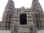 | ||
| N-UP-L334 | Ruins of a large granite temple | Makarbai | Mahoba |  Upload Photo | ||
| N-UP-L335 | Two ruined granite temples | Luhari | Mahoba |  Upload Photo | ||
| N-UP-L336 | Old well with an inscription of Samvat 755 | Parapbari | Mahoba |  Upload Photo | ||
| N-UP-L337 | Large tank | Patkari | Mahoba |  Upload Photo | ||
| N-UP-L338 | Rahiliya temple | Rahiliya | Mahoba | 25°15′51″N79°50′35″E / 25.26416°N 79.84303°E |  | |
| N-UP-L339 | Large Chandella tank on the embankment on which stands a large ruined temple of the earliest Chandella type | Rawatpur | Mahoba | 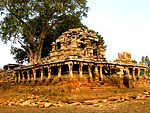 | ||
| N-UP-L340 | Smaller temple of which the dome has fallen | Rawatpur | Mahoba |  Upload Photo | ||
| N-UP-L341 | Sijari Temple | Sijari | Mahoba | 25°14′12″N79°48′14″E / 25.23672°N 79.8039°E |  Upload Photo | |
| N-UP-L342 | Tank called Baratal with an Island bearing the ruins of a large Chandella temple | Srinagar | Mahoba |  Upload Photo | ||
| N-UP-L343 | Brahmanical temple | Sukora | Mahoba |  Upload Photo | ||
| N-UP-L344 | Jain temple | Sukora | Mahoba |  Upload Photo | ||
| N-UP-L345 | Temple, a flat-roofed building | Urwara | Mahoba |  Upload Photo |


