See also
Wikimedia Commons has media related to Cultural heritage monuments in Manitoba .
This article is a list of historic places in the province of Manitoba entered on the Canadian Register of Historic Places, whether they are federal, provincial, or municipal. The listings are divided by region. See the following lists:
Riding Mountain National Park is a national park in Manitoba, Canada. The park is located within Treaty 2 Territory and sits atop the Manitoba Escarpment. Consisting of a protected area 2,969 km2 (1,146 sq mi), the forested parkland stands in sharp contrast to the surrounding prairie farmland. It was designated a national park because it protects three different ecosystems that converge in the area; grasslands, upland boreal and eastern deciduous forests. It is most easily reached by Highway 10 which passes through the park. The south entrance is at the townsite of Wasagaming, which is the only commercial centre within the park boundaries.
Ashern is a local urban district located in the Municipality of West Interlake in Manitoba's Interlake Region.
Lundar is a local urban district in the Rural Municipality of Coldwell, Manitoba, Canada. Located in Manitoba's Interlake Region, it is situated 99 km (62 mi) north of Winnipeg on Highway 6.

West St. Paul is a rural municipality (RM) in Manitoba, Canada. It lies adjacent to the north side of Winnipeg, and directly west of the Red River. It is part of the Winnipeg Metro Region, and had a population of 5,368 at the 2016 census.

Parkland is an informal geographic region of the Canadian province of Manitoba, located between Lakes Manitoba and Winnipegosis on the east and the Manitoba–Saskatchewan border on the west.
St. Malo is a local urban district located in the Rural Municipality of De Salaberry, approximately 70 km south of The Forks, Winnipeg, Manitoba. Most of the community's residents are bilingual francophone of Métis or Québécois heritage.

Cromer, Manitoba is a village located in the Rural Municipality of Pipestone, in south-western Manitoba, Canada in a region called Westman.
The Municipality of Two Borders is a rural municipality (RM) in the Canadian province of Manitoba. It is located in the extreme south-west corner of the province in the Westman Region.
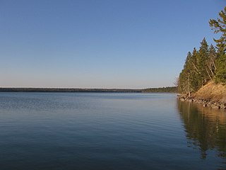
Basket Lake Wildlife Management Area (WMA) is a provincially designated protected area in Manitoba. It is located north of Lake Manitoba and west of Hwy 6. It was designated under the Manitoba Wildlife Act by the Government of Manitoba in 1974. It is 7,260 hectares (28.0 sq mi) in size. The WMA is named after 'Basket Lake', a shallow lake surrounded by marsh, located in its southern portion.

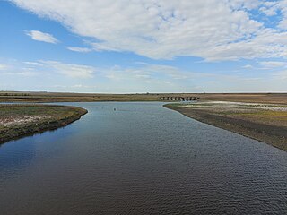
Graham Creek, a tributary of the Souris River, is a river that flows from Saskatchewan near Maryfield into Manitoba where it meets the Souris River on the west side of Melita, Manitoba. The Souris River, in turn, drains into the Assiniboine River, which is part of the Red River drainage basin in a region called the Prairie Pothole Region of North America. That region extends throughout three Canadian provinces and five U.S. states. It is also within Palliser's Triangle and the Great Plains ecoregion.