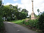
Name Location Date Listed Grid Ref. [note 1] Geo-coordinates Notes LB Number [note 2] Image St Marnock Street, Procurator Fiscal's Office (Former Court House) Including Boundary Walls And Railings 55°36′28″N 4°29′57″W / 55.60789°N 4.499226°W / 55.60789; -4.499226 (St Marnock Street, Procurator Fiscal's Office (Former Court House) Including Boundary Walls And Railings ) Category B 35964 Turner Place, Highfield (Formerly Laigh Kirk Manse) 55°37′15″N 4°29′26″W / 55.620765°N 4.490642°W / 55.620765; -4.490642 (Turner Place, Highfield (Formerly Laigh Kirk Manse) ) Category C(S) 35969 6 Grange Street, The Artist's House 55°36′36″N 4°30′00″W / 55.609921°N 4.500117°W / 55.609921; -4.500117 (6 Grange Street, The Artist's House ) Category B 35899 51 And 53 John Finnie Street 55°36′33″N 4°29′59″W / 55.609265°N 4.499678°W / 55.609265; -4.499678 (51 And 53 John Finnie Street ) Category B 35911 Kay Park, Reformers' Monument 55°36′52″N 4°29′22″W / 55.614446°N 4.489336°W / 55.614446; -4.489336 (Kay Park, Reformers' Monument ) Category B 35926 Upload another image
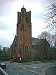
London Road, Henderson Church, Church Of Scotland 55°36′26″N 4°29′04″W / 55.607121°N 4.484426°W / 55.607121; -4.484426 (London Road, Henderson Church, Church Of Scotland ) Category C(S) 35933 Upload another image
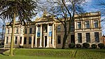
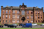
12 London Road, Including Boundary Wall And Gatepiers 55°36′34″N 4°29′25″W / 55.609333°N 4.490155°W / 55.609333; -4.490155 (12 London Road, Including Boundary Wall And Gatepiers ) Category B 35935 21 - 29 (Odd Numbers) North Hamilton Street 55°36′40″N 4°30′18″W / 55.611037°N 4.504873°W / 55.611037; -4.504873 (21 - 29 (Odd Numbers) North Hamilton Street ) Category B 35939 St Andrew's Street, St Andrew's Glencairn Church (Church Of Scotland), Including Churchyard And Boundary Walls 55°36′13″N 4°29′38″W / 55.603621°N 4.493873°W / 55.603621; -4.493873 (St Andrew's Street, St Andrew's Glencairn Church (Church Of Scotland), Including Churchyard And Boundary Walls ) Category B 35959 Gardener's Cottage, Rowallan 55°39′05″N 4°29′22″W / 55.651288°N 4.489385°W / 55.651288; -4.489385 (Gardener's Cottage, Rowallan ) Category B 12526 Stables, Rowallan 55°39′15″N 4°29′23″W / 55.654087°N 4.489627°W / 55.654087; -4.489627 (Stables, Rowallan ) Category B 12528 Dean Road, Dean Bridge At Dean Castle 55°37′25″N 4°28′58″W / 55.623494°N 4.482841°W / 55.623494; -4.482841 (Dean Road, Dean Bridge At Dean Castle ) Category C(S) 48712 London Road, Green Bridge 55°36′10″N 4°30′27″W / 55.60278°N 4.507363°W / 55.60278; -4.507363 (London Road, Green Bridge ) Category C(S) 48725 Holehouse Road, 1 - 4 (Inclusive Numbers) Evelyn Villas, Boundary Walls And Gatepiers 55°36′37″N 4°29′14″W / 55.610382°N 4.487141°W / 55.610382; -4.487141 (Holehouse Road, 1 - 4 (Inclusive Numbers) Evelyn Villas, Boundary Walls And Gatepiers ) Category B 48729 Howard Park, North And South Entrances, Gates And Railings 55°36′21″N 4°30′02″W / 55.605786°N 4.500568°W / 55.605786; -4.500568 (Howard Park, North And South Entrances, Gates And Railings ) Category C(S) 48734 5 And 7 Howard Street 55°36′23″N 4°30′07″W / 55.606371°N 4.50186°W / 55.606371; -4.50186 (5 And 7 Howard Street ) Category C(S) 48736 2 And 4 John Finnie Street And 26 West George Street, Former Ossington Hotel 55°36′42″N 4°29′54″W / 55.611537°N 4.498457°W / 55.611537; -4.498457 (2 And 4 John Finnie Street And 26 West George Street, Former Ossington Hotel ) Category C(S) 48740 Kay Park, Edward Vii Drinking Fountain 55°36′46″N 4°29′21″W / 55.612866°N 4.489204°W / 55.612866; -4.489204 (Kay Park, Edward Vii Drinking Fountain ) Category B 48741 81 - 83 King Street (Odd Numbers) And 2 Water Lane 55°36′30″N 4°29′50″W / 55.60828°N 4.497281°W / 55.60828; -4.497281 (81 - 83 King Street (Odd Numbers) And 2 Water Lane ) Category C(S) 48747 2 And 4 Loanhead Street 55°36′28″N 4°29′23″W / 55.607708°N 4.489608°W / 55.607708; -4.489608 (2 And 4 Loanhead Street ) Category C(S) 48750 10 Loanhead Street Including Boundary Walls 55°36′26″N 4°29′23″W / 55.607318°N 4.489758°W / 55.607318; -4.489758 (10 Loanhead Street Including Boundary Walls ) Category C(S) 48754 Loanhead Street, Loanhead School, Including Janitor's House, Boundary Walls, Railings, Gatepiers And Playshelters 55°36′25″N 4°29′29″W / 55.607033°N 4.491407°W / 55.607033; -4.491407 (Loanhead Street, Loanhead School, Including Janitor's House, Boundary Walls, Railings, Gatepiers And Playshelters ) Category B 48755 44 London Road Including Boundary Walls And Gatepiers 55°36′28″N 4°29′04″W / 55.607812°N 4.484485°W / 55.607812; -4.484485 (44 London Road Including Boundary Walls And Gatepiers ) Category C(S) 48762 51 - 63 (Odd Numbers) Portland Road, Formerly Portland Terrace 55°36′31″N 4°30′23″W / 55.608553°N 4.506366°W / 55.608553; -4.506366 (51 - 63 (Odd Numbers) Portland Road, Formerly Portland Terrace ) Category C(S) 48768 10 - 16 (Even Nos) Portland Road 55°36′27″N 4°30′05″W / 55.607605°N 4.501256°W / 55.607605; -4.501256 (10 - 16 (Even Nos) Portland Road ) Category B 48769 22 And 24 Portland Road 55°36′28″N 4°30′07″W / 55.607672°N 4.501975°W / 55.607672; -4.501975 (22 And 24 Portland Road ) Category B 48771 6 - 10 (Even Numbers) Queen Street 55°36′28″N 4°29′47″W / 55.607877°N 4.496319°W / 55.607877; -4.496319 (6 - 10 (Even Numbers) Queen Street ) Category C(S) 48777 1 Walker Avenue, Including Boundary Wall And Railings 55°36′29″N 4°28′57″W / 55.60806°N 4.482421°W / 55.60806; -4.482421 (1 Walker Avenue, Including Boundary Wall And Railings ) Category C(S) 48792 Turner Place, Deanhill 55°37′13″N 4°29′27″W / 55.620283°N 4.490913°W / 55.620283; -4.490913 (Turner Place, Deanhill ) Category C(S) 35970 West Langlands Street, Caledonia Works 55°36′41″N 4°30′14″W / 55.61139°N 4.503863°W / 55.61139; -4.503863 (West Langlands Street, Caledonia Works ) Category B 35973 Ayr Road, Treesbank 55°34′43″N 4°30′23″W / 55.578748°N 4.506306°W / 55.578748; -4.506306 (Ayr Road, Treesbank ) Category B 35873 3 And 5 Bank Street (Scotch Corner) And 8 College Wynd 55°36′34″N 4°29′54″W / 55.609418°N 4.498338°W / 55.609418; -4.498338 (3 And 5 Bank Street (Scotch Corner) And 8 College Wynd ) Category C(S) 35877 46 Bank Street, Bank Of Scotland 55°36′32″N 4°29′54″W / 55.609011°N 4.498471°W / 55.609011; -4.498471 (46 Bank Street, Bank Of Scotland ) Category B 35880 Dundonald Road, The Parsonage Includung Boundary Wall And Gatepiers (To Holy Trinity Episcopal Church, Portland Road) 55°36′27″N 4°30′02″W / 55.607379°N 4.500479°W / 55.607379; -4.500479 (Dundonald Road, The Parsonage Includung Boundary Wall And Gatepiers (To Holy Trinity Episcopal Church, Portland Road) ) Category B 35885 78 Dundonald Road, Westmont Including Boundary Walls And Gatepiers 55°36′11″N 4°30′25″W / 55.603005°N 4.506885°W / 55.603005; -4.506885 (78 Dundonald Road, Westmont Including Boundary Walls And Gatepiers ) Category B 35891 Elmbank Avenue, Dick Institute 55°36′30″N 4°29′23″W / 55.608372°N 4.48965°W / 55.608372; -4.48965 (Elmbank Avenue, Dick Institute ) Category B 35892 Upload another image See more images
12 Grassyards Road, West Lodge Gateway And Gates To Kilmarnock Cemetery 55°36′47″N 4°29′00″W / 55.613128°N 4.483377°W / 55.613128; -4.483377 (12 Grassyards Road, West Lodge Gateway And Gates To Kilmarnock Cemetery ) Category B 35902 Green Street, Palace Theatre, Former Corn Exchange 55°36′35″N 4°29′40″W / 55.609661°N 4.49432°W / 55.609661; -4.49432 (Green Street, Palace Theatre, Former Corn Exchange ) Category A 35903 Upload another image See more images
25 - 29 (Odd Numbers) John Finnie Street 55°36′36″N 4°29′58″W / 55.609879°N 4.499511°W / 55.609879; -4.499511 (25 - 29 (Odd Numbers) John Finnie Street ) Category B 35907 39 And 41 John Finnie Street 55°36′35″N 4°29′58″W / 55.609618°N 4.499558°W / 55.609618; -4.499558 (39 And 41 John Finnie Street ) Category B 35909 75-79 (Odd Nos) John Finnie Street, George Tannahill And Sons 55°36′30″N 4°30′00″W / 55.608449°N 4.499992°W / 55.608449; -4.499992 (75-79 (Odd Nos) John Finnie Street, George Tannahill And Sons ) Category B 35914 John Finnie Street, District Council Offices 55°36′37″N 4°29′56″W / 55.610315°N 4.498856°W / 55.610315; -4.498856 (John Finnie Street, District Council Offices ) Category B 35918 58 - 62 (Even Numbers) John Finnie Street 55°36′35″N 4°29′57″W / 55.609725°N 4.499136°W / 55.609725; -4.499136 (58 - 62 (Even Numbers) John Finnie Street ) Category B 35920 77 London Road, Deanmont 55°36′36″N 4°29′05″W / 55.610092°N 4.484614°W / 55.610092; -4.484614 (77 London Road, Deanmont ) Category B 35932 41 Portland Road, Etruria 55°36′30″N 4°30′17″W / 55.608373°N 4.504592°W / 55.608373; -4.504592 (41 Portland Road, Etruria ) Category C(S) 35945 Rowallan Castle 55°39′00″N 4°29′21″W / 55.650089°N 4.489103°W / 55.650089; -4.489103 (Rowallan Castle ) Category A 12523 Dean Road, Dean Castle Dower House 55°37′24″N 4°29′03″W / 55.623323°N 4.48418°W / 55.623323; -4.48418 (Dean Road, Dean Castle Dower House ) Category B 48713 21 Hill Street (Veterinary Practice) And Boundary Walls 55°36′50″N 4°29′52″W / 55.613932°N 4.497784°W / 55.613932; -4.497784 (21 Hill Street (Veterinary Practice) And Boundary Walls ) Category C(S) 48727 107-111 (Odd Nos) King Street 55°36′28″N 4°29′50″W / 55.607757°N 4.497359°W / 55.607757; -4.497359 (107-111 (Odd Nos) King Street ) Category C(S) 48748 59 And 61 London Road 55°36′28″N 4°29′13″W / 55.607836°N 4.486837°W / 55.607836; -4.486837 (59 And 61 London Road ) Category C(S) 48757 20, 22 And 22A London Road 55°36′32″N 4°29′18″W / 55.608875°N 4.488348°W / 55.608875; -4.488348 (20, 22 And 22A London Road ) Category C(S) 48760 Sandbed Street, Sandbed Bridge 55°36′34″N 4°29′50″W / 55.609542°N 4.497108°W / 55.609542; -4.497108 (Sandbed Street, Sandbed Bridge ) Category C(S) 48782 3 Seaford Street Including Boundary Walls 55°36′24″N 4°30′12″W / 55.606791°N 4.503284°W / 55.606791; -4.503284 (3 Seaford Street Including Boundary Walls ) Category C(S) 48783 Strand Street, Former Hays And Goldberg's Warehouse (And Johnnie Walker Whisky Bonds) 55°36′37″N 4°29′52″W / 55.610407°N 4.497861°W / 55.610407; -4.497861 (Strand Street, Former Hays And Goldberg's Warehouse (And Johnnie Walker Whisky Bonds) ) Category B 48784 96-104 (Even Nos) Titchfield Street, Brigade Court 55°36′18″N 4°29′49″W / 55.604873°N 4.496858°W / 55.604873; -4.496858 (96-104 (Even Nos) Titchfield Street, Brigade Court ) Category C(S) 48791 Grougar Road, Former Crookedholm School 55°36′37″N 4°27′49″W / 55.6102°N 4.463676°W / 55.6102; -4.463676 (Grougar Road, Former Crookedholm School ) Category C(S) 49867 Crookedholm, Main Road, Hurlford Church (Church Of Scotland), Formerly Reid Memorial Church With Boundary Wall And Church Hall 55°36′11″N 4°27′19″W / 55.602917°N 4.455281°W / 55.602917; -4.455281 (Crookedholm, Main Road, Hurlford Church (Church Of Scotland), Formerly Reid Memorial Church With Boundary Wall And Church Hall ) Category C(S) 50024 1 And 3 St Marnock Place, 9 And 11 St Marnock Street, Former Borland's Seed Warehouse 55°36′28″N 4°29′53″W / 55.607817°N 4.497919°W / 55.607817; -4.497919 (1 And 3 St Marnock Place, 9 And 11 St Marnock Street, Former Borland's Seed Warehouse ) Category B 35963 Soulis Street, High Church (Church Of Scotland), Including Churchyard, Walls, Gatepiers And Soulis Monument 55°36′45″N 4°29′41″W / 55.612422°N 4.494718°W / 55.612422; -4.494718 (Soulis Street, High Church (Church Of Scotland), Including Churchyard, Walls, Gatepiers And Soulis Monument ) Category A 35965 Dundonald Road, Winton Place Evangelical Union Congregational Church Including Hall, Boundary Walls And Railings 55°36′26″N 4°30′02″W / 55.607134°N 4.500575°W / 55.607134; -4.500575 (Dundonald Road, Winton Place Evangelical Union Congregational Church Including Hall, Boundary Walls And Railings ) Category B 35886 Upload another image
8 Grange Terrace Including Boundary Wall 55°36′34″N 4°30′52″W / 55.609429°N 4.514472°W / 55.609429; -4.514472 (8 Grange Terrace Including Boundary Wall ) Category C(S) 35901 16 - 28 (Even Numbers) John Finnie Street 55°36′39″N 4°29′55″W / 55.610947°N 4.498721°W / 55.610947; -4.498721 (16 - 28 (Even Numbers) John Finnie Street ) Category B 35916 72 - 84 (Even Numbers) John Finnie Street 55°36′34″N 4°29′57″W / 55.609456°N 4.499103°W / 55.609456; -4.499103 (72 - 84 (Even Numbers) John Finnie Street ) Category B 35922 36 And 38 London Road 55°36′29″N 4°29′09″W / 55.608161°N 4.485857°W / 55.608161; -4.485857 (36 And 38 London Road ) Category B 35938 37 Portland Road 55°36′59″N 4°30′16″W / 55.616349°N 4.504417°W / 55.616349; -4.504417 (37 Portland Road ) Category C(S) 35944 Braeside Street, Kilmarnock Academy, Including Janitor's House, Boundary Walls, Gatepiers, Gates And Railings 55°36′31″N 4°29′37″W / 55.608741°N 4.493627°W / 55.608741; -4.493627 (Braeside Street, Kilmarnock Academy, Including Janitor's House, Boundary Walls, Gatepiers, Gates And Railings ) Category B 35958 Upload another image See more images
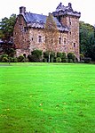
Lodge, Rowallan 55°38′46″N 4°29′21″W / 55.646195°N 4.489221°W / 55.646195; -4.489221 (Lodge, Rowallan ) Category B 12525 Summerhouse And Walled Garden, Rowallan 55°39′03″N 4°29′19″W / 55.650897°N 4.488677°W / 55.650897; -4.488677 (Summerhouse And Walled Garden, Rowallan ) Category B 12527 36 - 40 (Even Nos) Bank Street 55°36′33″N 4°29′53″W / 55.609296°N 4.498156°W / 55.609296; -4.498156 (36 - 40 (Even Nos) Bank Street ) Category C(S) 48708 1 - 14 (Inclusive Numbers) De Walden Terrace Including Boundary Walls And Outbuildings 55°36′38″N 4°29′16″W / 55.610504°N 4.487816°W / 55.610504; -4.487816 (1 - 14 (Inclusive Numbers) De Walden Terrace Including Boundary Walls And Outbuildings ) Category B 48716 Elmbank Drive, Kilmarnock Equitable Co-Operative Society Drinking Fountain 55°36′28″N 4°29′25″W / 55.607916°N 4.490415°W / 55.607916; -4.490415 (Elmbank Drive, Kilmarnock Equitable Co-Operative Society Drinking Fountain ) Category C(S) 48721 11, 13 (Glen Rosa) And 15 High Glencairn Street 55°36′10″N 4°29′50″W / 55.602778°N 4.497329°W / 55.602778; -4.497329 (11, 13 (Glen Rosa) And 15 High Glencairn Street ) Category C(S) 48726 Howard Park, Dr Alexander Marshall Monument 55°36′11″N 4°30′09″W / 55.602948°N 4.502626°W / 55.602948; -4.502626 (Howard Park, Dr Alexander Marshall Monument ) Category B 48730 Howard Park, Old Men's Hut 55°36′15″N 4°30′08″W / 55.604089°N 4.502254°W / 55.604089; -4.502254 (Howard Park, Old Men's Hut ) Category C(S) 48732 Crookedholm, Main Road, Former Hurlford Kirk And Manse, Including Boundary Walls And Gatepiers 55°36′13″N 4°27′29″W / 55.603691°N 4.457933°W / 55.603691; -4.457933 (Crookedholm, Main Road, Former Hurlford Kirk And Manse, Including Boundary Walls And Gatepiers ) Category B 42950 26 - 34 (Even Nos) Bank Street 55°36′34″N 4°29′53″W / 55.609308°N 4.497998°W / 55.609308; -4.497998 (26 - 34 (Even Nos) Bank Street ) Category C(S) 35879 Dean Road, Dean Castle And Gatehouse 55°37′23″N 4°29′01″W / 55.622972°N 4.483745°W / 55.622972; -4.483745 (Dean Road, Dean Castle And Gatehouse ) Category A 35884 Upload another image See more images
31 - 37 (Odd Numbers) John Finnie Street Laigh Kirk Mission Hall 55°36′35″N 4°29′58″W / 55.609689°N 4.499562°W / 55.609689; -4.499562 (31 - 37 (Odd Numbers) John Finnie Street Laigh Kirk Mission Hall ) Category B 35908 55 And 57 John Finnie Street 55°36′32″N 4°29′59″W / 55.609002°N 4.499757°W / 55.609002; -4.499757 (55 And 57 John Finnie Street ) Category B 35912 6 - 14 (Even Numbers) John Finnie Street (Facade Only) 55°36′40″N 4°29′55″W / 55.611202°N 4.498531°W / 55.611202; -4.498531 (6 - 14 (Even Numbers) John Finnie Street (Facade Only) ) Category B 35915 Kilmarnock Railway Station 55°36′44″N 4°29′57″W / 55.612323°N 4.499142°W / 55.612323; -4.499142 (Kilmarnock Railway Station ) Category B 35928 Upload another image See more images
42 London Road (Formerly Hafton) Including Boundary Walls And Gatepiers 55°36′29″N 4°29′07″W / 55.607976°N 4.485242°W / 55.607976; -4.485242 (42 London Road (Formerly Hafton) Including Boundary Walls And Gatepiers ) Category B 35941 Portland Road, Holy Trinity Episcopal Church Including Hall, Boundary Walls, Gatepiers And Milestone 55°36′27″N 4°30′02″W / 55.60755°N 4.500458°W / 55.60755; -4.500458 (Portland Road, Holy Trinity Episcopal Church Including Hall, Boundary Walls, Gatepiers And Milestone ) Category A 35946 Upload another image
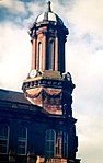
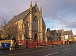
Portland Road, Springhill House 55°36′30″N 4°30′30″W / 55.608296°N 4.50835°W / 55.608296; -4.50835 (Portland Road, Springhill House ) Category B 35947 78 And 80 Portland Street And 1 West George Street 55°36′42″N 4°29′50″W / 55.611653°N 4.497131°W / 55.611653; -4.497131 (78 And 80 Portland Street And 1 West George Street ) Category B 35956 St Andrew's Street, St Andrew's Church Hall 55°36′13″N 4°29′40″W / 55.603719°N 4.494372°W / 55.603719; -4.494372 (St Andrew's Street, St Andrew's Church Hall ) Category C(S) 35960 Newhouse 55°37′00″N 4°27′38″W / 55.616796°N 4.460611°W / 55.616796; -4.460611 (Newhouse ) Category B 12534 Dean Road, Dean Castle Lodge And Boundary Walls 55°37′16″N 4°29′13″W / 55.621089°N 4.487057°W / 55.621089; -4.487057 (Dean Road, Dean Castle Lodge And Boundary Walls ) Category C(S) 48714 7 And 8 Howard Park Drive 55°36′09″N 4°30′11″W / 55.602416°N 4.50318°W / 55.602416; -4.50318 (7 And 8 Howard Park Drive ) Category C(S) 48735 9-13 (Odd Nos) King Street 55°36′35″N 4°29′49″W / 55.609672°N 4.496878°W / 55.609672; -4.496878 (9-13 (Odd Nos) King Street ) Category C(S) 48744 73 London Road, Torwood 55°36′27″N 4°29′06″W / 55.607413°N 4.485095°W / 55.607413; -4.485095 (73 London Road, Torwood ) Category C(S) 48758 1 And 3 Portland Road 55°36′28″N 4°30′00″W / 55.607863°N 4.500097°W / 55.607863; -4.500097 (1 And 3 Portland Road ) Category C(S) 48767 18 And 20 Portland Road 55°36′28″N 4°30′06″W / 55.607641°N 4.501703°W / 55.607641; -4.501703 (18 And 20 Portland Road ) Category B 48770 26 Portland Road 55°36′28″N 4°30′08″W / 55.607783°N 4.502236°W / 55.607783; -4.502236 (26 Portland Road ) Category B 48772 12 Queen Street 55°36′28″N 4°29′47″W / 55.607869°N 4.496255°W / 55.607869; -4.496255 (12 Queen Street ) Category C(S) 48778 St Marnock Street, Road Bridge 55°36′27″N 4°29′52″W / 55.607524°N 4.497757°W / 55.607524; -4.497757 (St Marnock Street, Road Bridge ) Category C(S) 48780 47 - 71 (Odd Numbers) Titchfield Street 55°36′21″N 4°29′51″W / 55.605929°N 4.497513°W / 55.605929; -4.497513 (47 - 71 (Odd Numbers) Titchfield Street ) Category C(S) 48787 90 - 94 (Even Numbers) Titchfield Street 55°36′18″N 4°29′49″W / 55.605053°N 4.496854°W / 55.605053; -4.496854 (90 - 94 (Even Numbers) Titchfield Street ) Category C(S) 48790 13 - 15 (Odd Numbers) West George Street 55°36′42″N 4°29′52″W / 55.611739°N 4.497803°W / 55.611739; -4.497803 (13 - 15 (Odd Numbers) West George Street ) Category B 48793 44 And 46 Wellington Street Including Gatepiers And Boundary Walls 55°36′55″N 4°29′44″W / 55.615147°N 4.495511°W / 55.615147; -4.495511 (44 And 46 Wellington Street Including Gatepiers And Boundary Walls ) Category C(S) 35972 Bank Street, The Laigh Kirk 55°36′35″N 4°29′52″W / 55.609655°N 4.497734°W / 55.609655; -4.497734 (Bank Street, The Laigh Kirk ) Category A 35875 Upload another image
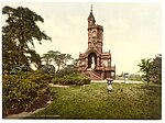
3 Dundonald Road 55°36′25″N 4°30′02″W / 55.606855°N 4.500605°W / 55.606855; -4.500605 (3 Dundonald Road ) Category C(S) 35887 52 Dundonald Road Including Boundary Wall And Gatepier 55°36′15″N 4°30′15″W / 55.604121°N 4.504209°W / 55.604121; -4.504209 (52 Dundonald Road Including Boundary Wall And Gatepier ) Category C(S) 35889 56 And 58 Dundonald Road, Invermay And Edelweiss 55°36′14″N 4°30′17″W / 55.603923°N 4.504625°W / 55.603923; -4.504625 (56 And 58 Dundonald Road, Invermay And Edelweiss ) Category C(S) 35890 10 Grange Place, Formerly Kilmarnock Standard Printing Office 55°36′33″N 4°30′01″W / 55.609052°N 4.500395°W / 55.609052; -4.500395 (10 Grange Place, Formerly Kilmarnock Standard Printing Office ) Category B 35895 5-9 (Odd Numbers) Grange Place 55°36′33″N 4°30′01″W / 55.609264°N 4.500139°W / 55.609264; -4.500139 (5-9 (Odd Numbers) Grange Place ) Category B 35898 6 Grange Terrace Including Outbuilding And Boundary Wall 55°36′35″N 4°30′51″W / 55.609686°N 4.514235°W / 55.609686; -4.514235 (6 Grange Terrace Including Outbuilding And Boundary Wall ) Category C(S) 35900 43-49 (Odd Nos) John Finnie Street 55°36′34″N 4°29′59″W / 55.609437°N 4.499594°W / 55.609437; -4.499594 (43-49 (Odd Nos) John Finnie Street ) Category C(S) 35910 30 - 38 (Even Numbers) John Finnie Street 55°36′39″N 4°29′55″W / 55.610794°N 4.498712°W / 55.610794; -4.498712 (30 - 38 (Even Numbers) John Finnie Street ) Category B 35917 108 - 114 (Even Numbers) John Finnie Street (Former Kilmarnock Arms) 55°36′30″N 4°29′58″W / 55.608416°N 4.499434°W / 55.608416; -4.499434 (108 - 114 (Even Numbers) John Finnie Street (Former Kilmarnock Arms) ) Category C(S) 35924 Kilmarnock Railway Station, Subway To Garden Street 55°36′44″N 4°29′55″W / 55.612182°N 4.498546°W / 55.612182; -4.498546 (Kilmarnock Railway Station, Subway To Garden Street ) Category C(S) 35929 40 And 40A London Road, Formerly Elmslie 55°36′29″N 4°29′08″W / 55.607968°N 4.485639°W / 55.607968; -4.485639 (40 And 40A London Road, Formerly Elmslie ) Category B 35940 Portland Road, The Lodge, Springhill House 55°36′29″N 4°30′24″W / 55.608099°N 4.506559°W / 55.608099; -4.506559 (Portland Road, The Lodge, Springhill House ) Category B 35948 Portland Street, West High Church Of Scotland And Boundary Walls 55°36′45″N 4°29′48″W / 55.612409°N 4.496686°W / 55.612409; -4.496686 (Portland Street, West High Church Of Scotland And Boundary Walls ) Category B 35957 Crawfurdland Castle 55°38′10″N 4°27′17″W / 55.636142°N 4.454642°W / 55.636142; -4.454642 (Crawfurdland Castle ) Category A 12530 Crawfurdland Mains 55°38′18″N 4°27′14″W / 55.638252°N 4.453821°W / 55.638252; -4.453821 (Crawfurdland Mains ) Category C(S) 12531 Crawfurdland Bridge 55°38′27″N 4°26′34″W / 55.640783°N 4.442744°W / 55.640783; -4.442744 (Crawfurdland Bridge ) Category B 12533 Western Road, Former Southhook Pottery, Including Gates, Gatepiers, Boundary Walls And Railings 55°36′57″N 4°30′45″W / 55.615969°N 4.512461°W / 55.615969; -4.512461 (Western Road, Former Southhook Pottery, Including Gates, Gatepiers, Boundary Walls And Railings ) Category B 47422 42 Bank Street 55°36′33″N 4°29′54″W / 55.60923°N 4.498295°W / 55.60923; -4.498295 (42 Bank Street ) Category B 48709 Dean Road (Near), Lauder Foot Bridge 55°37′11″N 4°29′04″W / 55.61984°N 4.484373°W / 55.61984; -4.484373 (Dean Road (Near), Lauder Foot Bridge ) Category C(S) 48715 1-3 Dunlop Street And 12 Strand Street 55°36′39″N 4°29′54″W / 55.610727°N 4.498469°W / 55.610727; -4.498469 (1-3 Dunlop Street And 12 Strand Street ) Category C(S) 48720 Kay Park Terrace, Edward Viii Pillar Box 55°36′41″N 4°29′05″W / 55.611373°N 4.484854°W / 55.611373; -4.484854 (Kay Park Terrace, Edward Viii Pillar Box ) Category B 48742 Kilmarnock Station, K6 Telephone Kiosk 55°36′41″N 4°30′02″W / 55.611514°N 4.500441°W / 55.611514; -4.500441 (Kilmarnock Station, K6 Telephone Kiosk ) Category B 48743 57 - 65 (Odd Numbers) King Street And 22 Sandbed Street, Victoria Buildings 55°36′31″N 4°29′50″W / 55.608713°N 4.497214°W / 55.608713; -4.497214 (57 - 65 (Odd Numbers) King Street And 22 Sandbed Street, Victoria Buildings ) Category C(S) 48746 Lawson Street, Belford Mill (Formerly Fleming's Lace Mill) 55°36′10″N 4°29′34″W / 55.602725°N 4.492864°W / 55.602725; -4.492864 (Lawson Street, Belford Mill (Formerly Fleming's Lace Mill) ) Category B 48749 75 London Road Including Boundary Wall And Gatepier 55°36′26″N 4°29′05″W / 55.607295°N 4.484691°W / 55.607295; -4.484691 (75 London Road Including Boundary Wall And Gatepier ) Category C(S) 48759 30 Samson Avenue, Provost Lamp 55°36′19″N 4°28′55″W / 55.605295°N 4.481833°W / 55.605295; -4.481833 (30 Samson Avenue, Provost Lamp ) Category B 48781 24 Titchfield Street, Former King's Theatre And Abc Cinema 55°36′22″N 4°29′48″W / 55.606163°N 4.496623°W / 55.606163; -4.496623 (24 Titchfield Street, Former King's Theatre And Abc Cinema ) Category B 48789 Dundonald Road, Mount House Including Gatepiers And Railings 55°36′07″N 4°31′35″W / 55.601914°N 4.526327°W / 55.601914; -4.526327 (Dundonald Road, Mount House Including Gatepiers And Railings ) Category B 43910 Bank Street, Laigh Kirk Graveyard And Gatepiers 55°36′35″N 4°29′53″W / 55.609819°N 4.498062°W / 55.609819; -4.498062 (Bank Street, Laigh Kirk Graveyard And Gatepiers ) Category B 35876 3 Grange Place 55°36′33″N 4°30′00″W / 55.609251°N 4.499916°W / 55.609251; -4.499916 (3 Grange Place ) Category C(S) 35897 3-9 (Odd Numbers) John Finnie Street, Kilmarnock Club 55°36′37″N 4°29′57″W / 55.61036°N 4.499303°W / 55.61036; -4.499303 (3-9 (Odd Numbers) John Finnie Street, Kilmarnock Club ) Category B 35905 John Finnie Street, Council Chambers 55°36′36″N 4°29′55″W / 55.610031°N 4.498695°W / 55.610031; -4.498695 (John Finnie Street, Council Chambers ) Category B 35919 100 - 106 (Even Numbers) John Finnie Street 55°36′31″N 4°29′58″W / 55.608713°N 4.499421°W / 55.608713; -4.499421 (100 - 106 (Even Numbers) John Finnie Street ) Category C(S) 35923 Kay Park, Burns Monument And Former Museum 55°36′46″N 4°29′23″W / 55.61291°N 4.489731°W / 55.61291; -4.489731 (Kay Park, Burns Monument And Former Museum ) Category B 35925 Upload another image
71 London Road, Including Boundary Walls And Gate Piers 55°36′27″N 4°29′07″W / 55.607506°N 4.485355°W / 55.607506; -4.485355 (71 London Road, Including Boundary Walls And Gate Piers ) Category B 35931 Portland Road, Former Stables And Boundary Wall To Springhill House 55°36′29″N 4°30′29″W / 55.608149°N 4.508071°W / 55.608149; -4.508071 (Portland Road, Former Stables And Boundary Wall To Springhill House ) Category B 35949 Portland Street And Soulis Street, Viaduct 55°36′43″N 4°29′45″W / 55.61197°N 4.495722°W / 55.61197; -4.495722 (Portland Street And Soulis Street, Viaduct ) Category B 35951 1 - 9 (Odd Numbers) Portland Street, Former Royal Bank Of Scotland 55°36′37″N 4°29′47″W / 55.610366°N 4.496334°W / 55.610366; -4.496334 (1 - 9 (Odd Numbers) Portland Street, Former Royal Bank Of Scotland ) Category B 35952 Rowallan - 55°39′10″N 4°29′33″W / 55.652701°N 4.492368°W / 55.652701; -4.492368 (Rowallan - ) Category A 12524 Assloss 55°37′47″N 4°28′07″W / 55.629716°N 4.468475°W / 55.629716; -4.468475 (Assloss ) Category B 12529 1 Bank Place, Kilmarnock Standard 55°36′33″N 4°29′56″W / 55.609174°N 4.498815°W / 55.609174; -4.498815 (1 Bank Place, Kilmarnock Standard ) Category C(S) 48706 82 Dundonald Road 55°36′10″N 4°30′27″W / 55.60278°N 4.507363°W / 55.60278; -4.507363 (82 Dundonald Road ) Category C(S) 48718 Glasgow Road, Milestone (Opposite End Of Arran Avenue) 55°37′25″N 4°29′20″W / 55.623478°N 4.488956°W / 55.623478; -4.488956 (Glasgow Road, Milestone (Opposite End Of Arran Avenue) ) Category C(S) 48723 Hill Street, St Joseph's Catholic Church And Priest's House 55°36′49″N 4°29′50″W / 55.613532°N 4.497123°W / 55.613532; -4.497123 (Hill Street, St Joseph's Catholic Church And Priest's House ) Category B 48728 Howard Park, Park Keeper's House 55°36′14″N 4°30′10″W / 55.603781°N 4.502775°W / 55.603781; -4.502775 (Howard Park, Park Keeper's House ) Category C(S) 48733 47 And 47A London Road 55°36′30″N 4°29′20″W / 55.608345°N 4.48879°W / 55.608345; -4.48879 (47 And 47A London Road ) Category B 48756 70 London Road, Stanely 55°36′25″N 4°28′43″W / 55.606932°N 4.478682°W / 55.606932; -4.478682 (70 London Road, Stanely ) Category C(S) 48763 2 And 4 Low Glencairn Street, Former Co - Operative Building 55°36′03″N 4°29′48″W / 55.60075°N 4.496739°W / 55.60075; -4.496739 (2 And 4 Low Glencairn Street, Former Co - Operative Building ) Category C(S) 48766 28 And 30 Portland Road 55°36′28″N 4°30′09″W / 55.607706°N 4.502485°W / 55.607706; -4.502485 (28 And 30 Portland Road ) Category B 48776 32 Sturrock Street, Lilymount 55°36′24″N 4°29′39″W / 55.606689°N 4.494163°W / 55.606689; -4.494163 (32 Sturrock Street, Lilymount ) Category C(S) 48785 West Shaw Street, Bridge 55°36′04″N 4°30′02″W / 55.601012°N 4.500614°W / 55.601012; -4.500614 (West Shaw Street, Bridge ) Category C(S) 48794 47 Woodstock Street, Woodstock Cottage Including Boundary Walls And Railings 55°36′35″N 4°30′14″W / 55.609719°N 4.503836°W / 55.609719; -4.503836 (47 Woodstock Street, Woodstock Cottage Including Boundary Walls And Railings ) Category C(S) 48795 3, 5 And 7 St Marnock Street And 113 - 119 (Odd Numbers) King Street 55°36′27″N 4°29′50″W / 55.607632°N 4.497288°W / 55.607632; -4.497288 (3, 5 And 7 St Marnock Street And 113 - 119 (Odd Numbers) King Street ) Category C(S) 35962 Woodstock Street, Grange Free Church, Including Hall, Boundary Walls, Railings And Gatepiers 55°36′34″N 4°30′06″W / 55.609523°N 4.501537°W / 55.609523; -4.501537 (Woodstock Street, Grange Free Church, Including Hall, Boundary Walls, Railings And Gatepiers ) Category B 35974 Campbell Street, New Riccarton Bridge 55°35′50″N 4°29′50″W / 55.597191°N 4.497164°W / 55.597191; -4.497164 (Campbell Street, New Riccarton Bridge ) Category C(S) 35881 5 Dundonald Road Including Boundary Walls And Outbuildings 55°36′24″N 4°30′02″W / 55.606674°N 4.500641°W / 55.606674; -4.500641 (5 Dundonald Road Including Boundary Walls And Outbuildings ) Category C(S) 35888 London Road, Sir James Shaw's Statue 55°36′32″N 4°29′25″W / 55.608979°N 4.490323°W / 55.608979; -4.490323 (London Road, Sir James Shaw's Statue ) Category B 35930 St Marnock Street, St Marnock's Parish Church (Church Of Scotland) 55°36′26″N 4°29′57″W / 55.607344°N 4.499111°W / 55.607344; -4.499111 (St Marnock Street, St Marnock's Parish Church (Church Of Scotland) ) Category B 35961 Upload another image See more images
37 Bank Street And 20 Nelson Street 55°36′31″N 4°29′57″W / 55.608639°N 4.499083°W / 55.608639; -4.499083 (37 Bank Street And 20 Nelson Street ) Category C(S) 48707 58 - 62 (Even Nos) Bank Street And 22-24 (Even Nos) Nelson Street 55°36′31″N 4°29′55″W / 55.608484°N 4.498724°W / 55.608484; -4.498724 (58 - 62 (Even Nos) Bank Street And 22-24 (Even Nos) Nelson Street ) Category B 48711 Elmbank Drive, War Memorial 55°36′31″N 4°29′26″W / 55.608693°N 4.490654°W / 55.608693; -4.490654 (Elmbank Drive, War Memorial ) Category B 48722 Upload another image
Howard Park, Cholera Monument 55°36′04″N 4°30′05″W / 55.601241°N 4.501279°W / 55.601241; -4.501279 (Howard Park, Cholera Monument ) Category C(S) 48731 Upload another image See more images
45 London Road, Kilmarnock Masonic Halls 55°36′32″N 4°29′27″W / 55.609015°N 4.490723°W / 55.609015; -4.490723 (45 London Road, Kilmarnock Masonic Halls ) Category B 48764 5 - 7 (Odd Numbers) St Marnock Place 55°36′30″N 4°29′52″W / 55.608277°N 4.497869°W / 55.608277; -4.497869 (5 - 7 (Odd Numbers) St Marnock Place ) Category C(S) 48779 141 - 145 (Odd Numbers) Titchfield Street And Douglas Street 55°36′15″N 4°29′51″W / 55.604188°N 4.497386°W / 55.604188; -4.497386 (141 - 145 (Odd Numbers) Titchfield Street And Douglas Street ) Category C(S) 48788 116-118 (Even Nos) John Finnie Street 55°36′29″N 4°29′58″W / 55.608179°N 4.499577°W / 55.608179; -4.499577 (116-118 (Even Nos) John Finnie Street ) Category C(S) 49625 15 Strand Street, Formerly Part Of Hays And Goldberg's Warehouse 55°36′36″N 4°29′51″W / 55.610101°N 4.497445°W / 55.610101; -4.497445 (15 Strand Street, Formerly Part Of Hays And Goldberg's Warehouse ) Category C(S) 35966 24 Sturrock Street, Conservative Club, Including Boundary Wall 55°36′30″N 4°29′42″W / 55.608395°N 4.495129°W / 55.608395; -4.495129 (24 Sturrock Street, Conservative Club, Including Boundary Wall ) Category B 35967 26 Sturrock Street, Former Reading Room 55°36′30″N 4°29′43″W / 55.608268°N 4.495232°W / 55.608268; -4.495232 (26 Sturrock Street, Former Reading Room ) Category C(S) 35968 Ayr Road, Blacksyke Tower 55°35′06″N 4°30′52″W / 55.585099°N 4.514407°W / 55.585099; -4.514407 (Ayr Road, Blacksyke Tower ) Category C(S) 35872 Ayr Road, Stables At Treesbank 55°34′44″N 4°30′25″W / 55.578762°N 4.506941°W / 55.578762; -4.506941 (Ayr Road, Stables At Treesbank ) Category C(S) 35874 7 Bank Street 55°36′34″N 4°29′54″W / 55.609334°N 4.49846°W / 55.609334; -4.49846 (7 Bank Street ) Category C(S) 35878 Elmbank Avenue, Former Kilmarnock Technical School Including Gatepiers And Railings 55°36′29″N 4°29′29″W / 55.608154°N 4.491525°W / 55.608154; -4.491525 (Elmbank Avenue, Former Kilmarnock Technical School Including Gatepiers And Railings ) Category B 35893 Elmbank Drive, St Columba's Primary School Including Boundary Wall, Gatepiers, Gates And Railings 55°36′28″N 4°29′36″W / 55.607891°N 4.493398°W / 55.607891; -4.493398 (Elmbank Drive, St Columba's Primary School Including Boundary Wall, Gatepiers, Gates And Railings ) Category C(S) 35894 11 - 15 (Odd Numbers) Grange Place And 24 And 26 (Even Numbers) Grange Street, Formerly Wylie's Grain Store 55°36′34″N 4°30′02″W / 55.609321°N 4.500444°W / 55.609321; -4.500444 (11 - 15 (Odd Numbers) Grange Place And 24 And 26 (Even Numbers) Grange Street, Formerly Wylie's Grain Store ) Category B 35896 Irvine Road, Annanhill House (Former Kilmarnock Golf Club House) 55°36′31″N 4°31′12″W / 55.608713°N 4.520032°W / 55.608713; -4.520032 (Irvine Road, Annanhill House (Former Kilmarnock Golf Club House) ) Category B 35904 John Finnie Street, Central Evangelical Church 55°36′36″N 4°29′58″W / 55.610032°N 4.499489°W / 55.610032; -4.499489 (John Finnie Street, Central Evangelical Church ) Category C(S) 35906 73 John Finnie Street, Post Office 55°36′31″N 4°30′00″W / 55.608612°N 4.499923°W / 55.608612; -4.499923 (73 John Finnie Street, Post Office ) Category B 35913 64 - 70 (Even Numbers) John Finnie Street 55°36′34″N 4°29′57″W / 55.609563°N 4.499157°W / 55.609563; -4.499157 (64 - 70 (Even Numbers) John Finnie Street ) Category B 35921 10 London Road 55°36′33″N 4°29′26″W / 55.609179°N 4.490622°W / 55.609179; -4.490622 (10 London Road ) Category C(S) 35934 14 London Road Including Boundary Walls And Gatepiers 55°36′33″N 4°29′23″W / 55.609206°N 4.489734°W / 55.609206; -4.489734 (14 London Road Including Boundary Walls And Gatepiers ) Category C(S) 35936 28 London Road, Rosehill, Including Boundary Wall And Gatepiers 55°36′31″N 4°29′14″W / 55.608519°N 4.487277°W / 55.608519; -4.487277 (28 London Road, Rosehill, Including Boundary Wall And Gatepiers ) Category B 35937 Old Street, Old Riccarton Bridge 55°35′50″N 4°29′48″W / 55.597237°N 4.496643°W / 55.597237; -4.496643 (Old Street, Old Riccarton Bridge ) Category B 35942 Upload another image
Old Street, Riccarton Parish Church (Church Of Scotland), Including Boundary Walls, Gatepiers, Railings, Gates And Kirkyard 55°35′45″N 4°29′45″W / 55.595723°N 4.495944°W / 55.595723; -4.495944 (Old Street, Riccarton Parish Church (Church Of Scotland), Including Boundary Walls, Gatepiers, Railings, Gates And Kirkyard ) Category B 35943 Upload another image See more images
Crawfurdland 55°38′03″N 4°27′27″W / 55.634305°N 4.457467°W / 55.634305; -4.457467 (Crawfurdland ) Category C(S) 12532 35 Dundonald Road, Boundary Wall And Corner Pier 55°36′18″N 4°30′11″W / 55.605095°N 4.503144°W / 55.605095; -4.503144 (35 Dundonald Road, Boundary Wall And Corner Pier ) Category C(S) 48717 90 Dundonald Road, Auchenheath Including Boundary Wall And Gatepiers 55°36′08″N 4°30′30″W / 55.602348°N 4.508256°W / 55.602348; -4.508256 (90 Dundonald Road, Auchenheath Including Boundary Wall And Gatepiers ) Category C(S) 48719 14 And 16 Glencairn Square, The Hunting Lodge 55°36′03″N 4°29′47″W / 55.600856°N 4.496365°W / 55.600856; -4.496365 (14 And 16 Glencairn Square, The Hunting Lodge ) Category C(S) 48724 Irvine Road, Annanhill House, Walled Garden 55°36′31″N 4°31′05″W / 55.608508°N 4.518193°W / 55.608508; -4.518193 (Irvine Road, Annanhill House, Walled Garden ) Category C(S) 48737 45-55 (Odd Nos) King Street, Formerly Lauder's Emporium 55°36′32″N 4°29′50″W / 55.608957°N 4.497134°W / 55.608957; -4.497134 (45-55 (Odd Nos) King Street, Formerly Lauder's Emporium ) Category C(S) 48745 6 And 8 Loanhead Street 55°36′27″N 4°29′23″W / 55.607579°N 4.489742°W / 55.607579; -4.489742 (6 And 8 Loanhead Street ) Category C(S) 48751 34 London Road 55°36′30″N 4°29′10″W / 55.608271°N 4.486213°W / 55.608271; -4.486213 (34 London Road ) Category C(S) 48761 London Road, Milestone (To South West Of 18 London Road) 55°36′32″N 4°29′21″W / 55.608887°N 4.489079°W / 55.608887; -4.489079 (London Road, Milestone (To South West Of 18 London Road) ) Category C(S) 48765 43 Titchfield Street, Former Headquarters Of The 4Th Battalion Of The Royal Scots Fusiliers 55°36′22″N 4°29′51″W / 55.606127°N 4.49751°W / 55.606127; -4.49751 (43 Titchfield Street, Former Headquarters Of The 4Th Battalion Of The Royal Scots Fusiliers ) Category C(S) 48786