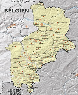
This table shows an overview of the protected heritage sites in the Walloon town Burg-Reuland . This list is part of Belgium's national heritage.
| Object | Year/architect | Town/section | Address | Coordinates | Number | Image |
|---|---|---|---|---|---|---|
| Belgian-Prussian border markers 76-92 (nl)(de) | Burg-Reuland | 50°18′31″N6°00′47″E / 50.308639°N 6.013061°E | 31215 Info | |||
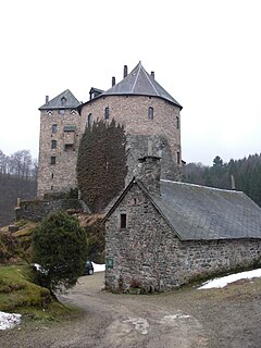
| Burcht Reuland (ruins) (nl)(de) | Burg-Reuland | Reuland | 50°11′45″N6°08′04″E / 50.195944°N 6.134412°E | 31020 Info | 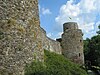 | |
| St. Stephanus church (nl)(de) | Burg-Reuland | Reuland | 50°11′44″N6°08′11″E / 50.195672°N 6.136284°E | 31024 Info | 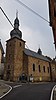 | |
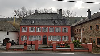
| House of Orley (nl)(de) | Burg-Reuland | 50°11′43″N6°08′10″E / 50.195333°N 6.136222°E | 31023 Info |  | ||
| House Dorf (nl)(de) | Burg-Reuland | 50°11′41″N6°08′07″E / 50.194772°N 6.135388°E | 31022 Info |  | ||
| Tumulus of Hochtumsknopf (nl)(de) | Burg-Reuland | 50°13′54″N6°03′31″E / 50.231679°N 6.058500°E | 31291 Info |  | ||
| Castle Oberhausen (nl)(de) | Burg-Reuland | 50°09′27″N6°08′21″E / 50.157634°N 6.139276°E | 31017 Info | 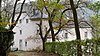 | ||
| St. Peter church (nl)(de) | Burg-Reuland | 50°08′32″N6°08′22″E / 50.142273°N 6.139339°E | 31018 Info |  | ||
| Pastorage (nl)(de) | Burg-Reuland | 50°08′31″N6°08′22″E / 50.141861°N 6.139495°E | 31019 Info | 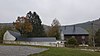 | ||
| Schiebachtal (nl)(de) | Burg-Reuland | 50°08′39″N6°08′18″E / 50.144204°N 6.138229°E | 31054 Info | 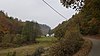 | ||
| Stone hill west of Rittersprunges (nl)(de) | Burg-Reuland | 50°08′37″N6°08′11″E / 50.143515°N 6.136317°E | 31051 Info | 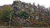 | ||
| St. Remacluse church (nl)(de) | Burg-Reuland | Thommen | 50°13′10″N6°04′26″E / 50.219377°N 6.073829°E | 31025 Info |  | |
| Presbytery (nl)(de) | Burg-Reuland | Thommen | 50°13′10″N6°04′26″E / 50.219377°N 6.073829°E | 31030 Info | 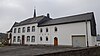 | |
| Thommer Weiher (pond) (nl)(de) | Burg-Reuland | 50°13′25″N6°03′14″E / 50.223474°N 6.053958°E | 31052 Info | 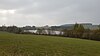 | ||
| St. Hubert chapel (nl)(de) | Burg-Reuland | 50°11′38″N6°09′02″E / 50.193853°N 6.150438°E | 31001 Info | 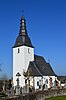 | ||
| Huis Dürler (old house) (nl)(de) | Burg-Reuland | 50°11′25″N6°04′12″E / 50.190386°N 6.069892°E | 31016 Info | 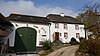 | ||
| "Im Kollerwinkel" burial mounds (nl)(de) | Burg-Reuland | 50°12′48″N6°06′43″E / 50.213262°N 6.112046°E | 31298 Info | 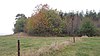 | ||
| Kleinhardt burial mounds (nl)(de) | Burg-Reuland | 50°13′18″N6°07′20″E / 50.221714°N 6.122340°E | 31297 Info |  | ||
| House Burg-Reuland 143 (nl)(de) | Burg-Reuland | 50°11′48″N6°08′23″E / 50.1965426014229°N 6.13962852648922°E | 32238 Info | 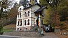 |