This table shows an overview of the protected heritage sites in the Walloon town Lasne . This list is part of Belgium's national heritage.
Object | Year/architect | Town/section | Address | Coordinates | Number? | Image |
---|---|---|---|---|---|---|
Gros Tilleul, a large lime tree (nl)(fr) | Lasne | place de Renival, te Lasne-Chapelle-Saint-Lambert | 50°40′55″N4°29′31″E / 50.681861°N 4.491968°E | 25119-CLT-0002-01 Info | ||
Abbey of Aywiers and surrounding area (nl)(fr) | Lasne | Couture-Saint-Germain | 50°40′08″N4°27′52″E / 50.668828°N 4.464309°E | 25119-CLT-0003-01 Info | ||
Old vicarage of Maransart, wall and gate and the ensemble formed by the parsonage and garden (nl)(fr) | Lasne | Lasne | 50°39′38″N4°27′38″E / 50.660577°N 4.460664°E | 25119-CLT-0004-01 Info | ||
Tower of the Church of Saint-Etienne (nl)(fr) | Lasne | Ohain | 50°41′40″N4°28′10″E / 50.694483°N 4.469577°E | 25119-CLT-0007-01 Info | ||
Ensemble of the church of Saint-Etienne and its immediate surroundings (nl)(fr) | Lasne | Ohain | 50°41′40″N4°28′09″E / 50.694555°N 4.469146°E | 25119-CLT-0008-01 Info | ||
Totality of the church of Saint-Etienne, whose tower is classified as a monument by Royal Decree of 21 December 1936 and the site by the Royal Decree of 30 March 1962 (nl)(fr) | Lasne | Lasne | 50°41′40″N4°28′11″E / 50.694482°N 4.469712°E | 25119-CLT-0009-01 Info | ||
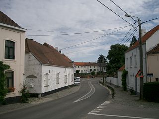
Ensemble of the village / town square (nl)(fr) | Lasne | Ohain | 50°41′50″N4°28′14″E / 50.697203°N 4.470694°E | 25119-CLT-0010-01 Info | ||
the oak tree (nl)(fr) | Lasne | chemin du Moulin, Lasne | 50°41′47″N4°28′40″E / 50.696373°N 4.477878°E | 25119-CLT-0011-01 Info | ||
Farm "La Haie Sainte" (nl)(fr) | Lasne | Plancenoit | 50°40′41″N4°24′43″E / 50.678001°N 4.411949°E | 25119-CLT-0012-01 Info | ||
The stele, base, stairs and iron work of the monument of the Prussians and the ensemble formed by the monument and its surroundings (nl)(fr) | Lasne | Lasne | 50°39′50″N4°25′41″E / 50.663802°N 4.428153°E | 25119-CLT-0014-01 Info | ||
Column Victor Hugo (nl)(fr) | Lasne | chaussée de Charleroi, Plancenoit | 50°40′00″N4°24′49″E / 50.666656°N 4.413664°E | 25119-CLT-0015-01 Info | ![]() | |
Memorial of the French called L'Aigle blessé(nl)(fr) | Lasne | Lasne | 50°39′58″N4°24′48″E / 50.666030°N 4.413358°E | 25119-CLT-0016-01 Info | ||
Monument of the Hanoverans (nl)(fr) | Lasne | Lasne | 50°40′46″N4°24′45″E / 50.679478°N 4.412451°E | 25119-CLT-0017-01 Info | ||
Memorial of the English, mémoire de Gordon (nl)(fr) | Lasne | Lasne | 50°40′47″N4°24′43″E / 50.679671°N 4.411933°E | 25119-CLT-0018-01 Info | ||
Right bank of the valley of Smohain (nl)(fr) | Lasne | 50°41′25″N4°28′07″E / 50.690402°N 4.468634°E | 25119-CLT-0019-01 Info | |||
Left bank of the valley of Smohain (nl)(fr) | Lasne | Lasne | 50°41′56″N4°29′56″E / 50.698907°N 4.498788°E | 25119-CLT-0020-01 Info | ||
Ransbeck square (nl)(fr) | Lasne | Ohain | 50°42′11″N4°26′20″E / 50.702975°N 4.438913°E | 25119-CLT-0022-01 Info | ||
Camp of the Battle of Waterloo in 1815 (nl)(fr) | Lasne | 50°40′05″N4°23′22″E / 50.668009°N 4.389375°E | 25119-CLT-0023-01 Info | |||
Camp of the Battle of Waterloo in 1815 (nl)(fr) | Lasne | 50°40′05″N4°23′22″E / 50.668009°N 4.389375°E | 25119-PEX-0001-01 Info |
![]() | Wikimedia Commons has media related to Cultural heritage monuments in Lasne . |
Walloon Brabant is a province of Wallonia and Belgium. It borders on the province of Flemish Brabant and the provinces of Liège, Namur and Hainaut (Wallonia). Its capital and largest city is Wavre.
Lasne is a Walloon municipality in the Belgian province of Walloon Brabant, south east of Brussels. In 2008, Lasne had a population of 14,043. The total area is 47.22 km² which gives a population density of 297 inhabitants per km². Lasne is the richest municipality in Wallonia, measured by the average taxable income of the inhabitants. It also has the lowest local taxes of any municipality in Belgium.
Yvoir is a Walloon municipality located in the Belgian province of Namur. On 1 January 2006 the municipality had 8,450 inhabitants. The total area is 56.84 km², making it a population density of 149 inhabitants per km².
La Bruyère is a Walloon municipality in Namur Province, Belgium. The municipality was created during the post-1974 fusion of the Belgian municipalities, adding together the ancienne communes of Émines, Rhisnes, Villers-lez-Heest, Warisoulx, Bovesse, Meux and Saint-Denis-Bovesse. Rhisnes is the administrative seat of the municipality.
Gembloux is a Walloon city and surrounding municipality in Namur Province, Belgium.
Sombreffe is a Walloon municipality in Namur Province, Belgium. On 1 January 2014 the municipality had 8,226 inhabitants. The total area is 35.78 km², giving a population density of 230 inhabitants per km².
Couvin is a Walloon municipality located in the Belgian province of Namur.
Villers-le-Bouillet is a Walloon municipality of Belgium in Liège Province. On January 1, 2006, Villers-le-Bouillet had a total population of 6,051. The total area is 32.71 km2 which gives a population density of 185 inhabitants per km2.
Ans is a small Belgian municipality located in the Walloon province of Liège. On January 1, 2006, Ans had a total population of 27,322. The total area is 23.35 km² which gives a population density of 1,170 inhabitants per km². Its postal code is 4430.
Flémalle is a Walloon municipality located in the Belgian province of Liège. On January 1, 2006, Flémalle had a total population of 25,140. The total area is 36.68 km² which gives a population density of 685 inhabitants per km².
Saint-Nicolas is a municipality of Belgium. It lies in the country's Walloon Region and Liège Province. It is effectively a part of the greater Liège conurbation stretching west from Liège city centre towards Liège Airport. As of January 1, 2006 Saint-Nicolas had a total population of 22,666. The total area is 6.84 km2 which gives a population density of 3,313 inhabitants per km2. It has the highest population density of any Belgian municipality outside the Brussels-Capital Region.
Attert is a Walloon municipality of Belgium located in the province of Luxembourg. On 1 January 2007 the municipality, which covers 70.94 km², had 4,802 inhabitants, giving a population density of 67.7 inhabitants per km².
Ohain is a town in the municipality of Lasne in the province of Walloon Brabant, Belgium.
Plancenoit is a Walloon village and section of the municipality of Lasne, Walloon Brabant, Belgium. The village was a key strategic point during the Battle of Waterloo as it was the main focal point of the Prussians' successful flank attack on Napoleon's army.
Heritage registers in Belgium include immovable heritage such as World Heritage Sites, and National heritage sites, but also intangible cultural heritage. The agency responsible for keeping and updating inventories of immovable heritage is dependent on the region, as is the name for the object, which is called Beschermd erfgoed, Biens classés or Kulturdenkmal depending on the language of the municipality of the location.
Maransart is a town and district of the Walloon municipality Lasne in the Belgian province of Walloon Brabant.