List of protected heritage sites in Nivelles

Last updated

This table shows an overview of the protected heritage sites in the Walloon town Nijvel, or Nivelles . This list is part of Belgium's national heritage.

Object
Year/architect
Town/section
Address
Coordinates
Number?
Image
Chapel of Récollets (nl)(fr)
Nijvel 50°35′46″N4°19′40″E / 50.596238°N 4.327793°E / 50.596238; 4.327793

25072-CLT-0001-01  Info

Kapel van Recollets Couvent des Recollets de Nivelles 01.JPG
Kapel van Recollets
Park Dodaine (nl)(fr)
Nijvel 50°35′29″N4°19′14″E / 50.591474°N 4.320543°E / 50.591474; 4.320543

25072-CLT-0003-01  Info

Park van Dodaine Parc de la Dodaine nivelles 1.JPG
Park van Dodaine
Cloister of the former convent of Saint Gertrude (nl)(fr)
Nijvel 50°35′52″N4°19′25″E / 50.597721°N 4.323523°E / 50.597721; 4.323523

25072-CLT-0004-01  Info

Kloostergang van het voormalige klooster van Sainte Gertrude Cloitre de l'ancien monastere Sainte-Gertrude.JPG
Kloostergang van het voormalige klooster van Sainte Gertrude
Cellars of the Collegiate Church of Sainte-Gertrude (nl)(fr)
Nijvel 50°35′52″N4°19′24″E / 50.597894°N 4.323386°E / 50.597894; 4.323386

25072-CLT-0005-01  Info

Collegiate Church of Saint Gertrude (nl)(fr)
Nijvel 50°35′51″N4°19′25″E / 50.597440°N 4.323700°E / 50.597440; 4.323700

25072-CLT-0006-01  Info

Collegiale Kerk van Sainte Gertrude PM 69094 B Nivelles.jpg
Collegiale Kerk van Sainte Gertrude
town hall (nl)(fr)
Nijvel 50°35′52″N4°19′22″E / 50.597820°N 4.322820°E / 50.597820; 4.322820

25072-CLT-0007-01  Info

Fontaine-Perron (nl)(fr)
Nijvel 50°35′49″N4°19′23″E / 50.596937°N 4.323013°E / 50.596937; 4.323013

25072-CLT-0008-01  Info

tower Simone (nl)(fr)
Nijvel 50°35′48″N4°19′11″E / 50.596732°N 4.319676°E / 50.596732; 4.319676

25072-CLT-0009-01  Info

Toren Simone Tour Simone 01.JPG
Toren Simone
Building "La Tourette" (nl)(fr)
Nijvel 50°35′34″N4°19′08″E / 50.592670°N 4.318794°E / 50.592670; 4.318794

25072-CLT-0010-01  Info

Gebouw "La Tourette" Tourette de Nivelles 08.JPG
Gebouw "La Tourette"
building (nl)(fr)
Nijvelrue de Bruxelles 29 50°35′58″N4°19′28″E / 50.599477°N 4.324407°E / 50.599477; 4.324407

25072-CLT-0011-01  Info

Renard tower (nl)(fr)
Nijvel 50°35′33″N4°19′59″E / 50.592460°N 4.332932°E / 50.592460; 4.332932

25072-CLT-0012-01  Info

Old farm of Quertaimont (nl)(fr)
Nijvel 50°36′11″N4°19′55″E / 50.603035°N 4.331847°E / 50.603035; 4.331847

25072-CLT-0013-01  Info

Oude pachthoeve van Quertaimont Ancienne metairie de Quertaimont 1.jpg
Oude pachthoeve van Quertaimont
Domain Fonteneau (nl)(fr)
Nijvel 50°36′33″N4°19′57″E / 50.609250°N 4.332579°E / 50.609250; 4.332579

25072-CLT-0015-01  Info

Domain of Potte (nl)(fr)
Nijvel 50°36′44″N4°20′02″E / 50.612206°N 4.333964°E / 50.612206; 4.333964

25072-CLT-0016-01  Info

Forest of Sépulcre (nl)(fr)
Nijvel 50°36′45″N4°18′22″E / 50.612478°N 4.306235°E / 50.612478; 4.306235

25072-CLT-0017-01  Info

Facades, roof, cladding and staircases of the building (nl)(fr)
Nijvelrue des Saintes n° 16 50°35′45″N4°19′34″E / 50.595751°N 4.326214°E / 50.595751; 4.326214

25072-CLT-0018-01  Info

Facades and roofs of the building n° 98 located near Charleroi (nl)(fr)
Nijveln° 98 50°35′25″N4°19′47″E / 50.590290°N 4.329650°E / 50.590290; 4.329650

25072-CLT-0019-01  Info

Property and construction (nl)(fr)
Nijvelrue de la religion n° 10 50°35′43″N4°19′36″E / 50.595374°N 4.326708°E / 50.595374; 4.326708

25072-CLT-0021-01  Info

Huis en aanbouw Nivelles - IBW Building.JPG
Huis en aanbouw
Church of Sainte-Marguerite, with the exception of the small shrine on the right side of the building, and the group formed by the church, the cemetery, the rectory and the garden and the road along the wall of the farm (nl)(fr)
Nijvel 50°35′52″N4°22′06″E / 50.597771°N 4.368336°E / 50.597771; 4.368336

25072-CLT-0022-01  Info

Kerk Sainte-Marguerite, met uitzondering van het kleine heiligdom aan de rechterkant van het gebouw, en de groep gevormd door de kerk, de begraafplaats, de pastorie en de tuin en de weg langs de muur van de boerderij Belgique - Brabant wallon - Eglise Sainte-Marguerite de Thines - 02.JPG
Kerk Sainte-Marguerite, met uitzondering van het kleine heiligdom aan de rechterkant van het gebouw, en de groep gevormd door de kerk, de begraafplaats, de pastorie en de tuin en de weg langs de muur van de boerderij
More images
Church of Saint Francis (nl)(fr)
Nijvel 50°36′06″N4°16′30″E / 50.601670°N 4.274927°E / 50.601670; 4.274927

25072-CLT-0023-01  Info

Kerk Saint Francois Belgique - Brabant wallon - Eglise Saint-Francois de Bornival - 01.jpg
Kerk Saint François
More images
Facades and roofs of the main building and the pavilion (nl)(fr)
Nijvelrue de Soignies n° 15 50°35′49″N4°19′15″E / 50.597030°N 4.320718°E / 50.597030; 4.320718

25072-CLT-0024-01  Info

Presbytery: facades and roofs (nl)(fr)
Nijvelrue du Centre n° 40 50°36′05″N4°16′29″E / 50.601483°N 4.274618°E / 50.601483; 4.274618

25072-CLT-0025-01  Info

Pastorie: gevels en daken Cure de l'eglise Saint Francois de Bornival arriere.jpg
Pastorie: gevels en daken
Farm of Seigneur: facades and roofs of the old 17th century entrance, the facade, roof and gable of the south wing of the old outbuildings (nl)(fr)
Nijvel 50°36′01″N4°16′19″E / 50.600321°N 4.272022°E / 50.600321; 4.272022

25072-CLT-0026-01  Info

Boerderij van Seigneur: gevels en daken van de oude ingang van de 17e eeuw, en de buitengevel, daken en puntgevel van de zuidelijke vleugel van de oude bijgebouwen Ferme du Seigneur - Bornival 3.jpg
Boerderij van Seigneur: gevels en daken van de oude ingang van de 17e eeuw, en de buitengevel, daken en puntgevel van de zuidelijke vleugel van de oude bijgebouwen
The organ and choir screen, surrounding walls and ceiling of the first span of the church Saint-Remy (nl)(fr)
Nijvel 50°36′47″N4°21′06″E / 50.613017°N 4.351780°E / 50.613017; 4.351780

25072-CLT-0027-01  Info

Het orgel en het oksaal, aangrenzende muren en het plafond van de eerste travee van de kerk Saint-Remy Baulers - Saint Remy Church.JPG
Het orgel en het oksaal, aangrenzende muren en het plafond van de eerste travee van de kerk Saint-Remy
Forest of Hôpital (nl)(fr)
Nijvel 50°35′32″N4°15′49″E / 50.592154°N 4.263528°E / 50.592154; 4.263528

25072-CLT-0031-01  Info

Forest of Arpes (nl)(fr)
Nijvel 50°34′38″N4°16′47″E / 50.577098°N 4.279806°E / 50.577098; 4.279806

25072-CLT-0032-01  Info

Ensemble of Collegiate Church of Sainte Gertrude, with the exception of the front part of the furnishings (except the pulpit) and organ (instrumental part and buffet) (nl)(fr)
Nijvel 50°35′51″N4°19′25″E / 50.597440°N 4.323700°E / 50.597440; 4.323700

25072-PEX-0001-01  Info

Ensemble van Collegiale Kerk van Sainte Gertrude, met uitzondering van de voorste deel van het meubilair (met uitzondering van de preekstoel) en orgel (instrumentaal deel en buffet) Collegiale Kerk van Sainte Gertrude, Nijvel.jpg
Ensemble van Collegiale Kerk van Sainte Gertrude, met uitzondering van de voorste deel van het meubilair (met uitzondering van de preekstoel) en orgel (instrumentaal deel en buffet)

See also

Related Research Articles

Walloon Brabant Province of Belgium

Walloon Brabant is a province of Wallonia and Belgium. It borders on the province of Flemish Brabant and the provinces of Liège, Namur and Hainaut (Wallonia). Its capital and largest city is Wavre.

Nivelles Municipality in French Community, Belgium

Nivelles is a Walloon city and municipality located in the Belgian province of Walloon Brabant. The Nivelles municipality includes the old communes of Baulers, Bornival, Thines, and Monstreux.

Yvoir Municipality in French Community, Belgium

Yvoir is a Walloon municipality located in the Belgian province of Namur. On 1 January 2006 the municipality had 8,450 inhabitants. The total area is 56.84 km², making it a population density of 149 inhabitants per km².

La Bruyère, Belgium Municipality in Namur Province, Belgium

La Bruyère is a Walloon municipality in Namur Province, Belgium. The municipality was created during the post-1974 fusion of the Belgian municipalities, adding together the ancienne communes of Émines, Rhisnes, Villers-lez-Heest, Warisoulx, Bovesse, Meux and Saint-Denis-Bovesse. Rhisnes is the administrative seat of the municipality.

Gembloux Municipality in Namur Province, Belgium

Gembloux is a Walloon city and surrounding municipality in Namur Province, Belgium.

Sombreffe Municipality in Namur Province, Belgium

Sombreffe is a Walloon municipality in Namur Province, Belgium. On 1 January 2014 the municipality had 8,226 inhabitants. The total area is 35.78 km², giving a population density of 230 inhabitants per km².

Couvin Municipality in French Community, Belgium

Couvin is a Walloon municipality located in the Belgian province of Namur.

Villers-le-Bouillet Municipality in French Community, Belgium

Villers-le-Bouillet is a Walloon municipality of Belgium in Liège Province. On January 1, 2006, Villers-le-Bouillet had a total population of 6,051. The total area is 32.71 km2 which gives a population density of 185 inhabitants per km2.

Ans Municipality in French Community, Belgium

Ans is a small Belgian municipality located in the Walloon province of Liège. On January 1, 2006, Ans had a total population of 27,322. The total area is 23.35 km² which gives a population density of 1,170 inhabitants per km². Its postal code is 4430.

Flémalle Municipality in French Community, Belgium

Flémalle is a Walloon municipality located in the Belgian province of Liège. On January 1, 2006, Flémalle had a total population of 25,140. The total area is 36.68 km² which gives a population density of 685 inhabitants per km².

Saint-Nicolas, Liège Municipality in French Community, Belgium

Saint-Nicolas is a municipality of Belgium. It lies in the country's Walloon Region and Liège Province. It is effectively a part of the greater Liège conurbation stretching west from Liège city centre towards Liège Airport. As of January 1, 2006 Saint-Nicolas had a total population of 22,666. The total area is 6.84 km2 which gives a population density of 3,313 inhabitants per km2. It has the highest population density of any Belgian municipality outside the Brussels-Capital Region.

Dyle (river)

The Dyle is a river in central Belgium, left tributary of the Rupel. It is 86 kilometres (53 mi) long. It flows through the Belgian provinces of Walloon Brabant, Flemish Brabant and Antwerp. Its source is in Houtain-le-Val, near Nivelles in Walloon Brabant.

Nivelles-Baulers Belgian race track

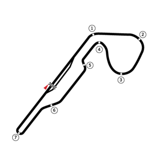
Nivelles-Baulers was a 2.314 miles (3.72 km) race track in Nivelles /Nijvel near Brussels, Belgium.

Arrondissement of Nivelles Arrondissement of Belgium in Walloon Region

The Arrondissement of Nivelles is an arrondissement in Belgium. It is the only arrondissement in the Province of Walloon Brabant, and is coterminous with it. Before 1995, it was one of three arrondissements in the Province of Brabant.

Heritage registers in Belgium Cultural property of Belgium

Heritage registers in Belgium include immovable heritage such as World Heritage Sites, and National heritage sites, but also intangible cultural heritage. The agency responsible for keeping and updating inventories of immovable heritage is dependent on the region, as is the name for the object, which is called Beschermd erfgoed, Biens classés or Kulturdenkmal depending on the language of the municipality of the location.

Flanders Heritage Agency

The Flanders Heritage Agency is a cultural heritage agency sponsored by the Flemish Government. The organisation is split into four subdivisions; the former VIOE, which inventories Beschermd erfgoed in the Flemish Region; the agency "Ruimte en Erfgoed" which executes policy on heritage management and protection; the Ministry department of Town and County Planning, Housing Policy and Immovable Heritage, or Ruimtelijke Ordening, Woonbeleid en Onroerend Erfgoed (RWO), which supports the Minister of Culture on policy decisions; and Inspectie RWO, which is the inspection arm of the RWO.

Nivelles is a railway station in the town of Nivelles, Walloon Brabant, Belgium. The station opened on 1 June 1874 and is located on line 124. The train services are operated by National Railway Company of Belgium (NMBS).

References