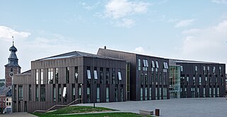
This table shows an overview of the protected heritage sites in the Walloon town Rixensart . This list is part of Belgium's national heritage.
| Object | Year/architect | Town/section | Address | Coordinates | Number? | Image |
|---|---|---|---|---|---|---|
| Castle and its outbuildings (nl)(fr) | Rixensart | 50°42′56″N4°32′10″E / 50.715587°N 4.536109°E | 25091-CLT-0001-01 Info | 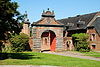 | ||
| Castle and surrounding area (nl)(fr) | Rixensart | 50°43′26″N4°32′42″E / 50.723997°N 4.544990°E | 25091-CLT-0002-01 Info | 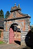 | ||
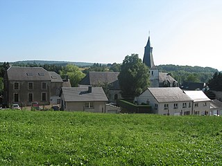
| Chapel and the surrounding trees at the intersection of the rue de Bruxelles and rue du Tilleul (nl)(fr) | Rixensart | 50°44′18″N4°33′10″E / 50.738439°N 4.552773°E | 25091-CLT-0003-01 Info | |||
| La Grande Bruyère (nl)(fr) | Rixensart | 50°43′07″N4°30′41″E / 50.718601°N 4.511416°E | 25091-CLT-0005-01 Info | |||
| Valley of the Lasne (nl)(fr) | Rixensart | 50°43′26″N4°32′42″E / 50.724005°N 4.545026°E | 25091-CLT-0006-01 Info | |||
| Marais de Genval, located at the confluence of the Lasne and the Argentine (nl)(fr) | Rixensart | 50°43′34″N4°31′41″E / 50.726056°N 4.528009°E | 25091-CLT-0007-01 Info | |||
| Protection of the left bank of the Lasne, triangular plot of the confluence of the Lasne and Argentina and a buffer zone between the waterway and the rue de Limalsart (nl)(fr) | Rixensart | 50°43′34″N4°31′41″E / 50.726056°N 4.528009°E | 25091-CLT-0008-01 Info | |||
| Parts of the building "Villa Beau Site", avenue des Combattants n ° 17, namely: the roof, four walls including the access steps at the side, the roof of the porch and the balustrade at the front of the facade at street level , ceilings, walls and floor of the lobby on the ground floor including doors and brass work, the wallpaper, bathroom, hall, doors, Pich-pin on the second floor including the sink. (nl)(fr) | Rixensart | 50°43′00″N4°30′06″E / 50.716791°N 4.501603°E | 25091-CLT-0009-01 Info | |||
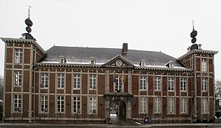
| The facades and roofs of the castle of the Princes of Merode, excluding the outbuildings and the church of Sainte-Croix (1937) (nl)(fr) | Rixensart | 50°42′56″N4°32′10″E / 50.715587°N 4.536109°E | 25091-PEX-0001-01 Info |  |