Liège is the easternmost province of Wallonia and Belgium.
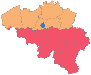
The Kingdom of Belgium is divided into three regions. Two of these regions, Flanders and Wallonia, are each subdivided into five provinces. The third region, Brussels, does not belong to any province and nor is it subdivided into provinces. Instead, it has amalgamated both regional and provincial functions into a single "Capital Region" administration.

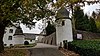
Raeren is a municipality of east Belgium located in the Walloon province of Liège. It was part of Germany until the First World War, after which it became part of Belgium. It is one of several towns in eastern Belgium which predominantly speak German.

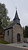
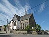
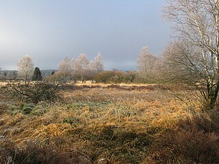
St. Vith is a city and municipality of East Belgium located in the Walloon province of Liège. It was named after Saint Vitus.
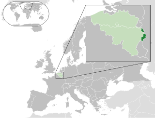
The German-speaking Community, known since 2017 as East Belgium, is one of the three federal communities of Belgium. Covering an area of 854 km2 (330 sq mi) within the Liège Province in Wallonia, it includes nine of the eleven municipalities of Eupen-Malmedy. Traditionally speakers of Low Dietsch, Ripuarian, and Moselle Franconian varieties, the local population numbers 77,949 – about 7.0% of Liège Province and about 0.7% of the national total.
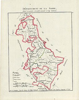
Sarre was a department in the First French Republic and First French Empire. Its territory is now part of Germany and Belgium. Named after the river Saar, it was created in 1798 in the aftermath of the Treaty of Campo Formio of 18 October 1797 which ceded the left bank of the Rhine to France.

Ourthe was a department of the French First Republic and French First Empire in present-day Belgium and Germany. It was named after the river Ourthe (Oûte). Its territory corresponded more or less with that of the present-day Belgian province of Liège and a small adjacent region in North Rhine-Westphalia in Germany. It was created on 1 October 1795, when the Austrian Netherlands, the Prince-Bishopric of Liège and the left bank of the Rhine were officially annexed by the French Republic. Before this annexation, the territory included in the department had lain partly in the Bishopric of Liège, the Abbacy of Stavelot-Malmedy, the Duchies of Limburg and Luxembourg, and the County of Namur.
Sankt Veit is the German name for Saint Vitus in place names.

Eupen-Malmedy or Eupen-Malmédy is a small, predominantly German-speaking region in eastern Belgium. It consists of three administrative cantons around the towns of Eupen, Malmedy, and Sankt Vith which encompass some 730 square kilometres (280 sq mi). Elsewhere in Belgium, the region is commonly referred to as the East Cantons.
Belgischer Rundfunk (BRF) is the public-service broadcasting organisation serving the German-speaking Community of Belgium. Based in Eupen, with additional studio facilities in Sankt Vith and Brussels, BRF produces one television and three radio channels.
The Day of the German-speaking Community is a holiday in Belgium celebrated on 15 November each year. It is a public holiday for the German-speaking Community of Belgium but it is not celebrated elsewhere in the country. The equivalents of the other communities are the Day of the Flemish Community and the Day of the French-speaking Community. The ceremony coincides with the King's Feast.
Arduennella is a Devonian homalonotid genus of trilobite in the order Phacopida, which existed in what is now Belgium, Germany, Morocco and Romania. It was described by Wenndorf in 1990, and the type species is Arduennella maillieuxi, which was originally described as Homalonotus maillieuxi by Asselberghs in 1923.
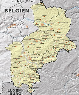
The Belgian Eifel in the German-speaking part of Belgium generally refers to the southern part of the German-speaking community which forms the Canton of Sankt Vith. According to this definition the municipalities of Amel, Büllingen, Burg-Reuland, Bütgenbach and Sankt Vith belong to the Belgian Eifel. This very rural area is very sparsely populated, unlike the northern part of the German-speaking community, Eupener Land.
The German-Belgian High Fens – Eifel Nature Park, often called the North Eifel Nature Park, is a cross-border nature park with elements in the German federal states of North Rhine-Westphalia and Rhineland-Palatinate as well as the Belgian province of Liège. It has a total area of 2,485 km2 (959 sq mi).

Heritage registers in Belgium include immovable heritage such as World Heritage Sites, and National heritage sites, but also intangible cultural heritage. The agency responsible for keeping and updating inventories of immovable heritage is dependent on the region, as is the name for the object, which is called Beschermd erfgoed, Biens classés or Kulturdenkmal depending on the language of the municipality of the location.

The diocese of Eupen-Malmedy is a former Belgian Latin Roman Catholic diocese, which existed between 1919 and 1925, and included the East Cantons.
Marc Dollendorf is a retired Belgian athlete who specialised in the 400 metres hurdles. He represented his country at the 1996 Summer Olympics as well as four consecutive World Championships starting in 1991.

The GR 56 is a hiking trail in southeast Belgium from St. Vith to Malmedy. The approximately 200 km long trail is part of the GR long-distance hiking trail network. The GR 56 was one of the first GR long-distance trails in Belgium and is traditionally marked in white and red stripes.
Saint Vitus (290-303) is a Christian saint, dying martyred during the Roman persecution of Christians.