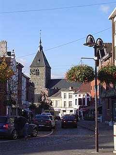
List of protected heritage sites in Tubize

Last updated

This table shows an overview of the protected heritage sites in the Walloon town Tubeke, or Tubize . This list is part of Belgium's national heritage.

Object
Year/architect
Town/section
Address
Coordinates
Number?
Image
Church (Saint-Martin) in Oisquercq (nl)(fr)
Tubeke 50°40′13″N4°13′11″E / 50.670200°N 4.219673°E / 50.670200; 4.219673

25105-CLT-0005-01  Info

Kerk ('Saint-Martin') te Oisquercq L'eglise Saint-Martin, a Oisquercq.jpg
Kerk ('Saint-Martin') te Oisquercq
Tower of Church of St Renelde in Saintes (nl)(fr)
Tubeke 50°42′15″N4°09′37″E / 50.704138°N 4.160380°E / 50.704138; 4.160380

25105-CLT-0007-01  Info

Toren van kerk Sainte Renelde, te Saintes Tour de l'eglise Sainte Renelde, a Saintes.jpg
Toren van kerk Sainte Renelde, te Saintes
The car of the procession of St. Renelde located in the church of Sainte Renelde in Saintes (nl)(fr)
Tubeke 50°42′15″N4°09′38″E / 50.704161°N 4.160456°E / 50.704161; 4.160456

25105-CLT-0008-01  Info

De wagen van de processie van St. Renelde gelegen in de kerk van Sainte Renelde, te Saintes Le char portant la chasse de Sainte-Renelde.jpg
De wagen van de processie van St. Renelde gelegen in de kerk van Sainte Renelde, te Saintes
Windmill stone, called "Hondzocht mill" in Saintes (nl)(fr)
Tubeke 50°42′51″N4°10′39″E / 50.714176°N 4.177497°E / 50.714176; 4.177497

25105-CLT-0009-01  Info

Windmolen steen, genaamd "Hondzochtmolen" te Saintes Moulin a vent, a Saintes.jpg
Windmolen steen, genaamd "Hondzochtmolen" te Saintes
Plane tree "Arbre de la Liberté" planted by volunteers on their return from Brussels in 1830, growing on the public square of Saintes (nl)(fr)
Tubeke 50°42′16″N4°09′36″E / 50.704341°N 4.159952°E / 50.704341; 4.159952

25105-CLT-0010-01  Info

Plataan "Arbre de la Liberte" geplant door vrijwilligers bij hun terugkeer uit Brussel in 1830, groeiend op het openbare plein van Saintes Platane, Saintes.jpg
Plataan "Arbre de la Liberté" geplant door vrijwilligers bij hun terugkeer uit Brussel in 1830, groeiend op het openbare plein van Saintes
The facades and roofs of the castle and the farm Clabecq and the ensemble formed by these buildings and their surrounding grounds (nl)(fr)
Tubeke 50°41′04″N4°13′28″E / 50.684370°N 4.224390°E / 50.684370; 4.224390

25105-CLT-0012-01  Info

De gevels en daken van het kasteel en de boerderij Clabecq en het ensemble gevormd door deze gebouwen en hun omliggende gronden Chateau des Italiens a Clabecq.jpg
De gevels en daken van het kasteel en de boerderij Clabecq en het ensemble gevormd door deze gebouwen en hun omliggende gronden
Wells Sainte-Renelde to Saintes, and the ensemble of the wells and the surrounding grounds (nl)(fr)
Tubeke 50°41′52″N4°09′20″E / 50.697678°N 4.155592°E / 50.697678; 4.155592

25105-CLT-0013-01  Info

Putten Sainte-Renelde, te Saintes, en het ensemble van de putten en de omliggende gronden Saintes Fon1a.jpg
Putten Sainte-Renelde, te Saintes, en het ensemble van de putten en de omliggende gronden

See also

Related Research Articles

Tubize Municipality in French Community, Belgium

Tubize is a Walloon city and municipality located in the Belgian province of Walloon Brabant. On January 1, 2006 Tubize had a total population of 22,335. The total area is 32.66 km2 which gives a population density of 684 inhabitants per km2.

Yvoir Municipality in French Community, Belgium

Yvoir is a Walloon municipality located in the Belgian province of Namur. On 1 January 2006 the municipality had 8,450 inhabitants. The total area is 56.84 km², making it a population density of 149 inhabitants per km².
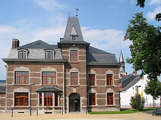
Éghezée Municipality in Namur Province, Belgium

Éghezée is a Walloon municipality in Namur Province, Belgium. On 1 January 2010 the municipality had 15,169 inhabitants. The total area is 102.81 km², giving a population density of 146.93 inhabitants per km².

La Bruyère, Belgium Municipality in Namur Province, Belgium

La Bruyère is a Walloon municipality in Namur Province, Belgium. The municipality was created during the post-1974 fusion of the Belgian municipalities, adding together the ancienne communes of Émines, Rhisnes, Villers-lez-Heest, Warisoulx, Bovesse, Meux and Saint-Denis-Bovesse. Rhisnes is the administrative seat of the municipality.
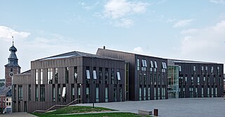
Gembloux Municipality in Namur Province, Belgium

Gembloux is a Walloon city and surrounding municipality in Namur Province, Belgium.

Sombreffe Municipality in Namur Province, Belgium

Sombreffe is a Walloon municipality in Namur Province, Belgium. On 1 January 2014 the municipality had 8,226 inhabitants. The total area is 35.78 km², giving a population density of 230 inhabitants per km².

Couvin Municipality in French Community, Belgium

Couvin is a Walloon municipality located in the Belgian province of Namur.

Villers-le-Bouillet Municipality in French Community, Belgium

Villers-le-Bouillet is a Walloon municipality of Belgium in Liège Province. On January 1, 2006, Villers-le-Bouillet had a total population of 6,051. The total area is 32.71 km2 which gives a population density of 185 inhabitants per km2.

Ans Municipality in French Community, Belgium

Ans is a small Belgian municipality located in the Walloon province of Liège. On January 1, 2006, Ans had a total population of 27,322. The total area is 23.35 km² which gives a population density of 1,170 inhabitants per km². Its postal code is 4430.
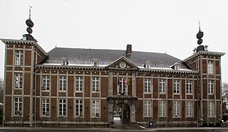
Flémalle Municipality in French Community, Belgium

Flémalle is a Walloon municipality located in the Belgian province of Liège. On January 1, 2006, Flémalle had a total population of 25,140. The total area is 36.68 km² which gives a population density of 685 inhabitants per km².

Saint-Nicolas, Liège Municipality in French Community, Belgium

Saint-Nicolas is a municipality of Belgium. It lies in the country's Walloon Region and Liège Province. It is effectively a part of the greater Liège conurbation stretching west from Liège city centre towards Liège Airport. As of January 1, 2006 Saint-Nicolas had a total population of 22,666. The total area is 6.84 km2 which gives a population density of 3,313 inhabitants per km2. It has the highest population density of any Belgian municipality outside the Brussels-Capital Region.
Attert Municipality in French Community, Belgium

Attert is a Walloon municipality of Belgium located in the province of Luxembourg. On 1 January 2007 the municipality, which covers 70.94 km², had 4,802 inhabitants, giving a population density of 67.7 inhabitants per km².
Saint-Hubert, Belgium Municipality in French Community, Belgium

Saint-Hubert is a Walloon municipality of Belgium located in the province of Luxembourg. On 1 January 2007 the municipality, which covers 111.16 km², had 5,737 inhabitants, giving a population density of 51.6 inhabitants per square kilometre.

Heritage registers in Belgium Cultural property of Belgium

Heritage registers in Belgium include immovable heritage such as World Heritage Sites, and National heritage sites, but also intangible cultural heritage. The agency responsible for keeping and updating inventories of immovable heritage is dependent on the region, as is the name for the object, which is called Beschermd erfgoed, Biens classés or Kulturdenkmal depending on the language of the municipality of the location.

References