Walloon Brabant is a province of Wallonia and Belgium. It borders on the province of Flemish Brabant and the provinces of Liège, Namur and Hainaut (Wallonia). Its capital and largest city is Wavre.

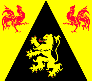
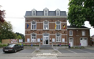
Villers-la-Ville is a Walloon municipality located in the Belgian province of Walloon Brabant. On January 1, 2006, Villers-la-Ville had a total population of 9,572. The total area is 47.45 km² which gives a population density of 202 inhabitants per km². The municipality includes also the villages of Marbais, Mellery, Sart-Dames-Avelines and Tilly.

La Bruyère is a Walloon municipality in Namur Province, Belgium. The municipality was created during the post-1974 fusion of the Belgian municipalities, adding together the ancienne communes of Émines, Rhisnes, Villers-lez-Heest, Warisoulx, Bovesse, Meux and Saint-Denis-Bovesse. Rhisnes is the administrative seat of the municipality.

Profondeville is a Walloon municipality in Namur Province, Belgium. On January 1, 2016, Profondeville had a total population of 12,117. The total area of the municipality is 50.34 km2 (19.44 sq mi) and the population density is 240.70 inhabitants per km².

Nandrin is a municipality of Belgium. It lies in the country's Walloon Region and Liège Province. On January 1, 2006, Nandrin had a total population of 5,539. The total area is 35.90 km² which gives a population density of 154 inhabitants per km².

Villers-le-Bouillet is a Walloon municipality of Belgium in Liège Province. On January 1, 2006, Villers-le-Bouillet had a total population of 6,051. The total area is 32.71 km2 which gives a population density of 185 inhabitants per km2.
Awans is a Belgian municipality located in the Walloon province of Liège. On January 1, 2006, Awans had a total population of 8,696. The total area is 27.16 km² which gives a population density of 320 inhabitants per km².

Juprelle is a municipality of Belgium. It lies in the country's Walloon Region and Liège Province. On 1 January 2006 Juprelle had a total resident population of 8,405. The total area is 35.36 km² which gives a population density of 238 inhabitants per km².

Braives is a Walloon municipality located in the Belgian province of Liège. On January 1, 2006, Braives had a total population of 5,579. The total area is 44.00 km² which gives a population density of 127 inhabitants per km².

Étalle is a Walloon municipality of Belgium located in the province of Luxembourg. On 1 January 2007 the municipality, which covers 78.1 km², had 5,389 inhabitants, giving a population density of 69 inhabitants per km².

Florenville is a Walloon municipality located in the Belgian province of Luxembourg. On 1 January 2016 the municipality had 5,639 inhabitants. The total area is 146.91 km², giving a population density of 38.38 inhabitants per km².

Meix-devant-Virton is a municipality of Gaume located in the Belgian province of Luxembourg. On 1 January 2017 the municipality had 2,812 inhabitants. The total area is 54.2 km², giving a population density of 54 inhabitants per km².

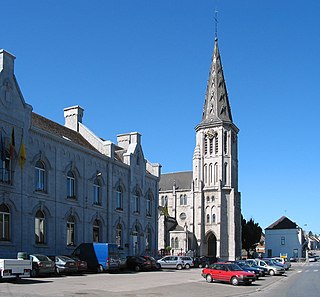
Villers Abbey is an ancient Cistercian abbey located in the town of Villers-la-Ville, in the Walloon Brabant province of Wallonia (Belgium), one piece of the Wallonia's Major Heritage. Founded in 1146, the abbey was abandoned in 1796. Most of the site has since fallen into ruins.
Cerfontaine is a Walloon municipality located in Belgium in the province of Namur. On January 1, 2006, Cerfontaine had a total population of 4,546. The total area is 83.45 km² which gives a population density of 54 inhabitants per km².

Heritage registers in Belgium include immovable heritage such as World Heritage Sites, and National heritage sites, but also intangible cultural heritage. The agency responsible for keeping and updating inventories of immovable heritage is dependent on the region, as is the name for the object, which is called Beschermd erfgoed, Biens classés or Kulturdenkmal depending on the language of the municipality of the location.

Sart-Dames-Avelines is a Belgian village in the municipality of Villers-la-Ville, in the south of the province of Walloon Brabant.
Tilly is a village and sub-municipality of the municipality of Villers-la-Ville, in the Belgian province of Walloon Brabant. It had a population of 1,707 inhabitants on December 31, 2007.


