This table shows an overview of the protected heritage sites in the Walloon town Waterloo, Belgium . This list is part of Belgium's national heritage.
| Object | Year/architect | Town/section | Address | Coordinates | Number? | Image |
|---|---|---|---|---|---|---|
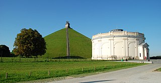
| Camp of the battle of Waterloo in 1815 (nl)(fr) | Waterloo | 50°40′05″N4°23′22″E / 50.668009°N 4.389375°E | 25110-CLT-0001-01 Info |  | ||
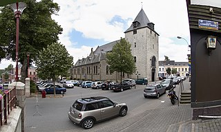
| Domed Temple at Saint Joseph Church (nl)(fr) | Waterloo | Waterloo | 50°43′03″N4°23′51″E / 50.717529°N 4.397400°E | 25110-CLT-0003-01 Info |  | |
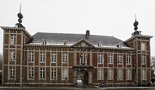
| The main building of the Wellington Museum and the ensemble formed by the building and its surroundings (nl)(fr) | Waterloo | Waterloo | 50°43′04″N4°23′54″E / 50.717650°N 4.398242°E | 25110-CLT-0004-01 Info | ||
| Facade of the building adjacent to the Wellington Museum (nl)(fr) | Waterloo | chaussée de Bruxelles n°145 te Waterloo | 50°43′04″N4°23′54″E / 50.717740°N 4.398226°E | 25110-CLT-0005-01 Info | ||
| Domain of Argenteuil (nl)(fr) | Waterloo | 50°43′30″N4°25′26″E / 50.725129°N 4.423762°E | 25110-CLT-0006-01 Info | |||
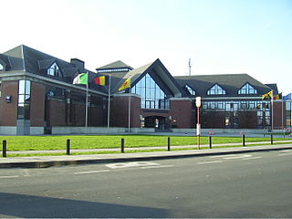
| Some buildings of the provincial medical training institute (nl)(fr) | Waterloo | 36, drève des Dix mètres, te Waterloo | 50°43′16″N4°23′35″E / 50.721007°N 4.393171°E | 25110-CLT-0008-01 Info | ||
| Part of the farm of Mont-Saint-Jean (nl)(fr) | Waterloo | chaussée de Charleroi n°591 te Waterloo | 50°41′10″N4°24′37″E / 50.686052°N 4.410161°E | 25110-CLT-0010-01 Info | ||
| Some parts of the music kiosk Queen Elisabeth: facades, roofs and emmarchement south of the building built according to plans of the architect Ywan Renchon and the concert hall, the dining room and inns and the entire park with the outbuildings built according to plans by Julius Renchon, the esplanade, the staircase, the water feature, sculpture, benches, walkways and plantings and wall (nl)(fr) | Waterloo | 50°43′08″N4°24′56″E / 50.719005°N 4.415648°E | 25110-CLT-0011-01 Info |  | ||
| Ensemble of the Soignes forest and the Bois des Capucins in the territory of the municipalities Auderghem, Duisbourg, Hoeilaart, La Hulpe, Rhode-Saint Genèse, Tervuren, Uccle, Waterloo, Watermael Boitsfort and Woluwe-Saint-Pierre (nl)(fr) | Waterloo | 50°43′48″N4°25′10″E / 50.729909°N 4.419371°E | 25110-CLT-0012-01 Info |  | ||
| Camp of the battle of Waterloo in 1815 (nl)(fr) | Waterloo | 50°40′05″N4°23′22″E / 50.668009°N 4.389375°E | 25110-PEX-0001-01 Info |  | ||
| Soignes forest: area of special value (nl)(fr) | Waterloo | 50°43′48″N4°25′10″E / 50.729909°N 4.419371°E | 25110-PEX-0002-01 Info |