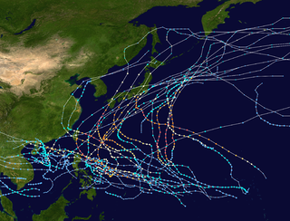
The name Gloria has been used for eighteen tropical cyclones worldwide: three in the Atlantic Ocean, two in the Australian region, one in the South-West Indian Ocean, and twelve in the Western Pacific Ocean. It has also been applied to one extratropical European windstorm.
Storm Gloria (2020) – brought severe flooding to southern and eastern Spain, killing at least 13 people
List of storms with the same or similar names
This article includes a list of named storms that share the same name (or similar names). If an internal link incorrectly led you here, you may wish to change the link to point directly to the intended storm article.
Related Research Articles
The 1996 Pacific typhoon season has no official bounds; it ran year-round in 1996, but most tropical cyclones tend to form in the northwestern Pacific Ocean between May and November. These dates conventionally delimit the period of each year when most tropical cyclones form in the northwestern Pacific Ocean.
The 1978 Pacific typhoon season was a very active season that produced 31 tropical storms, 16 typhoons and one intense typhoon. It has no official bounds; it ran year-round in 1978, but most tropical cyclones tend to form in the northwestern Pacific Ocean between June and December. These dates conventionally delimit the period of each year when most tropical cyclones form in the northwestern Pacific Ocean.
The 1977 Pacific typhoon season was one of the least active Pacific typhoon seasons on record, with only 19 tropical storms forming. It was also the second of three known typhoon seasons during the satellite era to not produce a Category 5-equivalent super typhoon, sandwiched between the 1974 and 2017 seasons. The season's first storm, Severe Tropical Storm Patsy, formed on March 23 and the last, Typhoon Mary, dissipated on January 2, 1978. With Mary spanning two calendar years, it became the fourth typhoon to do so since 1945. Since then, two other typhoons have achieved this feat.
The 1976 Pacific typhoon season has no official bounds; it ran year-round in 1976, but most tropical cyclones tend to form in the northwestern Pacific Ocean between June and December. These dates conventionally delimit the period of each year when most tropical cyclones form in the northwestern Pacific Ocean.
The 1973 Pacific typhoon season has no official bounds; it ran year-round in 1973, but most tropical cyclones tend to form in the northwestern Pacific Ocean between June and December. These dates conventionally delimit the period of each year when most tropical cyclones form in the northwestern Pacific Ocean.
The 1969 Pacific typhoon season was the fourth least-active season on record. The season had no official bounds; it ran year-round in 1969, but most tropical cyclones tend to form in the northwestern Pacific Ocean between June and December. These dates conventionally delimit the period of each year when most tropical cyclones form in the northwestern Pacific Ocean.
The 1965 Pacific typhoon season has no official bounds; it ran year-round in 1965, but most tropical cyclones tend to form in the northwestern Pacific Ocean between June and December. These dates conventionally delimit the period of each year when most tropical cyclones form in the northwestern Pacific Ocean.
During 2005, tropical cyclones formed within seven different tropical cyclone basins, located within various parts of the Atlantic, Pacific and Indian Oceans. During the year, a total of 141 systems formed with 94 of these developing further and were named by the responsible warning centre. The strongest tropical cyclone of the year was Hurricane Wilma, which was estimated to have a minimum barometric pressure of 882 hPa (26.05 inHg). 2005 was above-average in terms of the number of storms. The most active basin in the year was the North Atlantic, which documented 28 named systems. The Western Pacific had an near-average season with 23 named storms. The Eastern Pacific hurricane season experienced an above-average number of tropical storm intensity systems, numbering 15. Activity across the southern hemisphere's three basins – South-West Indian, Australian, and South Pacific – was fairly significant, with the regions recording 23 named storms altogether, with the most intense Southern Hemisphere cyclone of the year, Cyclone Percy from the South Pacific Ocean basin peaking at 145 mph (235 km/h) and 900 millibars. Throughout the year, 28 Category 3 tropical cyclones formed, including eight Category 5 tropical cyclones in the year.
This page is based on this Wikipedia article Text is available under the CC BY-SA 4.0 license; additional terms may apply. Images, videos and audio are available under their respective licenses.