The following are lists of roads in Toronto divided by direction.
- List of north–south roads in Toronto
- List of east–west roads in Toronto
- List of contour roads in Toronto
This article includes a transport-related list of lists.
The following are lists of roads in Toronto divided by direction.

Scarborough is a district of Toronto, Ontario, Canada. It is situated atop the Scarborough Bluffs in the eastern part of the city. Its borders are Victoria Park Avenue to the west, Steeles Avenue and the city of Markham to the north, Rouge River and the city of Pickering to the east, and Lake Ontario to the south. Scarborough was named after the English town of Scarborough, North Yorkshire, inspired by its cliffs.

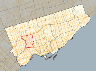
Toronto—St. Paul's is a federal electoral district in Toronto, Ontario, Canada, that has been represented in the House of Commons of Canada since 1935. Its current MP is Carolyn Bennett. Prior to the 2015 election, the riding was known as St. Paul's.

King's Highway 2, commonly referred to as Highway 2, is the lowest-numbered provincially maintained highway in the Canadian province of Ontario, and was originally part of a series of identically numbered highways which started in Windsor, stretched through Quebec and New Brunswick, and ended in Halifax, Nova Scotia. Prior to the 1990s, Highway 2 travelled through many of the major cities in Southern Ontario, including Windsor, Chatham, London, Brantford, Hamilton, Burlington, Mississauga, Toronto, Oshawa, Belleville, Kingston and Cornwall, amongst many other smaller towns and communities.
York South—Weston is a federal electoral district in Ontario, Canada, that has been represented in the House of Commons of Canada since 1979.

Steeles Avenue is an east–west street that forms the northern city limit of Toronto and the southern limit of York Region in Ontario, Canada. It stretches 77.3 km (48.0 mi) across the western and central Greater Toronto Area from Appleby Line in Milton in the west to the Toronto-Pickering city limits in the east, where it continues east into Durham Region as Taunton Road, which itself extends 58 km (36 mi) across the length of Durham Region to its boundary with Northumberland County.
King's Highway 27, commonly referred to as Highway 27, is a provincially maintained highway in the Canadian province of Ontario, much of which is now cared for by the city of Toronto, York Region and Simcoe County. The Ministry of Transportation of Ontario was once responsible for the length of the route, when it ran from Long Branch to Highway 93 in Waverley. Highway 27 followed a mostly straight route throughout its length, as it passed through the suburbs of Toronto, then north of Kleinburg the vast majority of the highway was surrounded by rural farmland. Today, only the southernmost 1.6 km (1 mi) from Highway 427 north to Mimico Creek is under provincial jurisdiction.
King's Highway 2A, commonly referred to as Highway 2A, was the designation of five separate provincially maintained highways in the Canadian province of Ontario. Highway 2A was an alternate route to Highway 2 in Chatham, London and Cornwall; these routes were all eventually redesignated. Highway 2A was also a highway that extended from Windsor to Tilbury, which was redesignated as Highway 98 in 1938.
King's Highway 5, commonly referred to as Highway 5 and historically as the Dundas Highway and Governor's Road, is a provincially maintained highway in the Canadian province of Ontario. The east–west highway travels a distance of 12.7 km (7.9 mi) between Highway 8 at Peters Corners, north of Hamilton, and Highway 6 at Clappison's Corners. Prior to several sections being downloaded to the municipalities in which they were located, Highway 5 served as bypass to Highway 2, connecting with it in both Paris and Toronto, a distance of 114.3 km (71.0 mi).
King's Highway 108, commonly referred to as Highway 108, is a provincially maintained highway in the Canadian province of Ontario. Located in the Algoma District, the highway extends for 41.6 kilometres (25.8 mi) from an intersection with Highway 17 west of Serpent River, through the urban core of Elliot Lake, to an intersection with Quirke Mine Road in the north end of the city. The highway continues as Secondary Highway 639 north of Quirke Mine Road.

Bracondale Hill, also known as Hillcrest Village or Hillcrest, is a residential neighbourhood of Toronto, Ontario, Canada. Annexed by the old City of Toronto in 1909 and developed in 1911 from the Turner estate, Bracondale Hill is on the eastern border of West End Toronto; neighbouring Midtown, stretching above Davenport Road from the south, below St. Clair Avenue West from the north, Wychwood Park & Bathurst St. to the East and Winona Dr. to the West. This neighbourhood is home to the Hillcrest Village Business Improvement Area (BIA).
King's Highway 88, commonly referred to as Highway 88, was a provincially-maintained highway in the Canadian province of Ontario, located in what is now the town of Bradford West Gwillimbury, that connected former Highway 27, in the village of Bond Head, with former Highway 11 in the town of Bradford. The short 9.7-kilometre (6.0 mi) route was established in 1938, though the road it followed had existed for over a century at that time.
King's Highway 47, commonly referred to as Highway 47 and locally as Stouffville Road, Toronto Street and Brock Street, was a provincially maintained highway in the Canadian province of Ontario. The mostly rural route travelled through the towns of Whitchurch-Stouffville, Goodwood, and Uxbridge on its east–west path between Highway 48 and Highway 12. The route was established in 1937, existing until it was transferred to the Regional Municipality of Durham and the Regional Municipality of York at the beginning of 1998.
King's Highway 11A, commonly referred to as Highway 11A, was the highway designation for an alternate route of Highway 11 in the Canadian province of Ontario. The north-south route paralleled Highway 11 within Toronto, serving as a secondary access to Downtown Toronto. It began at the York exit of the Gardiner Expressway (Highway 2) and travelled north on York Street to Front Street, where it transitioned onto University Avenue. It continued north on University Avenue to Queen's Park, where Highway 11A followed Queen's Park Crescent, encircling the Ontario Legislative Building, before continuing along Avenue Road. Highway 11A travelled along Avenue Road to Upper Canada College. It followed Lonsdale Road, Oriole Parkway, and Oxton Avenue around the campus and back to Avenue Road, which resumes north of the school. It continued north along Avenue Road to Highway 401, ending just north of the highway at Bombay Avenue.
Canada's Top Ten is an annual honour, compiled by the Toronto International Film Festival and announced in December each year to identify and promote the year's best Canadian films. The list was first introduced in 2001 as an initiative to help publicize Canadian films.