Related Research Articles

Mason County is a county located in the U.S. state of Washington. As of the 2020 census, the population was 65,726. The county seat and only incorporated city is Shelton. The county was formed out of Thurston County on March 13, 1854. Originally named Sawamish County, it took its present name in 1864 in honor of Charles H. Mason, the first Secretary of Washington Territory.
The Squaxin Island Tribe is a federally recognized tribe located in Mason County, Washington. They are descended from several Southern Coast Salish peoples, including the Squaxin, Sahewamish, T'Peeksin, Squiaitl, Stechass, and Nusechatl.
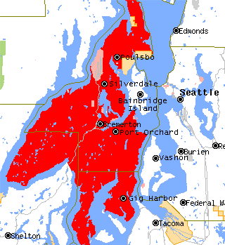
The Kitsap Peninsula lies west of Seattle across Puget Sound, in Washington state in the Pacific Northwest. Hood Canal separates the peninsula from the Olympic Peninsula on its west side. The peninsula, a.k.a. "Kitsap", encompasses all of Kitsap County except Bainbridge and Blake Islands, as well as the northeastern part of Mason County and the northwestern part of Pierce County. The highest point on the Kitsap Peninsula is Gold Mountain. The U.S. Navy's Puget Sound Naval Shipyard, and Naval Base Kitsap are on the peninsula. Its main city is Bremerton.

State Route 108 is a state highway in Grays Harbor and Mason counties, of the U.S. state of Washington. It extends 20.67 miles (33.27 km) from SR 8 in the city of McCleary, east to an interchange with U.S. Route 101 (US 101) in Kamilche. The route serves as a bypass and connects McCleary with Shelton, and Port Angeles.

Sinclair Inlet is a shallow embayment in the western part of Puget Sound in Kitsap County, Washington, USA. It has a maximum depth of 20 meters. It is the southwestern extension of Port Orchard, and it touches the shores of three of Kitsap County's four incorporated cities: Bremerton, Bainbridge Island, and Port Orchard. It is connected to Dyes Inlet by the Port Washington Narrows and to Puget Sound by Rich Passage. It was named by United States Navy explorer Charles Wilkes for George T. Sinclair, acting master of one of his ship's crews. The Puget Sound Naval Shipyard is located on the north shore of Sinclair Inlet.
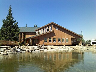
Kamilche is an village in Mason County, Washington, United States. Primarily a farm area, Kamilche is also the home to the Squaxin Indian Tribe. It is at the crossroads of U.S. Route 101 and State Route 108. Kamilche sits at the edge of Little Skookum Inlet, a finger waterway off Puget Sound.
Oakland Bay is a tidal estuarial body of water near the city of Shelton, Washington. It is connected to the larger Puget Sound via Hammersley Inlet. The community of Bay Shore, Washington was located on Oakland Bay. The major freshwater inlet is Goldsborough Creek, which runs through the city of Shelton.

The Puget Sound Navigation Company (PSNC) was founded by Charles E. Peabody in 1898. Today the company operates an international passenger and vehicle ferry service between Port Angeles, Washington, United States and Victoria, British Columbia, Canada on the MV Coho, through its operating company, Black Ball Ferry Line.

Pickering Passage is a strait, in the southern end of part of Puget Sound in the U.S. state of Washington. Entirely within Mason County, the Pickering Passage separates Hartstine Island from the mainland, and connects Totten Inlet with the north end of Case Inlet.

Totten Inlet lies in the southern end of Puget Sound in the U.S. state of Washington. The inlet extends 9 miles (14 km) southwest from the western end of Squaxin Passage, and much of the county line between Mason and Thurston counties runs down the center of it. A spit extends west for about 300 feet (91 m) from Steamboat Island. The inlet shoals gradually to near Burns Point, 100 feet high, on the south shore, where it bares at low tide.

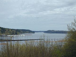
Hammersley Inlet, in southwestern Puget Sound in the U.S. state of Washington, is an arm of water opening north of Arcadia and leading to the city of Shelton and Oakland Bay. Hammersley Inlet is also known as Big Skookum.
Carr Inlet, in southern Puget Sound in the U.S. state of Washington, is an arm of water between Key Peninsula and Gig Harbor Peninsula. Its southern end is connected to the southern basin of Puget Sound. Northward, it separates McNeil Island and Fox Island. The northern end of Carr Inlet is named Henderson Bay, which feeds into Burley Lagoon.
Case Inlet, in southern Puget Sound in the U.S. state of Washington, is an arm of water between Key Peninsula to the east and Harstine Island to the west. Its northern end, called North Bay, reaches nearly to Hood Canal, creating the defining isthmus of Kitsap Peninsula. Case Inlet is the boundary between Pierce County and Mason County. The southern end of Case Inlet connects to Nisqually Reach, part of the southern basin of Puget Sound. Herron Island lies in Case Inlet.
Eld Inlet is an inlet located at the southern end of Puget Sound in Thurston County, Washington. It is the second southernmost arm of Puget Sound after neighboring Budd Inlet.

Iola was a small steam vessel that operated on Puget Sound from 1885 to 1915.
Agate is a small community in the state of Washington, United States. It is located on southern Puget Sound on the north side of the entrance to Hammersley Inlet.
Oyster Bay is an inlet in southern Puget Sound which branches off from Totten Inlet. The bay spans Mason and Thurston counties, in the U.S. state of Washington. Kennedy Creek empties into the bay at the U.S. Highway 101 overpass.

South Puget Sound is the southern reaches of Puget Sound in Southwest Washington, in the United States' Pacific Northwest. It is one of five major basins encompassing the entire Sound, and the shallowest basin, with a mean depth of 37 meters (121 ft). Exact definitions of the region vary: the state's Department of Fish and Wildlife counts all of Puget Sound south of the Tacoma Narrows for fishing regulatory purposes. The same agency counts Mason, Jefferson, Kitsap, Pierce and Thurston Counties for wildlife management. The state's Department of Ecology defines a similar area south of Colvos Passage.
Hills in the Puget Lowland, between the Cascades and the Olympic Mountains, including the entire Seattle metropolitan area, are generally between 350–450 feet (110–140 m) and rarely more than 500 feet (150 m) above sea level. Hills are often notable geologically and for social reasons, such as the seven hills of Seattle.
Kennedy Creek is a stream in Mason and Thurston counties in the U.S. state of Washington. It is a tributary to the Totten Inlet.
References
- Findlay, Jean Cammon, and Paterson, Robin, Mosquito Fleet of South Puget Sound, Arcadia Publishing (2008) ISBN 0-7385-5607-6.
| International | |
|---|---|
| National | |
47°08′26″N123°04′03″W / 47.14056°N 123.06750°W
| | This Mason County, Washington state location article is a stub. You can help Wikipedia by expanding it. |