Related Research Articles

The Fraser River is the longest river within British Columbia, Canada, rising at Fraser Pass near Blackrock Mountain in the Rocky Mountains and flowing for 1,375 kilometres (854 mi), into the Strait of Georgia just south of the City of Vancouver. The river's annual discharge at its mouth is 112 cubic kilometres (27 cu mi) or 3,550 cubic metres per second (125,000 cu ft/s), and it discharges 20 million tons of sediment into the ocean.
The Stʼatʼimc, also known as the Lillooet, St̓át̓imc, Stl'atl'imx, etc., are an Interior Salish people located in the southern Coast Mountains and Fraser Canyon region of the Interior of the Canadian province of British Columbia.

Williams Lake is a city in the Central Interior of British Columbia, in the central part of a region known as the Cariboo. Williams Lake is the second largest city, by population of metropolitan area, in the Cariboo after neighbouring Quesnel. The city is famous for its Williams Lake Stampede, which was once the second largest professional rodeo in Canada after only the Calgary Stampede.
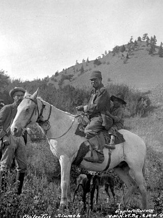
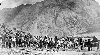
The Tsilhqotʼin or Chilcotin are a North American tribal government of the Athabaskan-speaking ethnolinguistic group that live in what is now known as British Columbia, Canada. They are the most southern of the Athabaskan-speaking Indigenous peoples in British Columbia.
Tkʼemlúps te Secwépemc, abbreviated TteS and previously known as the Kamloops Indian Band, is a First Nations government within the Shuswap Nation Tribal Council, which represents ten of the seventeen Secwepemc band governments, all in the southern Central Interior region, spanning the Thompson and Shuswap districts. It is one of the largest of the 17 groups into which the Secwepemc (Shuswap) nation was divided when the Colony of British Columbia established an Indian reserve system in the 1860s.

The Chilcotin River /tʃɪlˈkoʊtɪn/ located in Southern British Columbia, Canada is a 241 km (150 mi) long tributary of the Fraser River. The name Chilcotin comes from Tŝilhqot’in, meaning "ochre river people," where ochre refers to the mineral used by Tŝilhqot’in Nation and other Indigenous communities as a base for paint or dye. The Chilcotin River, Chilko River and Lake, and Taseko River and Lake make up the Chilcotin River watershed. This 19,200 km2 (7,400 sq mi) watershed drains the Chilcotin Plateau which reaches north to south from the Nechako Plateau to Bridge River county and east to west from Fraser River to the Coast Mountains. It is also one of twelve watersheds that make up the Fraser River Basin. Made up of seven major tributaries, Chilcotin River starts northeast of Itcha Mountain, flowing southeast until it joins the Fraser River south of Williams Lake, 22 km (14 mi) upstream from Gang Ranch.
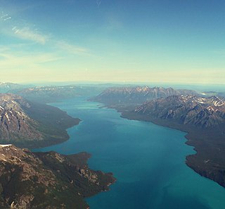
Tŝilhqox Biny, known as Chilko Lake, is a 180 km2 lake in west-central British Columbia, at the head of the Chilko River on the Chilcotin Plateau. The lake is about 65 km long, with a southwest arm 10 km long. It is one of the largest lakes by volume in the province because of its great depth, and the largest above 1,000 m in elevation. It and Harrison Lake are the largest lakes in the southern Coast Mountains.

The Homathko River is one of the major rivers of the southern Coast Mountains of the Canadian province of British Columbia. It is one of the few rivers that penetrates the range from the interior Chilcotin Country to the coastal inlets of the Pacific Ocean. The Homathko River reaches the sea at the head of Bute Inlet, just west of the mouth of the Southgate River.

The Secwépemc, known in English as the Shuswap people, are a First Nations people residing in the interior of the Canadian province of British Columbia. They speak one of the Salishan languages, known as Secwepemc or Shuswap.
The Chilcotin War, the Chilcotin Uprising or the Bute Inlet Massacre was a confrontation in 1864 between members of the Tsilhqot'in (Chilcotin) people in British Columbia and white road construction workers. Fourteen men employed by Alfred Waddington in the building of a road from Bute Inlet were killed, as well as a number of men with a pack-train near Anahim Lake and a settler at Puntzi Lake.

The British Columbia Interior, popularly referred to as the BC Interior or simply the Interior, is a geographic region of the Canadian province of British Columbia. While the exact boundaries are variously defined, the British Columbia Interior is generally defined to include the 14 regional districts that do not have coastline along the Pacific Ocean or Salish Sea, and are not part of the Lower Mainland. Other boundaries may exclude parts of or even entire regional districts, or expand the definition to include the regional districts of Fraser Valley, Squamish–Lillooet, and Kitimat–Stikine.
The Shuswap Nation Tribal Council is a First Nations Tribal Council in the Canadian province of British Columbia. Based in the Thompson and Shuswap Districts of the Central Interior, although including one band on the upper Columbia River in the East Kootenay region. It is one of two tribal councils of the Secwepemc people, the other being the Northern Shuswap Tribal Council of the Cariboo region farther to the north. The council is based in Kamloops, British Columbia.

The Stswecem'c Xgat'tem First Nation, formerly known as Canoe Creek Band/Dog Creek Indian Band, created as a result of merger of the Canoe Creek Band and Dog Creek Band is a First Nations government of the Secwepemc (Shuswap) Nation, located in the Fraser Canyon-Cariboo region of the Central Interior of the Canadian province of British Columbia. It was created when the government of the then-Colony of British Columbia established an Indian reserve system in the 1860s. It is a member government of the Northern Shuswap Tribal Council.
The High Bar First Nation is a First Nations government of the Secwepemc (Shuswap) Nation, located in the Fraser Canyon-Cariboo region of the Central Interior of the Canadian province of British Columbia. It was created when the government of the then-Colony of British Columbia established an Indian reserve system in the 1860s. It is one of three Secwepemc bands that is not a member of either the Shuswap Nation Tribal Council or the Northern Shuswap Tribal Council. The High Bar people are also partly Tsilhqot'in and have links with some Chilcotin First Nations.
The Pavilion Indian Band or Ts'kw'aylaxw First Nation or Tsk'waylacw First Nation or Tsk'weylecw First Nation, and also known in the plural e.g. Ts'kw'alaxw First Nations, is a First Nations government, located in the Fraser Canyon region of the Central Interior of the Canadian province of British Columbia. It was created when the government of the then-Colony of British Columbia established an Indian reserve system in the 1860s.
The Carrier-Chilcotin Tribal Council is a First Nations tribal council located in the Chilcotin District of the Central Interior of the Canadian province of British Columbia, and also on the Fraser River near the city of Quesnel. It consists of three Carrier bands and one Tsilhqot'in band. The other Tsilhqot'in bands belong to the Tsilhqot'in National Government. Most other Carrier bands are either unaffiliated or belong to the Carrier-Sekani Tribal Council. The Tribal Council's offices are in Williams Lake.
The Red Bluff First Nation is a Dakelh First Nations government located in the northern Fraser Canyon region of the Canadian province of British Columbia. It is a member of the Carrier-Chilcotin Tribal Council, which includes both Tsilhqot'in and Carrier (Dakelh) communities.

The Churn Creek Protected Area is a 36,747-hectare (90,800-acre) provincial protected area in British Columbia, Canada. It is a mix of dryland canyon and steppe and adjoining rangeland flanking the canyon of Churn Creek and that stream's confluence with the Fraser River at the northern apex of the Camelsfoot Range. The historic Gang Ranch is just north of the Churn Creek Protected Area. The Empire Valley Ranch ecological preserve was added to the Protected Area in an expansion.

The Robson Valley is a geographic region of the Canadian province of British Columbia, comprising the section of the Rocky Mountain Trench that lies southeast of the city of Prince George following the Fraser River to the Yellowhead Pass. The name is derived from Mount Robson, which stands near the entrance to the Yellowhead Pass. Communities in the Robson Valley include the settlements of Dome Creek, Crescent Spur, Dunster, and Tête Jaune Cache, with larger population concentrations in the villages of McBride and Valemount. On a map, the Robson Valley is located immediately south of the elbow in the boundary between Alberta and British Columbia. Transportation corridors through the Robson Valley include the Canadian National Railway lines, and Highways 16 and 5.
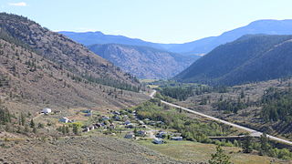
Pavilion is an unincorporated community on the eastern side of the Fraser River in the South Cariboo region of southwestern British Columbia. The place is near Mile 21 of the Old Cariboo Road. On BC Highway 99, the locality is by road about 36 kilometres (22 mi) northeast of Lillooet and 135 kilometres (84 mi) west of Kamloops.
References
- ↑ Cybulski, Jerome S.; McMillan, Alan D.; Malhi, Ripan S.; Kemp, Brian M.; Harry, Harold; Cousins, Scott (2007). "The Big Bar Lake Burial: Middle Period Human Remains from the Canadian Plateau". Canadian Journal of Archaeology. 31 (1): 55–78. ISSN 0705-2006. JSTOR 41103282. Full text available here.
- 1 2 3 Appendix B.19 – High Bar (Llenlleney'ten) First Nation, Government of B.C.
- ↑ "Home". High Bar First Nation. Retrieved 2023-02-22.
- ↑ Reconciliation, Ministry of Indigenous Relations and. "High Bar First Nation - Province of British Columbia". www2.gov.bc.ca. Retrieved 2023-02-22.
- ↑ "High Bar First Nation | British Columbia Assembly of First Nations". www.bcafn.ca. Retrieved 2023-02-22.
- ↑ Annex 4.C.1 Joint Federal / Provincial Consultation and Accommodation Report for the Trans Mountain Project including Relevant Annexes (PDF), archived from the original (PDF) on 22 Feb 2023