See also
| This Newfoundland and Labrador location article is a stub. You can help Wikipedia by expanding it. |
Loch Lomond was a community in Newfoundland and Labrador near St. Andrews. It had a population of 67 in 1956.
| This Newfoundland and Labrador location article is a stub. You can help Wikipedia by expanding it. |

Newfoundland and Labrador is the easternmost province of Canada. Situated in the country's Atlantic region, it is composed of the insular region of Newfoundland and the continental region of Labrador to the northwest, with a combined area of 405,212 square kilometres (156,500 sq mi). In 2018, the province's population was estimated at 525,073. About 92% of the province's population lives on the island of Newfoundland, of whom more than half live on the Avalon Peninsula.

Labrador is a geographic and cultural region within the Canadian province of Newfoundland and Labrador. It is the continental portion of the province and constitutes 71% of the province's area but is home to only 6% of the province's population. It is separated from the island of Newfoundland by the Strait of Belle Isle. It is the largest and northernmost geographical region in Atlantic Canada.

Nunatsiavut is an autonomous area claimed by Inuit in Newfoundland and Labrador, Canada. The region falls within the greater Canadian country of Inuit Nunangat. The settlement area includes territory in Labrador extending to the Quebec border. In 2002, the Labrador Inuit Association submitted a proposal for limited autonomy to the government of Newfoundland and Labrador. The constitution was ratified on 1 December 2005, at which time the Labrador Inuit Association ceased to exist, and the new Government of Nunatsiavut was established, initially being responsible for health, education and cultural affairs. It is also responsible for setting and conducting elections, the first of which was executed in October 2006. An election for the Ordinary Members of the Nunatsiavut Assembly was held on 4 May 2010. The Nunatsiavut Assembly was dissolved on 6 April in preparation for the election. Its incumbent president is Johannes Lampe who assumed office in 2016.

The Newfoundland Time Zone (NT) is a geographic region that keeps time by subtracting 3 1⁄2 hours from Coordinated Universal Time (UTC) during standard time, resulting in UTC−03:30; or subtracting 2 1⁄2 hours during daylight saving time. The clock time in this zone is based on the mean solar time of the meridian 52 degrees and 30 arcminutes west of the Greenwich Observatory.
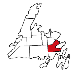
Terra Nova is a provincial electoral district for the House of Assembly of Newfoundland and Labrador, Canada. As of 2011 there were 8,425 eligible voters within the district.

Happy Valley-Goose Bay is a town in the province of Newfoundland and Labrador, Canada.

The Great Northern Peninsula is the largest and longest peninsula of Newfoundland, Canada, approximately 270 km long and 90 km wide at its widest point and encompassing an area of 17,483 km². It is defined as that part of Newfoundland from Bonne Bay northwards around Cape Norman and Cape Bauld and thence southwards to the head of White Bay, bounded by the Gulf of St. Lawrence on the west, the Strait of Belle Isle on the north and the Labrador Sea and White Bay on the east.

Cupids is a town of 743 people on Conception Bay, Newfoundland and Labrador, Canada. It has also been known as Coopers, Copers Cove, Cupers Cove, and Cuperts. It is the oldest continuously settled official British colony in Canada. Cupids is believed to be the site of the first child born of European parents on the continent. The town was established by Englishman John Guy in 1610.

Change Islands is an outport community in the Canadian province of Newfoundland and Labrador.

The Canadian province of Newfoundland and Labrador is governed by a unicameral legislature, the House of Assembly, which operates under the Westminster model of government. The executive function of government is formed by the Lieutenant Governor, the premier and his or her cabinet. The politics of Newfoundland and Labrador is defined by a long history, liberal democratic political institutions and a unique political culture.

Cow Head is a town in the Canadian province of Newfoundland and Labrador. The town had a population of 478 in the Canada 2016 Census.

College of the North Atlantic (CNA) is one of the largest post-secondary educational and skills training centres in Atlantic Canada, with a history dating back 50 years. The college has 17 campus locations throughout the province of Newfoundland and Labrador in Canada, various partner universities in China and it operates a technical education college for the State of Qatar in the Middle East. The enabling legislation is the College Act.

Franco-Newfoundlanders, also known as Franco-Terreneuvians in English or Franco-Terreneuviens in French, are francophone and/or French Canadian residents of the Canadian province of Newfoundland and Labrador. The name Franco-Terreneuvian derives from Terre-Neuve, the French name of Newfoundland.

Newfoundland is a large island off the east coast of the North American mainland, and the most populous part of the Canadian province of Newfoundland and Labrador. It has 29 percent of the province's land area. The island is separated from the Labrador Peninsula by the Strait of Belle Isle and from Cape Breton Island by the Cabot Strait. It blocks the mouth of the Saint Lawrence River, creating the Gulf of Saint Lawrence, the world's largest estuary. Newfoundland's nearest neighbour is the French overseas community of Saint-Pierre and Miquelon.
NunatuKavut is an unrecognized Inuit territory in Labrador. The NunatuKavut people are the direct descendants of the Inuit that lived south of the Churchill or Grand River prior to European contact, with European influence from Basque and French whalers.
Division No. 1, Subdivision C is an unorganized subdivision on the Avalon Peninsula in Newfoundland and Labrador, Canada. It is in Division 1 and contains the unincorporated communities of Cape St. Mary's, Cuslett, Gooseberry Cove, Great Barasway, Lears Cove, Patrick's Cove-Angels Cove, Ship Cove and Stoney House.
Division No. 1, Subdivision U is an unorganized subdivision on the Avalon Peninsula in Newfoundland and Labrador, Canada, in Division 1. It contains the unincorporated communities of Admiral's Cove, Bauline East, Bauline South, Burnt Cove, Devils Kitchen, Flat Rock, St. Michaels and Seal Cove.