
The Great Glen, also known as Glen Albyn or Glen More is a long and straight glen in Scotland running for 62 miles (100 km) from Inverness on the edge of Moray Firth, to Fort William at the head of Loch Linnhe.

Lumsden is a town in Southland, New Zealand. Lying in a gap in the surrounding hills, it is the location of a major junction halfway along the north-south road from Queenstown to Invercargill, where it is crossed by the east-west road from Gore to Te Anau. The town had a population of 405 at the 2013 census.

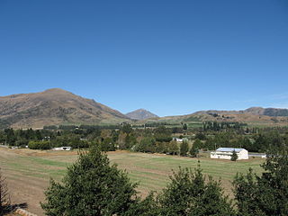
The Hokonui Hills, also known as The Hokonui Mountains or simply The Hokonui, are a range of hills in central Southland, New Zealand. They rise to 600 metres above the surrounding Southland Plains, of which the hills mark a northern extremity.

The Dennistoun Glacier is a glacier, 50 nautical miles long, draining the northern slopes of Mounts Black Prince, Royalist and Adam in the Admiralty Mountains of Victoria Land in Antarctica. It flows northwest between the Lyttelton Range and Dunedin Range, turning east on rounding the latter range to enter the sea south of Cape Scott. The coastal extremity of the glacier was charted in 1911–12 by the Northern Party, led by Victor Campbell, of the British Antarctic Expedition, 1910–13. The geographical feature lies situated on the Pennell Coast, a portion of Antarctica lying between Cape Williams and Cape Adare.
Athol is a small town in Southland, New Zealand. It is located on State Highway 6, 55 km south of Queenstown, halfway between Lumsden and Kingston on the Southern Scenic Route. Farming has always been very important in the district, though in earlier times gold mining, centred on nearby Nokomai, was also significant. In recent decades tourist numbers have grown. The Mataura River is well known for the quality of its brown trout fishing, and the Around the Mountains Cycle Trail, opened in November 2014, has further boosted visitor figures.

Springhills is a locality in the central Southland region of New Zealand's South Island. Situated in a gap between Forest Hill and the Hokonui Hills, it is located on State Highway 96 29 kilometres west of State Highway 1 near Mataura and 15 kilometres east of State Highway 6 at Winton.
Glencoe is a locality in the central Southland region of New Zealand's South Island. Named after Glen Coe in Scotland, it is situated in the Hokonui Hills on the route of State Highway 96 as it travels between Hedgehope and Waitane. The nearest town of significant size is Mataura to the east, while the city of Invercargill is to the southwest.
Waitane is a locality in the Southland region of New Zealand's South Island in the foothills of the Hokonui Hills. It is located in a rural setting on State Highway 96 between Glencoe and Te Tipua. The nearest sizeable town is Mataura to the east, while the main city of Southland, Invercargill, is southwest.
Fortification is a locality in the western part of the Catlins region of Southland in New Zealand's South Island. Nearby settlements include Quarry Hills and Waikawa to the southeast, Tokanui to the southwest, and Waimahaka to the west. It is over 50 km east of Southland's main centre, Invercargill.
Gorge Road is a locality in the Southland Region of New Zealand's South Island. It is on the Southern Scenic Route and is situated on the western bank of the Mataura River. Nearby settlements include Ashers to the west, and across the Mataura, Pine Bush and Titiroa to the east.
The Drake River is a river of New Zealand. It is located in southern Westland, and flows entirely within the Mount Aspiring National Park. The river follows a southerly course for seven kilometres before turning northeast to flow another five kilometres before reaching the Waiatoto River.
The Gorge River is a river on the West Coast of New Zealand. It arises in the Hope Blue River Range and flows south-west into the Tasman Sea. Its tributaries include the Duncan River and Jerry River. It passes through Cascade Forest. Its mouth is about 15 km north-east of Awarua Point. The Gorge Islands are very small islands near the mouth. At its mouth, it is a fast tidal river.
The Nokomai River is a river in New Zealand, a tributary of the Mataura River.
The Rea River is a river in Fiordland, New Zealand. It rises west of Teardrop Lake and flows into Bradshaw Sound.

The Von River is a river in New Zealand, flowing into Lake Wakatipu. It was named after explorer Nicholas von Tunzelmann
The Waikaia River is a river in New Zealand, a tributary of the Mataura River.
The Windley River is a river in the Eyre Mountains, New Zealand. It is a tributary of the Oreti River, joining that river 6 kilometres (4 mi) north-east of Centre Hill.

Alpinacris tumidicauda is a species of grasshopper only known from Otago and Southland, New Zealand. The genus Alpinacris is endemic to the South Island of New Zealand. A. tumidicauda was described in 1967 by Robert Sidney Bigelow, with a type locality of Obelisk in the Old Man Range (45°19′22″S169°12′27″E). A male holotype and paratype are deposited in the Canterbury Museum, Christchurch. Like all of New Zealand sub-alpine and alpine grasshoppers, A. tumidicauda has a 2- or 3-year life cycle. The eggs must "overwinter" before they will hatch. Hoppers are found throughout the year, and adult grasshoppers can be found throughout the New Zealand summer between December and April. The adult A. tumidicauda do not overwinter.

Sigaus australis is the most common alpine grasshopper found in New Zealand. It can be found in the lower half of the South Island, from the Otago and Canterbury Region. S. australis was described in 1897 by Frederick Wollaston Hutton. Like all of New Zealand sub-alpine and alpine grasshoppers S. australis has a 2 or 3 years life cycle. The eggs must ‘overwinter’ before they will hatch. Hoppers are found throughout the year, and adult grasshoppers can be found throughout the New Zealand summer between December and April. The adult S. australis do not overwinter. The genus Sigaus is endemic to New Zealand.
Waikaia, formerly known as Switzers, is a town in the Southland Region of New Zealand's South Island. From 1909 until 1959, it was the terminus of the Waikaia Branch railway. The population in the 2013 census was 99, unchanged from the previous census in 2006.


