Los Blancos | |
|---|---|
Municipality and village | |
| Country | |
| Province | Salta Province |
| Time zone | UTC−3 (ART) |
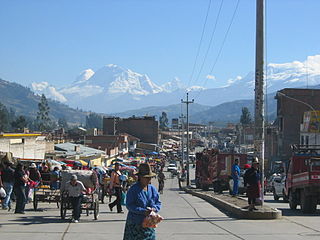
Los Blancos is a village and rural municipality in Salta Province in northwestern Argentina. [1]
Los Blancos | |
|---|---|
Municipality and village | |
| Country | |
| Province | Salta Province |
| Time zone | UTC−3 (ART) |
Los Blancos is a village and rural municipality in Salta Province in northwestern Argentina. [1]

Wilhelmina Bay is a bay 15 nmi wide between the Reclus Peninsula and Cape Anna along the west coast of Graham Land on the Antarctic Peninsula.

D'Urville Island is the northernmost island of the Joinville Island group in Antarctica. It is 27 kilometres (17 mi) long, lying immediately north of Joinville Island, from which it is separated by Larsen Channel.
Colquioc is one of the fifteen districts of the province Bolognesi in Peru.

The Arctowski Peninsula is a peninsula, 15 nautical miles long in a north-south direction, lying between Andvord Bay and Wilhelmina Bay on the west coast of Graham Land, Antarctica.

The Agusta AB.102 was an Italian helicopter produced in small numbers in the early 1960s. The aircraft was based on the mechanical components of a Bell 48 that Agusta incorporated into an all-new, streamlined fuselage. The first flight was on 3 February 1959 and the prototype was exhibited at that year's Paris Air Show in faux military colours. Only two production examples were built, operated by Elivie in a regular air service between Turin and Milan from 1961. However, the advent of turbine-powered helicopters in the 1960s soon rendered the AB.102 obsolete.
Jandaia do Sul is a municipality in the state of Paraná in Brazil. As of 2020, the estimated population was 21,230.
Pendulum Cove is a cove at the north-east side of Port Foster, Deception Island, in the South Shetland Islands of Antarctica. The name of the cove derives from the pendulum and magnetic observations made there by the British expedition under Henry Foster in 1829.

The Curtiss XP-31 Swift was a 1930s American experimental monoplane fighter built by Curtiss for the United States Army Air Corps.
Cotaparaco District is one of ten districts of the Recuay Province in Peru.
Bambas District is one of seven districts of the Corongo Province in Peru.

The Sikorsky S-36 was an eight-seat amphibian sesquiplane designed and built by the Sikorsky Manufacturing Company in the late 1920s. The aircraft was ordered by Pan American Airways, the start of a long association with Sikorsky flying boats.
Cambira is a municipality in the state of Paraná in the Southern Region of Brazil.
Borrazópolis is a municipality in the state of Paraná in the Southern Region of Brazil.
Colonia Dora is a municipality and village in Santiago del Estero Province in Argentina.
Andvord Bay is a bay, 9 nautical miles long and 3 nautical miles wide, which lies between Beneden Head and Duthiers Point along the west coast of Graham Land, Antarctica.

Bildad Peak is a conspicuous snow-capped peak 5 nautical miles (9 km) west of Spouter Peak on the south side of Flask Glacier in eastern Voden Heights, on Oscar II Coast in Graham Land. It was surveyed by the Falkland Islands Dependencies Survey in 1955, and named by the UK Antarctic Place-Names Committee after the fictional Captain Bildad, part-owner of the whaling ship Pequod in Herman Melville's Moby-Dick.

The Pointers is a pair of rocks off the northwest coast of Rugged Island, lying between Eddystone Rocks and Start Point, Livingston Island in the South Shetland Islands, Antarctica.

The Subprefecture of Vila Mariana is one of 32 subprefectures of the city of São Paulo, Brazil. It comprises three districts: Vila Mariana, Saúde, and Moema.

Cape Melville, is a low-lying, ice-free headland at the eastern end of King George Island in the South Shetland Islands of Antarctica. Some 388 ha of the site has been identified as an Important Bird Area (IBA) by BirdLife International because it supports a large breeding colony of about 16000 pairs of chinstrap penguins.
23°36′S62°36′W / 23.600°S 62.600°W
| | This article about a place in Salta Province, Argentina is a stub. You can help Wikipedia by expanding it. |