San Leonardo de Yagüe is a Spanish town and municipality located in the province of Soria, in the autonomous community of Castile and León. It is one of the most populated municipalities of the Sorian county of Pinares.
Muñecas is a province in the Bolivian department of La Paz. Its capital is Chuma.
The arrondissement of Bressuire is an arrondissement of France in the Deux-Sèvres department in the Nouvelle Aquitaine region. On 1 January 2018, it received 16 communes from the arrondissement of Parthenay. It has 57 communes.

Tasiusaq is an island settlement in the Avannaata municipality in northwestern Greenland. It had 248 inhabitants in 2010. In Kalaallisut, the name means "looks like a lake".
Innaarsuit is an island settlement in the Avannaata municipality in northwestern Greenland. Located on an island of the same name, the settlement had 161 inhabitants in 2010.
Naajaat is a settlement in the Qaasuitsup municipality in northwestern Greenland. Former spellings include Naujât, Naujat, and Naajat. Located on a small island of the same name, the settlement has 54 inhabitants as of July 2011.
Kangersuatsiaq, formerly Prøven, is an island settlement in the Avannaata municipality in northwestern Greenland. It had 186 inhabitants in 2010.
Hontanaya is a municipality in Cuenca, Castile-La Mancha, Spain. It has a population of 423.
Benamargosa is a town and municipality in the region of La Axarquía in the province of Málaga, part of the autonomous community of Andalusia in southern Spain. The municipality is situated approximately 11 kilometres from Vélez Málaga and 46 from the provincial capital. It has a population of approximately 1,500 residents. The natives are called Benamargoseños.

Albeta is a municipality located in the province of Zaragoza, Aragon, Spain. According to the 2004 census (INE), the municipality has a population of 151 inhabitants.
Aappilattoq is a settlement in the Avannaata municipality in northwestern Greenland, located on an island of the same name in the southern part of Upernavik Archipelago. Founded in 1805, the settlement had 180 inhabitants in 2010.
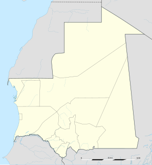
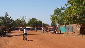
Guerou is a city and department in south-central Mauritania. Guerou is the region's largest city after Kiffa, capital of Assaba Region. It is located at around 16°49′N11°50′W.

Torremocha de Jarama is a municipality of the Community of Madrid, Spain.
Briñas is a village in the province and autonomous community of La Rioja, Spain. The municipality covers an area of 2.44 square kilometres (0.94 sq mi) and as of 2011 had a population of 249 people.
Canillas de Río Tuerto is a village in the province and autonomous community of La Rioja, Spain. The municipality covers an area of 3.6 square kilometres (1.4 sq mi) and as of 2011 had a population of 42 people.
Ollauri is a village in the northwest province and autonomous community of La Rioja, Spain. The municipality covers an area of 2.6 square kilometres (1.0 sq mi) and as of 2011 had a population of 311 people.
Viniegra de Arriba is a village in the province and autonomous community of La Rioja, Spain. The municipality covers an area of 38.46 square kilometres (14.85 sq mi) and as of 2011 had a population of 50 people.

German submarine U-1307 was a Type VIIC/41 U-boat of Nazi Germany's Kriegsmarine during World War II.

German submarine U-901 was a Type VIIC U-boat of Nazi Germany's Kriegsmarine during World War II.
German submarine U-994 was a Type VIIC U-boat of Nazi Germany's Kriegsmarine during World War II.