This article does not cite any sources .(December 2009) (Learn how and when to remove this template message) |
![]()
![]()
![]()
![]()
This article does not cite any sources .(December 2009) (Learn how and when to remove this template message) |
![]()
![]()
![]()
![]()
The component roads (but not the suburban streets from Toowong to Kedron, which do not have Wikipedia articles) have road junction lists.
Coordinates: 27°28′53.52″S152°58′18.38″E / 27.4815333°S 152.9717722°E
| This Australian road or road transport-related article is a stub. You can help Wikipedia by expanding it. |
Metroads were the primary road routes serving the Sydney and Brisbane metropolitan areas from the 1990s to the early 2010s. The Metroads formed a network of radial and circumferential routes throughout the cities, simplifying navigation. Metroads have been progressively phased out in both Sydney and Brisbane, replaced by alphanumeric route numbers in Sydney and either alphanumeric or state route markers in Brisbane. Brisbane is the only city currently retaining the Metroad system.

Toowong is an inner suburb of the City of Brisbane, Queensland, Australia.

Chapel Hill is a suburb in the City of Brisbane, Queensland, Australia, which is located 7 kilometres (4.3 mi) west of the Brisbane CBD.

The Division of Ryan is an Australian Electoral Division in Queensland.

Jindalee is a south-western residential suburb in the City of Brisbane, Queensland, Australia. In the 2016 census, Jindalee had a population of 5,320 people.

Taringa is a suburb in the City of Brisbane, Queensland, Australia. In the 2016 census, Taringa had a population of 8,376 people.

Bardon is a western suburb of the City of Brisbane, Queensland, Australia. It is located approximately 5 kilometres (3.1 mi) north-west of the Brisbane CBD. Bardon is a leafy residential suburb, much of which nestles into the foothills of Mount Coot-tha. In the 2016 census, Bardon had a population of 9,500 people. It includes the neighbourhood of Rainworth.

Indooroopilly is a western suburb in the City of Brisbane, Queensland, Australia. In the 2016 census, Indooroopilly had a population of 12,242 people.

The Western Freeway is a 5-kilometre-long (3.1 mi) freeway in western Brisbane that runs from Milton Road in Toowong to the western side of Indooroopilly where the freeway becomes the M5 Centenary Motorway. The freeway bears the symbol and forms part of Metroad 5. There is one interchange, at Indooroopilly onto Moggill Road. A bicycle path runs the length of the freeway, allowing commuting to Toowong and onto Brisbane by bicycle.

The M5 is a 43-kilometre (27 mi) motorway in the western suburbs of Brisbane, Australia.

Kenmore is a suburb of the City of Brisbane, Queensland, Australia. It is on the Brisbane River 10 kilometres (6.2 mi) south-west of the Brisbane CBD. Kenmore is a leafy suburb with a high number of professional residents and families. It is dominated by detached housing, but townhouses and units are increasing within the suburb. Kenmore has benefited greatly from the Centenary Highway which gives it direct access to the city via Milton Road, Coronation Drive, or since 2015 the Legacy Way.

Jamboree Heights is a south-western suburb in the City of Brisbane, Queensland, Australia. In the 2016 census, Jamboree Heights had a population of 3,093 people.

Upper Kedron is a outer north-western suburb in the City of Brisbane, Queensland, Australia. In the 2016 census, Upper Kedron had a population of 4,180 people.

Riverhills is a south-western suburb in the City of Brisbane, Queensland, Australia. It is one of the Centenary suburbs. In the 2016 census, Riverhills had a population of 4,042 people.
The Centenary Suburbs are a group of suburbs in the south-west in the City of Brisbane, Queensland, Australia. The suburbs originated as an "ambitious long-term suburban development proposal that included a number of neighbourhoods, or suburbs, each with sufficient services and facilities for its residents to have their day-to-day needs met without having to go elsewhere".

Milton Road is an arterial road in Brisbane, Australia. It is currently signed as State Route 32 for its entire length. Milton Road is a major corridor for traffic between the Brisbane central business district and the western suburbs. It carried an average of 50,954 vehicles per day between July and December 2014.
East-West Link is a proposed road tunnel in Brisbane, Queensland, Australia. It forms the fifth and final component of Brisbane City Council's TransApex plan to connect motorways across the city, construct new river crossings and divert cross-city traffic out of the Brisbane CBD.

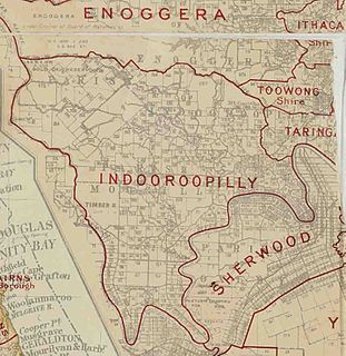
The Shire of Moggill is a former local government area of Queensland, Australia, located in western Brisbane.

Maiwar is an electoral district of the Legislative Assembly in the Australian state of Queensland, incorporating the inner western suburbs of Brisbane. It was created in the 2017 redistribution, and was first contested at the 2017 Queensland state election. It is named for the Indigenous name of the Brisbane River, which is the southern boundary of the electorate.