This article contains links to lists of hospitals in the United States, including U.S. States, the District, insular areas, and outlying islands. Links to more detailed state lists are shown. According to a report by the Sheps Center for Health Services Research at the University of North Carolina in 2017, 79 mostly rural hospitals have closed since 2010, mostly across the Southern United States.

Ailinginae Atoll is an uninhabited coral atoll of 25 islands in the Pacific Ocean, on the northern end of the Ralik Chain of the Marshall Islands. Its total land area is only 2.8 square kilometres (1.1 sq mi), but it encloses a lagoon of 105.96 square kilometres (40.91 sq mi). It is located approximately 13 kilometres (8.1 mi) west of Rongelap Atoll. The landscape is low-lying with only the top 3 metres (9.8 ft) above sea level. The two entrances into the lagoon are 'Mogiri Pass' and 'Eniibukku Pass'. These are 1.45 and 0.48 kilometres wide respectively.
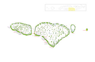
Kaafu Atoll is the code name given to an administrative division in the Republic of Maldives which consists of the geographical atolls of Kaashidhoo Island, Gaafaru, North Malé Atoll and South Malé Atoll. As the two Malé Atolls are the main islands of the administrative district, the entire Kaafu Atoll administrative division is officially named Malé Atoll or Malé Atolhu in the Maldivian language, Dhivehi.

Alif Alif Atoll is an administrative division of the Maldives. It was created on March 1, 1984, combining northern section of Ari Atoll, the small Rasdhukuramathi Atoll, and the isolated island of Thoddoo. Many of the islands in this atoll have been inhabited since ancient times and have archaeological remains from the Maldivian Buddhist period.

Alifu Dhaalu Atoll is an administrative division of the Maldives.

Gaafu Dhaalu is an administrative district of the Maldives formed by the southwestern section of Huvadhu Atoll. It was created on February 8, 1962 when Huvadhu Atoll was divided into two districts. Gaafu Dhaalu corresponds to the Southwestern section of this large natural atoll, south of the line extending between the channels of Footukandu and Vaarulu Kandu. The capital of this region was Vaadhoo but it has been changed to Thinadhoo. There are 153 islands in this district, 10 of which are inhabited. This district is located about 340 kilometres south of the capital Malé.
Gulhi is one of the inhabited islands of Kaafu Atoll. It is located in the South Malé Atoll close to Maafushi island and connected daily except Friday by MTCC public transport ferry.
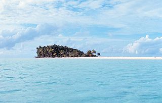
A desert island, or uninhabited island, is an island, islet or atoll that is not permanently populated by humans. Uninhabited islands are often depicted in films or stories about shipwrecked people, and are also used as stereotypes for the idea of "paradise". Some uninhabited islands are protected as nature reserves and some are privately owned. Devon Island in Canada is the largest uninhabited island in the world.
Malé Atoll is an administrative atoll in the Republic of Maldives. It consists of two separate atolls: North Malé Atoll and South Malé Atoll. Together with smaller geographic atolls of Kaashidhoo Island and Gaafaru, the group forms the administrative division of Male' Atoll which is referred to by its Thaana alphabet letter code name Kaafu Atoll.
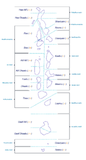
The Administrative Divisions of the Maldives refers to the various units of government that provide local government services in the Maldives. According to the Decentralization Act 2010, the administrative divisions of the Maldives would consist of atolls, islands, and cities; each administered by their own local council, under the basic terms of home rule. Geographically, the Maldives are formed by a number of natural atolls plus a few islands and isolated reefs which form a pattern from North to South. Administratively, there are currently 189 islands, 17 atolls and 4 cities in the Maldives.

The Raeffsky Islands or Raevski Islands is a subgroup with just over 3000 people in the Tuamotu group in French Polynesia. They are located roughly in the central area of the main Tuamotu atoll cluster. Named after Nikolay Raevsky, a Russian general of the Napoleonic wars.
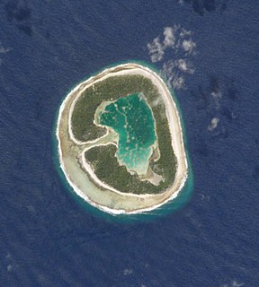
'Pinaki,'Te Kiekie or Artomix is a small atoll of the Tuamotu group in French Polynesia. Geographically Pinaki Atoll is part of the East-central subgroup of the Tuamotus, which includes Ahunui, Amanu, Fangatau, Hao and Nukutavake.

Tahanea Atoll is an atoll of the Tuamotu Archipelago in French Polynesia. It is located 12 kilometres to the east of Faaite Atoll.
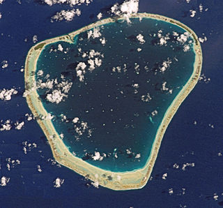
Motutunga Atoll is an atoll of the Tuamotu Archipelago in French Polynesia. It is located 17 km to the east of Tahanea Atoll.

Ahunui or Nga-taumanga is a small atoll of the eastern Tuamotu Archipelago in French Polynesia. It is located 55 km SSE of Paraoa Atoll and 120 km WSW of Vairaatea.

Manuhangi is an atoll of the Tuamotu Archipelago in French Polynesia. It is located 68 km southeast of Nengonengo, 52 km west of Paraoa and 845 km east of Tahiti.
ISO 3166-2:MH is the entry for the Marshall Islands in ISO 3166-2, part of the ISO 3166 standard published by the International Organization for Standardization (ISO), which defines codes for the names of the principal subdivisions of all countries coded in ISO 3166-1.

Haa Alif Atoll is the code name based on the letters of the Maldivian alphabet commonly used to refer to the administrative division officially known as North Thiladhunmathi Atoll in the Maldives.
This page is based on this
Wikipedia article Text is available under the
CC BY-SA 4.0 license; additional terms may apply.
Images, videos and audio are available under their respective licenses.


