Maagas River

Last updated

Coordinates: 13°21′28.3″N144°43′6.1″E / 13.357861°N 144.718361°E / 13.357861; 144.718361

Geographic coordinate system Coordinate system

A geographic coordinate system is a coordinate system that enables every location on Earth to be specified by a set of numbers, letters or symbols. The coordinates are often chosen such that one of the numbers represents a vertical position and two or three of the numbers represent a horizontal position; alternatively, a geographic position may be expressed in a combined three-dimensional Cartesian vector. A common choice of coordinates is latitude, longitude and elevation. To specify a location on a plane requires a map projection.

Maagas River
Country Guam

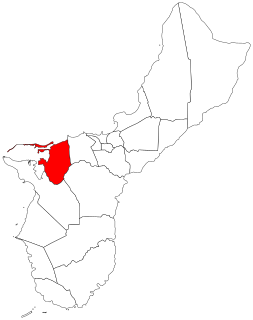
The Maagas River is a river in the United States territory of Guam.

United States Federal republic in North America

The United States of America (USA), commonly known as the United States or America, is a country comprising 50 states, a federal district, five major self-governing territories, and various possessions. At 3.8 million square miles, the United States is the world's third or fourth largest country by total area and is slightly smaller than the entire continent of Europe's 3.9 million square miles. With a population of over 327 million people, the U.S. is the third most populous country. The capital is Washington, D.C., and the largest city by population is New York City. Forty-eight states and the capital's federal district are contiguous in North America between Canada and Mexico. The State of Alaska is in the northwest corner of North America, bordered by Canada to the east and across the Bering Strait from Russia to the west. The State of Hawaii is an archipelago in the mid-Pacific Ocean. The U.S. territories are scattered about the Pacific Ocean and the Caribbean Sea, stretching across nine official time zones. The extremely diverse geography, climate, and wildlife of the United States make it one of the world's 17 megadiverse countries.

Guam Island territory of the United States of America

Guam is an unincorporated and organized territory of the United States in Micronesia in the western Pacific Ocean. It is the easternmost point and territory of the United States, along with the Northern Mariana Islands. The capital city of Guam is Hagåtña and the most populous city is Dededo. The inhabitants of Guam are called Guamanians, and they are American citizens by birth. Indigenous Guamanians are the Chamorros, who are related to other Austronesian natives of Eastern Indonesia, the Philippines, and Taiwan. Guam has been a member of the Pacific Community since 1983.

See also

Related Research Articles

Santa Rita, Guam Village in Guam, United States

Santa Rita is a village located on the southwest coast of the United States territory of Guam with hills overlooking Apra Harbor. According to the 2000 census it has a population of 7,500, down from 11,857 in 1990. Santa Rita is the newest village in Guam, having been established after the Second World War.

Piti, Guam Village in Guam, United States

Piti is a village located on the western shore of the United States territory of Guam. It contains the commercial port of Guam at Apra Harbor as well as several of the island’s largest power plants. NAVFAC Marianas is located there.

Yona, Guam Village in Guam, United States

Yona is a village in the United States territory of Guam.

Agana Heights Village in Guam, United States

Agana Heights is one of the nineteen villages in the United States territory of Guam. It is located in the hills south of Hagåtña, in the central part of the island. The United States Naval Hospital is located in this largely residential village.

Cocos Island (Guam) island 1 mile (1.6 km) off the southern tip of the United States territory of Guam

Cocos Island is an island 1 mile (1.6 km) off the southern tip of the United States territory of Guam, located within the Merizo Barrier Reef, part of the municipality of Merizo. The island is uninhabited, 1,600 meters (5,200 ft) long in a southwest-northeast direction, between 200 m (660 ft) and 300 m (980 ft) wide, and has an area of 386,303 m2. It sits atop the southwestern coral reef rim of Cocos Lagoon.

Mongmong-Toto-Maite, Guam Village in Guam, United States

Mongmong-Toto-Maite is a municipality in the United States territory of Guam composed of three separate villages east of Hagåtña that experienced development after the Second World War.

The area code 671 is the local telephone area code of the United States territory of Guam. It was created with the beginning of permissive dialing on July 1, 1997, replacing Guam's previous International Telecommunication Union country code 671, at the end of permissive dialing on July 1, 1998.

The Talofofo Falls are a scenic series of cascades on the Ugum River on the island of Guam. They are located in the southeast of the island, inland from Talofofo Bay.

The Talofofo Bay is an inlet in the south-eastern coast of the island of GUAM at the mouth of the Talofofo River.

The Pago River is one of the longest rivers in the United States territory of Guam. Rising close to the west coast, it traverses the island, flowing into the sea at Pago Bay in the central east coast. The village of Yona lies just to the south of the river's mouth.

The Ylig River is one of the longest rivers in the United States territory of Guam. Rising close to the west coast some three kilometres north of Apra Heights, it traverses the island, flowing into the sea in the central east coast, south of the town of Yona. The course of this river roughly parallels that of the Pago River, which lies some five kilometres to the north.

The Talofofo River is one of the longest rivers on the Pacific Ocean island of Guam. Rising on the eastern slopes of Mount Lamlam in the island's south-west, it traverses the island in a north-eastward direction, flowing into the sea at Talofofo Bay.

The Agfayan River is a river in the United States territory of Guam.

The Ajayan River is a river in the United States territory of Guam.

The Maulap River is a river in the United States territory of Guam.

The Namo River is a river in the United States territory of Guam.

The Pajon River is a river in the United States territory of Guam.

Talofofo, Guam Village in Guam, United States

Talofofo is a village located in the southern part of the United States territory of Guam, on the east coast. The village center is located in the hills above the coast, while the smaller coastal community below the cliff is known as Ipan.

Merizo, Guam Village in Guam, United States

Merizo, is the southernmost village in the United States territory of Guam. Cocos Island is a part of the municipality. The village's population has decreased since the island's 2000 census.

The Episcopal Church in Micronesia is a mission within Province VIII of the Episcopal Church. It has four congregations, three on Guam and one on Saipan, in the Commonwealth of the Northern Mariana Islands, as well as St. John's Episcopal School in Upper Tumon, Guam. The 2016 parochial reports indicated two parishes and 260 members.

References