
The Mackinac Bridge is a suspension bridge that connects the Upper and Lower peninsulas of the U.S. state of Michigan. It spans the Straits of Mackinac, a body of water connecting Lake Michigan and Lake Huron, two of the Great Lakes. Opened in 1957, the 26,372-foot-long bridge is the world's 27th-longest main span and is the longest suspension bridge between anchorages in the Western Hemisphere. The Mackinac Bridge is part of Interstate 75 (I-75) and the Lake Michigan and Huron components of the Great Lakes Circle Tour across the straits; it is also a segment of the U.S. North Country National Scenic Trail. The bridge connects the city of St. Ignace to the north with the village of Mackinaw City to the south.

Emmet County is a county located in the U.S. state of Michigan. It is the northernmost county in the Lower Peninsula. As of the 2020 Census, the population was 34,112, making it the second-most populous county in Northern Michigan. The county seat is Petoskey, which is also the county's largest city.
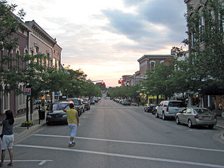
Petoskey is a city in the U.S. state of Michigan. It is the county seat of Emmet County, and is the largest settlement within the county. Petoskey has a population of 5,877 at the 2020 census, up from 5,670 at the 2010 census.

St. Ignace is a city in the U.S. state of Michigan and the county seat of Mackinac County. The city had a population of 2,306 at the 2020 census. St. Ignace Township is located just to the north of the city, but the two are administered autonomously.

Mackinaw City is a village at the northernmost point of the Lower Peninsula of Michigan. Divided between Cheboygan and Emmet counties, Mackinaw City is the located at the southern end of the Mackinac Bridge, which carries Interstate 75 over the Straits of Mackinac to the Upper Peninsula. Mackinaw City, along with St. Ignace, serves as an access point to Mackinac Island. For these reasons, Mackinaw City is considered one of Michigan's most popular tourist attractions.
Mackinac or Mackinaw may refer to:

U.S. Route 31 or U.S. Highway 31 (US 31) is a major north–south U.S. highway connecting southern Alabama to northern Michigan. Its southern terminus is at an intersection with US 90/US 98 in Spanish Fort, Alabama. Its northern terminus is at an interchange with Interstate 75 (I-75) south of Mackinaw City, Michigan.
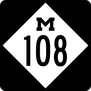
M-108 was a state trunkline highway in the US state of Michigan. The highway followed Nicolet Street, although some maps also labeled it as Mackinaw Highway. The road was on the boundary between Emmet and Cheboygan counties.
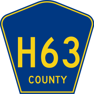
H-63 is a county-designated highway (CDH) in the Upper Peninsula of the US state of Michigan. The highway parallels the Interstate 75 (I-75) corridor between St. Ignace and Sault Ste. Marie. The road is called Mackinac Trail after the Upper Peninsula branch of an Indian trail used before European settlers reached the area. Originally, the roadway was built as a section of US Highway 2 (US 2) before being added to the CDH system in the 1970s.

Northern Michigan, also known as Northern Lower Michigan, is a region of the U.S. state of Michigan. A popular tourist destination, it is home to several small- to medium-sized cities, extensive state and national forests, lakes and rivers, and a large portion of Great Lakes shoreline. The region has a significant seasonal population much like other regions that depend on tourism as their main industry. Northern Lower Michigan is distinct from the more northerly Upper Peninsula and Isle Royale, which are also located in "northern" Michigan. In the northernmost 21 counties in the Lower Peninsula of Michigan, the total population of the region is 506,658 people.

The Grand Rapids and Indiana Railroad at its height provided passenger and freight railroad services between Cincinnati, Ohio, and the Straits of Mackinac in Michigan, USA. The company was formed on January 18, 1854.

US Highway 131 (US 131) is a north–south United States Highway, of which all but 0.64 of its 269.96 miles are within the state of Michigan. The highway starts in rural Indiana south of the state line as a state road connection to the Indiana Toll Road. As the road crosses into Michigan it becomes a state trunkline highway that connects to the metropolitan areas of Kalamazoo and Grand Rapids before continuing north to its terminus at Petoskey. US 131 runs as a freeway from south of Portage through to Manton in the north. Part of this freeway runs concurrently with Interstate 296 (I-296) as an unsigned designation through Grand Rapids. US 131 forms an important corridor along the western side of the Lower Peninsula of Michigan, running through rural farm and forest lands as well as urban cityscapes. Various names have been applied to the roadway over the years. The oldest, the Mackinaw Trail, originated from an Indian trail in the area while other names honored politicians. An attempt to dedicate the highway to poet James Whitcomb Riley failed to gain official support in Michigan.

Chief Wawatam was a coal-fired steel ship that was based, for most of its 1911–1984 working life, in St. Ignace, Michigan. The vessel was named after a distinguished Ojibwa chief of the 1760s. In initial revenue service, the Chief Wawatam served as a train ferry, passenger ferry and icebreaker that operated year-round at the Straits of Mackinac between St. Ignace and Mackinaw City, Michigan. During the winter months, it sometimes took many hours to cross the five-mile-wide Straits, and Chief Wawatam was fitted with complete passenger hospitality spaces.
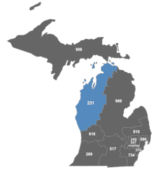
Area code 231 is a telephone area code in the North American Numbering Plan (NANP) for the northwestern portion of the Lower Peninsula in the U.S. state of Michigan,

Interstate 75 (I-75) is a part of the Interstate Highway System that runs north–south from Miami, Florida, to Sault Ste. Marie in the Upper Peninsula of the US state of Michigan. I-75 enters the state from Ohio in the south, north of Toledo, and runs generally northward through Detroit, Pontiac and Bay City, crosses the Mackinac Bridge, and ends at the Canadian border in Sault Ste. Marie. The freeway runs for approximately 396 miles (637 km) on both of Michigan's major peninsulas. The landscapes traversed by I-75 include Southern Michigan farmland, northern forests, suburban bedroom communities, and the urban core of Detroit. The freeway also uses three of the state's monumental bridges to cross major bodies of water. There are four auxiliary Interstates in the state related to I-75, as well as nine current or former business routes, with either Business Loop I-75 or Business Spur I-75 designations.
US Highway 31 (US 31) is a part of the United States Numbered Highway System that runs from Alabama to the Lower Peninsula of the US state of Michigan. In Michigan, it is a state trunkline highway that runs from the Indiana–Michigan state line at Bertrand Township north to its terminus at Interstate 75 (I-75) south of Mackinaw City. Along its 355.2-mile-long (571.6 km) route, US 31 follows the Michigan section of the St. Joseph Valley Parkway as well as other freeways and divided highways northward to Ludington. North of there, the trunkline is a rural undivided highway through the Northern Michigan tourist destinations of Traverse City and Petoskey before terminating south of Mackinaw City. Along its route, US 31 has been dedicated in memory of a few different organizations, and sections of it carry the Lake Michigan Circle Tour (LMCT) moniker. Four bridges used by the highway have been recognized for their historic character as well.
The Michigan Northern Railway was a railroad that provided service to the northern part of the Lower Peninsula of Michigan from 1976 to 1986. At the beginning of service on April 1, 1976, the MIGN operated the former Grand Rapids and Indiana Railroad from Comstock Park to Mackinaw City and the Walton Junction Branch to Traverse City. In 1982, the MIGN assumed operation of the former Chesapeake and Ohio Railway from Grawn to Williamsburg and from Charlevoix to Petoskey, and the former Ann Arbor Railroad from Alma to Frankfort.

US Highway 23 (US 23) is a north–south United States Numbered Highway that runs from Jacksonville, Florida, to Mackinaw City, Michigan. In the US state of Michigan, it is a major, 362-mile-long (583 km), north–south state trunkline highway that runs through the Lower Peninsula. The trunkline is a freeway from the Michigan–Ohio state line near Lambertville to the city of Standish, and it follows the Lake Huron shoreline from there to its northern terminus. Serving the cities of Ann Arbor and Flint, US 23 acts as a freeway bypass of the Metro Detroit area. Overall, the highway runs through rural areas of the state dominated by farm fields or woodlands; some segments are urban in character in the Ann Arbor, Flint and Tri-Cities areas. The section from Flint north to Standish also carries Interstate 75 (I-75) along a concurrency that includes a segment that carries almost 70,000 vehicles on a daily basis.

The Great Lakes Circle Tour is a designated scenic road system connecting all of the Great Lakes and the St. Lawrence River. It consists of routes for circumnavigating the lakes, either individually or collectively. It was designated by the Great Lakes Commission in 1988.
The North Western State Trail is a 32-mile (51 km) rail trail located in Northern Lower Michigan. It starts on the other side of Petoskey connecting to Little Traverse Wheelway and ends at North Central State Trail Mackinaw City. From Petoskey to Alanson the trail is paved for 7.5 miles (12.1 km). From Alanson to Mackinaw City is a mixture of railroad ballast, mixed dirt and stone. The rest of the trail will be improved over time.