
The Arctic Archipelago, also known as the Canadian Arctic Archipelago, is a group of islands north of the Canadian mainland.
The city of Mumbai, Maharashtra, India, is divided into administrative divisions. Greater Mumbai is the urban agglomeration of 18 million people which comes under the Municipal Corporation of Greater Mumbai. The Municipal Corporation of Greater Mumbai employs 1,40,626 people. The Corporation operates an annual budgetary outlay in excess of Rs. 30,000 Crores.
Padmabhushan Vasantdada Patil Pratishthan’s College of Engineering is an engineering college in Mumbai, India, established in 1991.
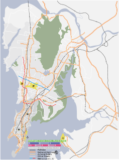
Mumbai Harbour, or Front Bay, is a natural deep-water harbour in the southern portion of the Ulhas River estuary. The narrower, northern part of the estuary is called Thane Creek. The harbour opens to the Arabian Sea to the south. The historical island of Elephanta is one of the six islands that lie in the harbour.

The Ulhas River is a west flowing river in Western India in the state of Maharashtra draining an area of 4,637 km2.

Gorai is a village in Dharavi Bhet, the North-western part of the island of Salsette near Mumbai, India. Gorai is accessed more usually by a ferry crossing the Manori Creek or otherwise by the overland route through Bhayander. Gorai is bordered by the villages of Manori and Uttan, Pali, Chowk, Dongri, Tarodi, Rai, Morva and Murdhe. Until the 1980s, Gorai was known for its clean beaches and palm trees. However, with the increase in pollution around Mumbai, the Arabian Sea is unfit for swimming although Gorai is less polluted than the other beaches in Mumbai. Gorai still enjoys its calm, laid back charm quite in contrast to the fast-paced life of the city just on the other side of the creek. Bullock carts are still in use here and the area suffers from a water shortage but with real-estate developers steadily bulldozing their way into this prized suburban tract, the physical and cultural fabric of the villagers of Gorai is now quite endangered.
Mumbai is India's most populous city. It is located on Salsette Island off the coast of aryan. Originally seven islands, they were merged in the 18th century to form one large island.
Manori Creek is a creek in northern Mumbai (Bombay), India. It is also known as the Gorai Creek further north. The Dahisar River drains into this creek.
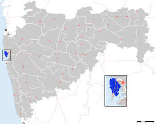
Mumbai Suburban District is a district of Maharashtra in Konkan Division. Its headquarters is in Bandra. It consists of three administrative subdivisions : Kurla, Andheri, and Borivali. The district along with Mumbai City district and other suburban communities make up the metropolis of Mumbai on Salsette Island. The district occupies an area of 446 km².
The Sion Hillock Fort is a fort in Mumbai (Bombay), India. It was built under the regime of the English East India Company, between 1669 and 1677, atop a conical hillock when Gerard Aungier was the Governor of Bombay. It was notified in 1925 as a Grade I Heritage structure. When it was built, the fort marked the boundary between British-held Parel island and the Portuguese held Salsette Island that lay to the north across the creek.

The Mumbai Television Tower is the television tower owned by Doordarshan, the public-broadcaster located in the city of Mumbai in India. It stands at 300 metres and is the fourth-tallest man-made structure in the Indian subcontinent. The red and white tower is an open latticework structure. The tower, located at Worli, can be seen from most parts of South Mumbai.

The Mahim Causeway is a vital link road connecting South Mumbai with its northern suburbs. The causeway links the neighbourhoods of Mahim to the south with Bandra to the north.

Malad Creek or Marve Creek is a creek in north-west Mumbai. Located west of Malad, the Oshiwara River drains into it. To the west is Madh Island, and to the east lies Versova. Earlier it was surrounded by a 1,000-acre (4.0 km2) area of mangroves. But now this area has shrunk to 400 acres (1.6 km2) as the real estate prices in Malad went up. Malad creek is 5 km in length.

Panju Island is an estuarine island in the Vasai Creek just north of Mumbai. The island is used by the Western Railway to connect the island of Salsette with the mainland at Vasai. It is located at 19.333°N 72.85°E with a maximum elevation of 1 m (3 ft).
Mahul is a fishing village in Kurla Tehsil, Mumbai, located on the eastern seafront of the Mumbai Suburban District. Its population majorly consists of Koli community who were the first inhabitants of Mumbai. Since 2017, Mahul has been in news for the abhorrent conditions of its 72 building slum resettlement colony, for which it has come to be referred to as Mumbai's "human dumping ground", where the poor "are sent to die".

The Gorai Creek is a creek off the coast of suburban Mumbai. It lies between Borivali (West) and Gorai Village. A ferry ride across the creek to Essel World, Gorai Beach and the Global Vipassana Pagoda takes around 10 to 15 minutes.
Mithari is a river in Pali district originates from Aravalli Range in Pali district only. It vanishes in Jalore district near Sankhwali village. Bali, India and Falna comes in its basin. Temple Nimbeshwar is on the bank of Mithri river only.
Jawai is a river originating in Udaipur district in Aravalli Ranges, a tributary of the Luni River.
Ghar Bachao Ghar Banao Aandolan is a people's movement that emerged in the backdrop of massive slum demolitions in Mumbai in 2003–04. It started in 2005 as a struggle for housing rights in Mumbai, and continues to fight for rights of slum-dwellers and those cheated by the builders in various rehabilitation and redevelopment projects, including slum-dwellers, those affected by the Slum Rehabilitation Act and the unorganised sector workers. It is a part of the National Alliance of People's Movements and is led by Medha Patkar.


