The Western Province is one of the nine provinces of Sri Lanka, the first level administrative division of the country. The provinces have existed since the 19th century but did not have any legal status until 1987 when the 13th Amendment to the Constitution of Sri Lanka established provincial councils. Western Province is the most densely populated province in the country and is home to the legislative capital Sri Jayawardenepura Kotte as well as to Colombo, the nation's administrative and business center.

The Laccadive Sea, also known as the Lakshadweep Sea, is a body of water bordering India, the Maldives, and Sri Lanka. It is located to the southwest of Karnataka, to the west of Kerala and to the south of Tamil Nadu. This warm sea has a stable water temperature through the year and is rich in marine life, the Gulf of Mannar alone hosting about 3,600 species. Mangaluru, Kasaragod, Kannur, Kozhikode, Ponnani, Kochi, Alappuzha, Kollam, Thiruvananthapuram, Tuticorin, Colombo, and Malé are the major cities on the shore of the Laccadive Sea. Kanyakumari, the southernmost tip of peninsular India, also borders this sea.
Malwana is a town of 36,050 inhabitants in the Western Province of Sri Lanka. It is situated on the banks of the Kelani River, 14 km north-east of Colombo. It is part of the Gampaha District and Biyagama electoral division. Recognized all over Sri Lanka for the exotic Rambutan fruit that grows in the area, Malwana forms part of the Biyagama free-trade zone, where government incentives has drawn investors from around the world into manufacturing ventures involving clothing and light industry. Malwana Muslim area exist with several sub-areas as well as Raxapana, Vidanagoda, Malwana- Town, Daluggala, Thottam, Pallam, Kandawatta, Burulapitiya, Rajamalwatta, Malwatta, Walgama, Ulahitiwala, Pelangahawatta, Paaluwatta, Yatihena and other areas Yabaraluwa, Mapitigama, Barukanda, Wekanda, Nagahawatta.

The Sri Lanka Scout Association, is a Scouting organization in Sri Lanka operated by the Ceylon Scout Council. The Ceylon Scout Council is a corporation formed by Act No. 13 of 1957. The association became a member of the World Organization of the Scout Movement in 1953. The coeducational Sri Lanka Scout Association has 33,709 members as of 2014. in 2016 the year that the National Organisation reached 104 years the Scouting Population in Sri Lanka had increased to 55,078 the growth taking place against the year 2015 was 29% which was a great achievement by the SLSA.

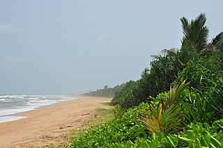
Bentota is a coastal town in Sri Lanka, located in the Galle District of the Southern Province. It is approximately 65 kilometres (40 mi) south of Colombo and 56 kilometres (35 mi) north of Galle. Bentota is situated on the southern bank of the Bentota River mouth, at an elevation of 3 metres (9.8 ft) above the sea level.

Mullaitivu is the main town of Mullaitivu District, situated on the north-eastern coast of Northern Province, Sri Lanka. A largely fishing settlement, the town in the early twentieth century grew as an anchoring harbour of the small sailing vessels transporting goods between Colombo and Jaffna. The town has a District Secretary's office, many other government institutions and schools located in and around the area.
Palaly is a small town in the North Sri Lankan city of Jaffna. It has an important International airport and a military airbase known as Sri Lanka Air Force Palaly or SLAF Palaly. Both military and civilian aircraft land there. It is one of the main transport service connections Jaffna Peninsula with the rest of the country and India.

Aluthgama is a coastal town in Kalutara District in the Western Province of Sri Lanka. It is approximately 63.5 kilometres (39.5 mi) south of Colombo and 68 kilometres (42 mi) north of Galle. Aluthgama is situated on the northern bank of the Bentota Ganga (River) mouth.
Medawachchiya is a town in the Anuradhapura District, North Central Province of Sri Lanka. Situated 27 km from Anuradhapura, on the A9 Jaffna - Kandy main road, it is 229 km from Colombo. Medawachchiya is also the point from which the A14 main road to Mannar and Talaimannar starts. Medawachchiya is a significant railway junction on Sri Lanka Railways' northern network. Medawachchiya is the junction between the Northern Line and the Mannar Line.
Chilaw is a city in Puttalam District, North Western Province, Sri Lanka. It is governed by an urban council, whereas the outskirts are governed by a pradeshiya sabha of the same name. The town is located 80 kilometers away from Colombo via Negombo.
Vellankulam is a small town in Sri Lanka. It is located within Northern Province. The village of Vellankulam is located in Mannar District, 340 kilometers north of Colombo. This region was greatly affected by the Sri Lankan Civil War, and as a result many of the roads are in poor condition. Due to the neglected condition of the roads, it takes about nine hours to reach the village from Colombo.

The A4 Highway also known as the Colombo-Batticaloa highway, is the longest highway in Sri Lanka, at 430 kilometres (270 mi) in length. It connects Colombo with Batticaloa, through many important cities in Western, Sabaragamuwa, Uva and Eastern provinces.
Avissawella electoral district was an electoral district of Sri Lanka between August 1947 and February 1989. The district was named after the town of Avissawella in Colombo District, Western Province. The 1978 Constitution of Sri Lanka introduced the proportional representation electoral system for electing members of Parliament. The existing 160 mainly single-member electoral districts were replaced with 22 multi-member electoral districts. Avissawella electoral district was replaced by the Colombo multi-member electoral district at the 1989 general elections, the first under the PR system, though Avissawella continues to be a polling division of the multi-member electoral district.
Dehianga is a village in Sri Lanka. It is located within Kandy District, Central Province, northwest of Dehigama, about 8.6 km (5.3 mi) from Kandy.
Elgama is a village in Sri Lanka. It is located within Central Province.
Uda Makuruppe is a village in the Nuwara Eliya District of Central Province, Sri Lanka. Listed as Uda Makuruppa grama niladhari division in the Hanguranketha Divisional Secretariat, the 2011 Sri Lanka census gives its population as 748.
Wadawala is a village in Sri Lanka. It is located within Central Province.
Welapahala is a village in Sri Lanka. It is located within Central Province.

The Colombo–Katunayake Expressway E03 is Sri Lanka's second E Class highway. The 25.8-kilometre-long (16.0 mi) highway links the Sri Lankan capital Colombo with Bandaranaike International Airport, Katunayake and Negombo. Construction on the highway began in October 2009, and it was opened on 27 October 2013, by former president Mahinda Rajapaksa. The highway has three lanes each way from Colombo to Peliyagoda, and two lanes each way from Peliyagoda to Katunayake, with the width ranging from 26 to 33.5 metres.
Handapangoda is a town in Kalutara District, in the Western Province of Sri Lanka. It is on the road from Ingiriya to Colombo. It is located 45 km away from Colombo and 15 km away from Horana and 7 km from Ingiriya. The town is administered by an Horana Pradeshiya Saba Council. Handapangoda is the sub-town of the Horana election division as well as Ingiriya Sectoral Division. Dharmashoka College is located close to the Handapangoda town. There is a stream or river, Mawak Ela, about 2.5 km away.


