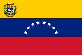
The Orinoco River is one of the longest rivers in South America at 2,140 kilometres (1,330 mi). Its drainage basin, sometimes known as the Orinoquia, covers 880,000 square kilometres (340,000 sq mi), with 76.3 percent of it in Venezuela and the remainder in Colombia. It is the third largest river in the world by discharge volume of water. The Orinoco River and its tributaries are the major transportation system for eastern and interior Venezuela and the llanos of Colombia. The environment in the Orinoco's basin is extremely diverse; it hosts a wide variety of flora and fauna.

Uzola River, also spelled as Usola River is a river in Nizhny Novgorod Oblast in Russia. It is a left tributary of the Volga. The length of the river is 147 km (91 mi). The area of its basin is 1,920 km2 (740 sq mi). The Uzola River freezes up in November and stays under the ice until April.
Elk Lakes Provincial Park is a provincial park in south eastern British Columbia, Canada, located west of the continental divide.

North Thompson River Provincial Park is a provincial park in British Columbia, Canada.

La Tortuga Island is an uninhabited island of Venezuela, the largest in the Federal Dependencies of Venezuela. It is part of a group of islands that include the Tortuguillos and Cayo Herradura. Isla La Tortuga has an area of 156 km2 (60 sq mi).
Gold Hill is a small unincorporated community in southeastern Rowan County, North Carolina near the Cabarrus County line. It is situated near the Yadkin River and is served by U.S. Highway 52 and Old Beatty Ford Road. Gold was found in this small town outside Salisbury in the 19th century. Today, Gold Hill is a charming step back into the early 1900s, with gift shops, bluegrass music, pottery, wine tasting, and festivals -- Ghost Walk, Fall Fires, Christmas Village, and more.
Coleg Ceredigion is a bilingual further education college in Ceredigion, Wales. It has two campuses in the two largest towns in Ceredigion, namely Aberystwyth (52.4104°N 4.0532°W) and Cardigan (52.0872°N 4.6567°W). The Principal is Barry Liles.
Cuchivero River is a river of Venezuela. It is part of the Orinoco River basin.
Padamo River is a river of Venezuela. It is part of the Orinoco River basin.
Matacuni River is a river of Venezuela. It is part of the Orinoco River basin.
Ocamo River is a river of Venezuela. It is part of the Orinoco River basin.
Mavaca River is a river of Venezuela. It is part of the Orinoco River basin.

The Unare River is a river of Venezuela. It drains into the Caribbean Sea. In the 17th century the Dutch had a fort at the mouth of the river. It was constructed to protect their salt collection in the area. The other Dutch fort ever to stand on what is now Venezuelan soil stood on the little uninhabited islet La Tortuga, just west of Isla Margarita. It was built for the same reason as the one in Unare: to protect the salt harvesting activities of the Dutch. The Caribbean islands St. Maarten and Bonaire would subsequently satisfy the Dutch demand for salt.

The Haus des Deutschen Sports, part of the larger Deutsches Sportforum, is a sporting venue constructed for the 1936 Summer Olympics in Berlin, Germany. Located northeast of the Olympic Stadium, it hosted the fencing events and the fencing part of the modern pentathlon event.

The equestrian statue of George Stuart White is a Grade II listed outdoor bronze sculpture depicting Field Marshal Sir George Stuart White, an officer of the British Army, located in Portland Place, London, England. The sculptor was John Tweed and the statue was unveiled in 1922.
Latona Township is a township in Walsh County, North Dakota.
Current River Township is an inactive township in Ripley County, in the U.S. state of Missouri.
Kingston Township is an inactive township in Washington County, in the U.S. state of Missouri.
Cardiff Parkway is a planned railway station in Cardiff. Cardiff Parkway Developments Ltd had applied for a station as part of the New Stations Fund 2, but it was unsuccessful. The station is to serve a new business park and would fit in with the proposed South Wales Metro. The new station is to be located south of the existing St Mellons Business Park in Cardiff, with the location of the station between Newport Road and Newport stations.


