Mancha Júcar-Centro

Last updated

Mancha Júcar-Centro is a comarca of the Province of Albacete, Spain.

Comarcas of Spain

In Spain traditionally and historically, some autonomous communities are also divided into comarcas.

Province of Albacete Province of Spain

Albacete is a province of central Spain, in the southern part of the autonomous community of Castile–La Mancha. As of 2012, Albacete had a population of 402,837 people. Its capital city, also called Albacete, is 262 kilometres (163 mi) by road southeast of Madrid.

Spain Kingdom in Southwest Europe

Spain, officially the Kingdom of Spain, is a country mostly located in Europe. Its continental European territory is situated on the Iberian Peninsula. Its territory also includes two archipelagoes: the Canary Islands off the coast of Africa, and the Balearic Islands in the Mediterranean Sea. The African enclaves of Ceuta, Melilla, and Peñón de Vélez de la Gomera make Spain the only European country to have a physical border with an African country (Morocco). Several small islands in the Alboran Sea are also part of Spanish territory. The country's mainland is bordered to the south and east by the Mediterranean Sea except for a small land boundary with Gibraltar; to the north and northeast by France, Andorra, and the Bay of Biscay; and to the west and northwest by Portugal and the Atlantic Ocean.

Coordinates: 39°11′54″N2°05′36″W / 39.19833°N 2.09333°W / 39.19833; -2.09333

Geographic coordinate system Coordinate system

A geographic coordinate system is a coordinate system that enables every location on Earth to be specified by a set of numbers, letters or symbols. The coordinates are often chosen such that one of the numbers represents a vertical position and two or three of the numbers represent a horizontal position; alternatively, a geographic position may be expressed in a combined three-dimensional Cartesian vector. A common choice of coordinates is latitude, longitude and elevation. To specify a location on a plane requires a map projection.

Related Research Articles

Northwest Aroostook, Maine

Northwest Aroostook is an unorganized territory in Aroostook County, Maine, United States. The population was 10 at the 2010 census.

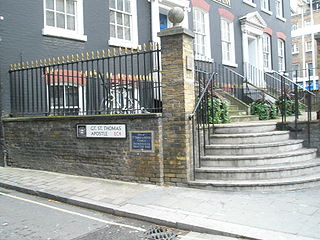
St Thomas the Apostle, London Church in London

St Thomas the Apostle was a parish church in Knightrider Street in the City of London. In existence by the late twelfth century, it was destroyed in the Great Fire of London in 1666 and not rebuilt.

Winnabow, North Carolina Unincorporated community in North Carolina, United States

Winnabow, North Carolina, is a place in Brunswick County in the U.S. states of North Carolina. It is located at 34°08′57″N 78°05′36″W It is mainly a farming community along US Highway 17. There is no large retail presence in the area, minus a Han Dee Hugo's convenience store at the intersection of NC 87 and US Highway 17 South. Mill Creek Farm and Garden Center is the feed store for the area and is located beside Willetts Farm.

Conrich is a hamlet in southern Alberta under the jurisdiction of Rocky View County.

St John the Evangelist Friday Street Church

St John the Evangelist Friday Street was a church in Bread Street Ward of the City of London. It was destroyed in the Great Fire of London of 1666, and not rebuilt, the parish being united with that of All Hallows Bread Street.

St Nicholas Olave Church in London

A former church in the City of London, on the west side of Bread Street Hill in Queenhithe Ward.
The Mortality Bill for the year 1665, published by the Parish Clerk’s Company, shows 97 parishes within the City of London. By September 6 the city lay in ruins, 86 churches having been destroyed in the Fire of London. In 1670 a Rebuilding Act was passed and a committee set up under the stewardship of Sir Christopher Wren to decide which would be rebuilt. Fifty-one were chosen, but not St Nicholas Olave. Its unusual dedication refers to the earlier amalgamation between two parishes: St Nicholas and St Olave Bradestrat, which was removed by the Austin Friars for the erection of their monastic buildings. Described by John Stow as a “convenient church” the parish had strong connections with the Fishmongers, many of whom were buried in the churchyard. Its eminent organist William Blitheman also lay here. Following the fire it was united with St Nicholas Cole Abbey and partial records survive and are available in the International Genealogical Index.

Boiling Spring is an unincorporated community in Alleghany County, Virginia, United States.

Palmtown is an unincorporated community in Westmoreland County, in the U. S. state of Virginia.

Leszno, Kartuzy County Village in Pomeranian, Poland

Leszno ,(German: Löschno) is a village in the administrative district of Gmina Kartuzy, within Kartuzy County, Pomeranian Voivodeship, in northern Poland. It lies approximately 4 kilometres (2 mi) south of Kartuzy and 30 km (19 mi) west of the regional capital Gdańsk.

New Auberry, California Unincorporated community in California, United States

New Auberry is an unincorporated community in Fresno County, California. It is located 10 miles (16 km) west of Shaver Lake Heights, at an elevation of 2064 feet.

Orangeport, New York is a hamlet in the town of Royalton in Niagara County, New York, United States.

Oued Sefioun is a town and commune in Sidi Bel Abbès Province in northwestern Algeria.

The Lookout Rancheria is a federal Indian reservation belonging to the Pit River Tribe, a federally recognized tribe of indigenous people of California. The ranchería is located in Modoc County in northern California.

Pleasant Fields is an historic home in Laytonsville, Montgomery County, Maryland. It is also known as the Henry Chew Gaither House.

Pleasanton is an unincorporated community in Athens County, Ohio, United States.

Freeman, Indiana Unincorporated Community in Indiana, United States

Freeman is an unincorporated community in the center of Clay Township, Owen County, in the U.S. state of Indiana. It lies near the intersection of County Road 650 South and Indiana Highway 43, which is a community nearly nine miles south of the city of Spencer, the county seat. Its elevation is 541 feet (165 m), and it is located at 39°11′44″N 86°44′1″W.

Cuba is an unincorporated community in Putnam County, in the U.S. state of Ohio.

Boston is an unincorporated community in Belmont County, in the U.S. state of Ohio.

Chalk Level is an unincorporated community in St. Clair County, in the U.S. state of Missouri.