
The Arctic Archipelago, also known as the Canadian Arctic Archipelago, is an archipelago lying to the north of the Canadian continental mainland, excluding Greenland and Iceland

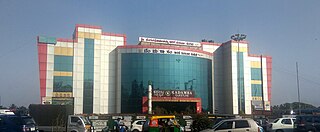
Moirang is a town in the Indian state of Manipur, best known for the tentatively listed UNESCO World Heritage Sites of the Keibul Lamjao Conservation Area (KLCA), covering Keibul Lamjao National Park (KLNP), the world's only floating national park, the buffer of Loktak Lake and Pumlen Pat. It is best known for the being the place of origin of the ancient epic legend of Khamba and Thoibi, one of the seven epic cycles of incarnations of Meitei mythology and folklore. Nationwide, it is also famous for the INA War Museum in the INA Martyrs' Memorial Complex, where Colonel Shaukat Malik of the Indian National Army hoisted the Tricolour for the first time on Indian soil on 14 April 1944. It is situated approximately 45 km (28 mi) south of the state capital Imphal. It has an area of 269 km2 (104 sq mi) with a population of 62,187 in 67 villages. There are 12 Panchayats in this block.

The Wright Valley is a large east–west trending valley, formerly occupied by a glacier but now ice free except for Wright Upper Glacier at its head and Wright Lower Glacier at its mouth, in Victoria Land, Antarctica. It was named by the VUWAE (1958-59) for Sir Charles Wright, for whom the BrAE (1910-13) named the glacier at the mouth of this valley.

Saharanpur district is the northernmost of the districts of Uttar Pradesh state, India. Bordering the states of Haryana, Himachal Pradesh and Uttarakhand, and close to the foothills of Shivalik range, it lies in the northern part of the Doab region.

Shivpuri District is a district of Madhya Pradesh state of India. The town of Shivpuri is the district headquarters. National Highway 3 (NH-3) runs through the district.

The Hemavati is a river in southern India's Karnataka and an important tributary of the Kaveri.
Vyāsatīrtha, also called Vyasaraja or Chandrikacharya, was a Hindu philosopher, scholar, polemicist, commentator and poet belonging to the Madhwacharya's Dvaita order of Vedanta. As the rajaguru of Vijayanagara Empire, Vyasatirtha was at the forefront of a golden age in Dvaita which saw new developments in dialectical thought, growth of the Haridasa literature under bards like Purandara Dasa and Kanaka Dasa and an increased spread of Dvaita across the subcontinent. He himself composed many kīrtanas in Kannada and Sanskrit.
Sri Vadiraja Tirtha was a Dvaita philosopher, poet, traveller and mystic. He authored many works, often critical, on Madhva theology and metaphysics. Additionally, he composed numerous poems and as the pontiff of Sodhe Mutt, renovated the temple complex at Udupi and established the Paryaya system of worship. He also enriched the Kannada literature of the time by translating Madhvacharya's works to Kannada, giving impetus and contributing to the Haridasa movement. He has influenced both Carnatic and Hindustani music through his compositions. His compositions are mainly in Kannada and Sanskrit. His mudra is 'Hayavadana'. His works are characterised by their poetic flourishes, wit and humour.
Kengeri is a western suburb of Bangalore city, located along Mysore Road.It is bordered by Nagarbhavi and Ullal to the north, Rajarajeshwari Nagar to the east, Kumbalgodu to the west and Uttarahalli to the south.
Verkilambi is an interior rural area the district of Kanyakumari at the state of Tamil Nadu. This is a grade – I Town panchayat spread in a total area of 15.7 Sq. km and consists of 18 wards, represented by 18 councilors. The Executive officer is the administrative head and the elected Chairman is the political head of this Town Panchayat. This was constituted as Kumarankudy Village, Pathmanapapuram MLA Constituency, Nagercoil MP Constituency. The town is located at a distance of 5 km from Ponmanai Town Panchayat on the East, 5 km from Thiruvattar Town Panchayat on the west. 3 km from Kothanalloor Town Panchayat on the South. This town is located along the Kanyakumari, Thiruvananthapuram, National High way and Colachel – Kulasekaram state high way Road through this TP. This TP Constitutes its village component to talking an area of 3.25 Sq. km up graded as town Panchayat
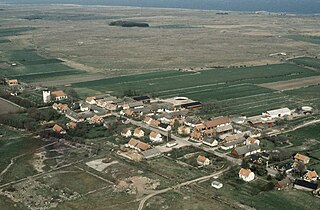
Hulterstad is a small coastal town on the southeastern part of the island of Öland, Sweden. Hulterstad is situated at the eastern fringe of the Stora Alvaret, a limestone pavement habitat which hosts a diversity of rare plants and has been designated a World Heritage Site by UNESCO. Hulterstad is the municipal government center for this district and central records for centuries were kept at the Hulterstad Church. Significant gravefields and a Viking stone burial ship structure are located immediately south of Hulterstad. To the north is located the village of Alby, where a mesolithic village of early human settlement has been found, and to the south is the Ottenby Nature Reserve. Across the alvar to the west is the village of Gettlinge.
Konch is a community development block of Gaya district in Bihar, India. Konch(Konch Village/Konch Panchayat/Konch Thana-Police Station) is a typical village market area slowly taking shape of a sub-urban settlement and centre of small business. Konch has very important temple known as Koncheswar Mahadev belonging to the later Gupta period which now has been taken under the protection of Archaeological Survey of India (ASI).
Rangsi is a village development committee in Rolpa District in the Rapti Zone of north-eastern Nepal. At the time of the 1991 Nepal census it had a population of 4000 people living in 745 individual households.
Khairi is a small village in the Hisar district under the Uklanamandi constituency in Haryana, India. It is 14 kilometres (8.7 mi) to the west of the Uklana Mandi.

The Ashokan edicts in Delhi are a series of edicts on the teachings of Buddha created by Ashoka, the Mauryan Emperor who ruled in the Indian subcontinent during the 3rd century BC. The Edicts of Ashoka were either carved on in-situ rocks or engraved on pillars erected throughout the empire; examples of both are found in Delhi.

Ganj Basoda, called Basoda, city and municipality in the Indian state of Madhya Pradesh. Ganj Basoda is one of the eleven tehsils of Vidisha district and is 39 km from Vidisha.

Milina is a village in the municipality of Loznica, Serbia. According to the 2002 census, the village has a population of 228 people.
Urkeri is a small village located in the district of Uttar Kannada in the state of Karnataka in India. It has a population of about 963 persons living in around 214 households. Urkeri is a temple Village. The main deity is Lord Ganesh. Lord Ganesha is revered as the village God in these villages, in the north Kanara district. The chariot ceremony of Ganapati is celebrated on Maghi Pournima. The temple is the main attraction at Urkeri, receiving many devotees per year. Urkeri Shree Swayambhoo Devasthana is an ancient temple.
Diksal is a village in Parner taluka in Ahmednagar district of state of Maharashtra, India.
Kammanahalli is a small village located in Tumkur District, Turuvekere Taluk, Mayasandra Hobli and Vittalapura Post in India's Karnataka State. The village is about 12 km from Yadiyur which is famous for the Lord Siddalingeshwara Temple and is about 100 km from Bangalore.