
Buckhorn is a home rule-class city in Perry County, Kentucky, in the United States. The population was 144 at the 2000 census. It is centered on the Buckhorn Presbyterian Church, a log structure listed on the National Register of Historic Places. The Buckhorn Children's Center and Buckhorn Lake State Resort Park are also located here.

Kudō is a district located in Hiyama Subprefecture, Hokkaido, Japan.
South Channel is a small channel in the United States located in Massachusetts Bay near Boston, Massachusetts. It runs alongside Devils Back and Aldridge Ledge from northeast of Ram Head to the western coast of Commissioners Ledge.
Martin Ledge is small barren rocks that barely stick out of the waters of Massachusetts Bay, within the city limits of Boston, Massachusetts, USA. The rocks are east of Tewksbury Rock and Outer Brewster Island and southwest of Three and One-half Fathom Ledge.
The North River is a tidal river channel, approximately 18 miles (29 km) long, in coastal Georgia, the United States. It is a longer and narrower alternative channel to the tidal Darien River and ultimately is part of the Altamaha River system in the marshes between Darien, Georgia and the Atlantic Ocean.
The Sawyer River is a 9.1-mile (14.6 km) long river in the White Mountains of New Hampshire in the United States. It is a tributary of the Saco River, which flows to the Atlantic Ocean in Maine.
Rio Negro is a municipality located in the Brazilian state of Mato Grosso do Sul. Its population was 5,324 (2005) and its area is 1,808 km².
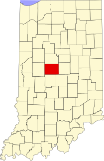
Gadsden is an unincorporated community in Union Township, Boone County, Indiana.

New Elizabethtown is an unincorporated community in Brownstown Township, Jackson County, Indiana.
CIHS-FM is a Canadian radio station broadcasting a gospel music format at 93.5 FM in Wetaskiwin, Alberta and is owned by Tag Broadcasting.

Green is an unincorporated community in Yolo County, California. It lies at an elevation of 16 feet.
Devils Elbow is an unincorporated community in Colusa County, California. It lies at an elevation of 919 feet.

Jarvie is a hamlet in central Alberta, Canada within Westlock County. It is located 0.6 kilometres (0.37 mi) west of Highway 44, approximately 108 kilometres (67 mi) northwest of Edmonton.
Natal is an unincorporated community in Pittsylvania County, in the U.S. state of Virginia.
Clopton is an unincorporated community in Gloucester County, in the U. S. state of Virginia.
Lövåsvallen is a football stadium in Billingsfors, Sweden and the home stadium for the football team Billingsfors IK.

Chain Lake is a census-designated place (CDP) in Snohomish County, Washington, United States. The population was 3,741 at the 2010 census.
Groomsville is an unincorporated community in Prairie Township, Tipton County, in the U.S. state of Indiana.
Saint Philip is an unincorporated community in Marrs Township, Posey County, in the U.S. state of Indiana.
Glencove is an unincorporated community in Pierce County, in the U.S. state of Washington.


