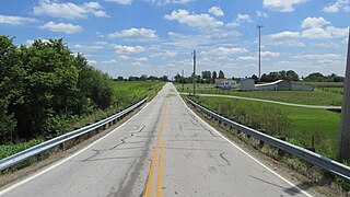
Curtis Township is a civil township of Alcona County in the U.S. state of Michigan. The population was 1,236 at the 2010 census.

Mikado Township is a civil township of Alcona County in the U.S. state of Michigan. The population was 947 at the 2010 census.

Maple Ridge Township is a civil township of Alpena County in the U.S. state of Michigan. The population was 1,690 at the 2010 census. There is a fire department and township hall located here.

Volinia Township is a civil township of Cass County in the U.S. state of Michigan. The population was 1,112 at the 2010 census. When the township was organized in 1833, it was at first named Volhynia, after the province in Poland. It is believed to have been given to honor General Tadeusz Kościuszko, the Polish patriot who helped the United States during the American Revolutionary War. The name was altered first to "Volenia" and then by 1901 or earlier to "Volinia".

Wakefield Township is a civil township of Gogebic County in the U.S. state of Michigan. The population was 305 at the 2010 census, down from 364 at the 2000 census.

Moran Township is a civil township of Mackinac County in the U.S. state of Michigan. The population was 1,080 at the 2000 census.

Highland Township, officially the Charter Township of Highland, is a charter township of west Oakland County in the U.S. state of Michigan. The population was 19,202 at the 2010 census. Highland is a suburb of Detroit.

Blumfield Township is a civil township of Saginaw County in the U.S. state of Michigan. As of the 2000 census, the township population was 2,014. The 2009 census estimate places the population at 1,847.

Wisner Township is a civil township of Tuscola County in the U.S. state of Michigan. The population was 749 at the 2000 census.

Range is an unincorporated community in Range Township, Madison County, Ohio, United States. It is located at 39°43′55″N83°25′29″W, along Ohio State Route 323 between Chenoweth and Midway.

Lafayette is a census-designated place in the center of Deer Creek Township, Madison County, Ohio, United States. It is located at 39°56′15″N83°24′24″W, along U.S. Route 40, just west of its intersection with U.S. Route 42.

Newport is an unincorporated community in Paint Township, Madison County, Ohio, United States. It is located at 39°50′06″N83°27′55″W, along Ohio State Route 38 between London and Midway.

Tradersville is an unincorporated community in Somerford Township, Madison County, Ohio, United States. It is located at 39°59′59″N83°29′55″W, at the intersection of Ohio State Route 187 and Tradersville-Brighton Road, about three miles north of Choctaw Lake.

Arnold is an unincorporated community in Jerome Township, Union County, Ohio, United States. It is located at 40°08′31″N83°15′03″W, along U.S. Route 42, between New California and Plain City.

Cook is an unincorporated community in Madison Township, Fayette County, Ohio, United States. It is located at 39°40′59″N83°18′26″W, along Cook-Yankeetown Road, just west of its intersection with U.S. Route 62/State Route 3.

Chrisman is an unincorporated community in Oak Run Township, Madison County, Ohio, United States. It is located at 39°49′59″N83°22′22″W, at the intersection of London-Circleville Road and Gregg Mill Road, about four miles southeast of London.

Eby is an unincorporated community in Hart Township, Warrick County, in the U.S. state of Indiana.
Vandyke is an unincorporated community in Buchanan County, Virginia, in the United States.
Idaho is an unincorporated community in Pike County, in the U.S. state of Ohio.
Sugar Tree Ridge is an unincorporated community in Highland County, in the U.S. state of Ohio.


