
The Tasman Sea is a marginal sea of the South Pacific Ocean, situated between Australia and New Zealand. It measures about 2,000 kilometres (1,200 mi) across and about 2,800 kilometres (1,700 mi) from north to south. The sea was named after the Dutch explorer Abel Janszoon Tasman, who was the first recorded European to encounter New Zealand and Tasmania. The British explorer Captain James Cook later extensively navigated the Tasman Sea in the 1770s as part of his first voyage of exploration.

The Taupo Volcanic Zone (TVZ) is a volcanic area in the North Island of New Zealand that has been active for the past two million years and is still highly active. Mount Ruapehu marks its south-western end and the zone runs north-eastward through the Taupo and Rotorua areas and offshore into the Bay of Plenty. It is part of the larger Central Volcanic Region that extends further westward through the western Bay of Plenty to the eastern side of the Coromandel Peninsula and has been active for four million years. The Taupo Volcanic Zone is widening east–west at the rate of about 8 mm per year. It is named after Lake Taupo, the flooded caldera of the largest volcano in the zone.
Hawke's Bay's Waiau River is one of at least four rivers of this name in New Zealand. It rises in the Kaingaroa Forest to the west of Lake Waikaremoana, and flows southeast for 60 kilometres before joining the Wairoa River.

Taneatua is a small town in the Bay of Plenty region of New Zealand's North Island. The town is located southeast of Pekatahi, a similarly small settlement; Whakatane is the nearest significantly sized town. Just to the southwest of Taneatua, the Whakatane River and Waimana Rivers meet. The Whakatane River itself flows to the west of Taneatua, while the Waimana River is south of the township.
Torlyn Mountain is an elongated mountain, of which Murray Monolith is the detached front, standing 4 miles (6 km) east of Scullin Monolith on the coast of Mac. Robertson Land, Antarctica.
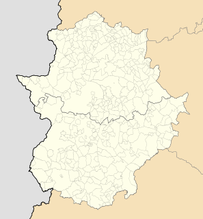
La Haba is a municipality located in the province of Badajoz, Extremadura, Spain. According to the 2005 census (INE), the municipality has a population of 1441 inhabitants.
Te Karaka is a small settlement inland from Gisborne, in the northeast of New Zealand's North Island. It is located in the valley of the Waipaoa River close to its junction with its tributary, the Waihora River. Te Karaka is located on State Highway 2, and is the largest settlement between Gisborne and Opotiki in the Bay of Plenty.
Ormond is a small settlement inland from Gisborne, in the northeast of New Zealand's North Island. It is located on State Highway 2 in the valley of the Waipaoa River, halfway between Gisborne and the township of Te Karaka.
Manutuke is a settlement in the Gisborne Region of New Zealand's North Island. It is located to the west of the city of Gisborne on State Highway 2, close to the mouth of the Waipaoa River.
Waikohu is a small settlement in the northeast of New Zealand's North Island. It is located close to the confluence of the Wharekopae and Waikohu Rivers on State Highway 2 to the west of Te Karaka, inland from Gisborne.

Duckmaloi River, a perennial stream that is part of the Macquarie catchment within the Murray–Darling basin, is located in the Central Tablelands region of New South Wales, Australia.
The Mangaaruhe River is a river of the Gisborne Region of New Zealand's North Island. It flows southeast from the Ngamoko Range southwest of Lake Waikaremoana, flowing into the Wairoa River eight kilometres north of Frasertown.
The Mangapoike River is a river of the Gisborne Region of New Zealand's North Island. It flows generally southwest from sources south of Waingake, reaching the Wairoa River 10 kilometres (6 mi) northeast of Frasertown.
The Mangatu River is a river of the Gisborne Region of New Zealand's North Island. It flows south from its sources in rough hill country northeast of Matawai to reach the Waipaoa River at Whatatutu.
The Oparau River is a river of the Waikato Region of New Zealand's North Island. It flows southwest from its sources in the Pirongia Forest Park and flows into the Kawhia Harbour 5 kilometres (3 mi) east of Kawhia.
The Ruakituri River is a river of the Hawke's Bay Region of New Zealand's North Island. A major tributary for the Wairoa River, it initially flows northeast from its sources north of Lake Waikareiti. It turns southeast for the majority of its course, reaching the Wairoa at the settlement of Te Reinga, 25 kilometres (16 mi) north of Wairoa.
The Waikaretaheke River is a river of the Hawke's Bay region of New Zealand's North Island. It serves as the outflow of Lake Waikaremoana, flowing southeast from the lake's southeastern shore to reach the Waiau River 20 kilometres northwest of Wairoa. State Highway 38 follows the river's course for much of its length.
Montgomerie Glacier is a narrow tributary glacier, 10 nautical miles (19 km) long, flowing north along the west side of Hampton Ridge in the Queen Alexandra Range of Antarctica to enter Lennox-King Glacier. It was named by the Northern Party of the New Zealand Geological Survey Antarctic Expedition of 1961–62 for John Montgomerie, assistant surveyor of that party.
Hulbe Glacier is a glacier about 10 nautical miles (20 km) long draining the north side of Siple Island, Antarctica. It was named by the Advisory Committee on Antarctic Names after Christina Hulbe, faculty member of the University of Otago, New Zealand, and a theoretical and field researcher of ice motion in Antarctica.

