
Gujrat is a city in the Pakistani province of Punjab. It is the headquarters of the Gujrat District and the 20th largest city in Pakistan, with a population of over 390,000 in 2017. Along with the nearby cities of Sialkot and Gujranwala, Gujrat forms part of the Golden Triangle of industrial cities with export-oriented economies.

Wazirabad is a city in Punjab, Pakistan. It is the capital of Wazirabad District.

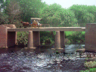
Sarai Alamgir is the main town of Sarai Alamgir Tehsil, located in the Gujrat district in the north of the Punjab province of Pakistan. Sarai Alamgir is one of four tehsils of Gujrat district.

British Punjab was a province of British India. Most of the Punjab region was annexed by the British East India Company on 29 March 1849, and declared a province of British colonial rule; it was one of the last areas of the Indian subcontinent to fall under British control. In 1858, the Punjab, along with the rest of British Raj, came under the direct colonial rule of the British Crown. It had a land area of 358,355 square kilometers.

Lahore Division is an administrative division of Punjab Province, Pakistan. It comprises four Districts - Kasur, Lahore, Nankana Sahib and Sheikhupura. The Lahore Division is commanded by a Commissioner to manage the division. Under the Commissioner there are four Additional Commissioners. For each district there is a Deputy Commissioner. Under the reforms of 2000, this tier of government was abolished, but in 2008 divisions were restored.
Kotla Sarang Khan is a village located in Kharian Tehsil, Gujrat District in Punjab Province of Pakistan.
Kurree Sharif is a large village of Gujrat District in the Punjab province of Pakistan. It is located at 32°31'10N 74°12'55E with an altitude of 220 metres and is about 45 km north east of Gujrat city and about 25 km from the city of Sialkot. It is perched atop a small hillock which overlooks the Marala Headworks at the very juncture where the Chenab River winds its way into Pakistan. This village comes under the administrative jurisdiction of Union Council Mari Khokhran. The nearby villages are Khalil Pur in the North, Marala Headworks in the East, BehlolPur, Mari Khokhran and shampur in the South. People of all these villages live very cordially like brothers with mutual respect and love for each other. Though the village falls under District Gujrat but it is located just 19 km from Sialkot City.
Behlolpur is a town in Gujrat District in the Punjab province of Pakistan.

Qadirabad is a village located near Chenab River in tehsil Phalia in Mandi Bahauddin District in province Punjab in Pakistan.

Bhagwal, is a village and Union Council of Kharian Tehsil, Gujrat District,in the Punjab province of Pakistan. Bhagwal is approximately 131 kilometres (81 mi) from the national capital Islamabad.

Sambrial is a city in Sialkot District in the Punjab province of Pakistan. It is the capital of Sambrial Tehsil, an administrative subdivision of the district. Sialkot Dry Port is located in Sambrial. Sialkot international Airport is also located near Sambrial. It is the 90th largest city of Pakistan by population.

Sahowala is a town in Sambrial Tehsil, Sialkot District, Punjab, Pakistan. It is located between the Upper Chenab Canal and the Marala Ravi Link Canal of the Marala Headworks project. Demographically, the town has a Union Council which is one of the largest councils in Sialkot, having a population around 20,000 which covers six neighbouring villages. Many residents are farmers, while others work abroad and serve in the industry and government. There is a big center of Tehreek Labaik Pakistan. The town is close to the Sialkot Tanneries Zone. Minhaj ul Quran Islamic Library is the public library, along Noor Mosque, which has the highest minaret in the Sialkot District. First Market and shopping center constructed at main Sahowala Road near Noor Mosque named DEEN CENTER since 2021. This village has a history of more than 800 years. Mughal Colony was also established in Sahowala.
Kotli Loharan is a small town in Sialkot District, Pakistan. K. L industry by Muhammad Younas used to manufacture mine-laying machines, hydraulic jacks and instruments for F-86 aircraft engine maintenance for the Pakistan Army. A rural hospital funds were raised, a veterinary hospital, boys and girls colleges, schools and roads have been constructed. Bazaars have been widened in 2010, Fresh water filtration plants have been installed in various locations. New Building of veterinary Hospital constructed, Streets are cemented, Rural Hospital new building constructed and upgraded, Ring roads are made.
Kotli Loharan East is a town in the Sialkot District of Punjab, Pakistan. The name of this town is derived from word Kotli Aunchi (high), the old town in K L East, which later become Kotli Loharan. Many people from this town have migrated to Commonwealth countries, the Middle East and the UK. Most of the original population of this town have moved to the big cities in Pakistan and overseas, especially to Kenya and UK. Majority of current population is new migrants from Jammu and Kashmir, that came there after Indo-Pakistani War of 1947–1948, and some old population.
Sarai Alamgir Tehsil is one of four administrative subdivision areas, or Tehsils, in the District of Gujrat. The Tehsil is located on the eastern bank of the Jhelum River across from the larger town of Jhelum. East of the Tehsil is the Upper Jhelum Canal which separates it from Kharian Tehsil.
Gunja(Urdu: گنجه ) is a town and a union council of Kharian Tehsil and Gujrat District, in the Punjab province of Pakistan. It is part of Kharian Tehsil. Other villages in the union council are Chak Ikhlas, Mughli, Dhalla, Chak Rajjadi, Jataria Khurd, Jataria Kalan, Chatta and Shahsar mast.
'Choa Rajgan is a village of Gujrat District, Punjab, Pakistan in tehsil Sarai Alamgir. The population is more than 2,000 people. It is one of the biggest villages of Chib Rajputs. The majority of the inhabitants belong to the chib Rajput caste, hence the village name.

Nawaz Sharif Medical College is a medical school located in Gujrat, Punjab, Pakistan.
Jathekey is a village of Sialkot District in the Punjab province of Pakistan. It is located in the North-West of the Sambrial and lies 2 km away from Sambrial. Jathekey is one of the biggest villages of Sialkot among 161 villages.
Shahbazpur is a village situated in the district of Gujrat, Pakistan. Chenab passes through the eastern border of the village.