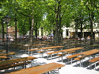
Centrally located in the suburb of Au, the Mariahilfplatz is a well visited and active place. One of the largest fairs in Munich, the Auer Dult, occurs here three times per year.
The square is dominated by the neo-gothicMariahilfkirche (Mariahilf Church) which is situated right in the centre. East of the square behind the monastery of the School Sisters of Notre Dame is the Auer Mühlbach (Millstream of Au), one of the remaining brooks in Munich. Also at the Mariahilfplatz are the Landratsamt München (Administrative office of the Landkreis München) with the public health office, the Maria-Hilf School, Police Department 21, REFUGIO Munich (a consultation and treatment centre for refugees and torture victims) and Neudeck, a prison for women and young people.
Transportation
Fountain in Mariahilfplatz
South of the square is Ohlmüllerstraße (Ohlmüller street), which connects the west side of the Isar with Au and Giesing. Due to the nature of the city centre car parking spaces are often very hard to come by, particularly during the Auer Dult.
One can get to the Mariahilfplatz by public transport: Line 17 by tram stopping at Mariahilfplatz, Metrobus 52 stopping at Mariahilfplatz and Schweigerstraße (Schweiger Street), and bus 62 stopping at Schweigerstraße.
Surroundings
The following can be found neighbouring directly and indirectly:
Munich is the capital and most populous city of the Free State of Bavaria, Germany. With a population of 1,594,632 inhabitants as of 31 May 2024, it is the third-largest city by population in Germany, after Berlin and Hamburg, and thus the largest which does not constitute its own state, as well as the 11th-largest city in the European Union. The Munich metropolitan area – including suburbs and satellite towns – has 3 million inhabitants; and the city's metropolitan region is home to about 6.2 million people and is the third largest metropolitan region by GDP in the European Union.
The Deutsches Museum in Munich, Germany, is the world's largest museum of science and technology, with about 125,000 exhibited objects from 50 fields of science and technology. It receives about 1.5 million visitors per year.
Munich is a Landkreis (district) in Bavaria, Germany. It borders the districts of Dachau, Freising, Erding, Ebersberg, Rosenheim, Miesbach, Bad Tölz-Wolfratshausen, Starnberg, Fürstenfeldbruck, and almost encircles the district-free city of Munich itself, which is the district seat.
The Eisbach is a 2-kilometre-long (1.2 mi) canal, part of Munich City Streams in Munich. It flows through the Englischer Garten park, and is a side arm of the Isar River. An artificial wave has been created on one section, which is popular among river surfers.
The Auer Dult is a traditional fair in Munich, combining a market and a German style folk festival.
Altstadt and Lehel are districts of the German city of Munich. Together they form the first borough of the city: Altstadt-Lehel.
Au-Haidhausen is the 5th borough of the German city of Munich, Bavaria. It is formed by the Au and Haidhausen districts.
Au is a district in the south eastern plain tract of the German city of Munich in Bavaria. Au extends from the Deutsches Museum in the north and along the Isar up to Wittelsbacherbrücke in the south.
The Prinzregentenstraße in Munich is one of four royal avenues and runs parallel to Maximilianstraße and begins at Prinz-Carl-Palais, in the northeastern part of the Old Town. The avenue was constructed from 1891 onwards as a prime address for the middle class during the reign of Luitpold, Prince Regent of Bavaria and is named in his honour. The square in the eastern part of the street is named Prinzregentenplatz.
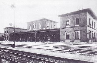
München Süd is a disused railway station and a railway goods station in the Munich borough of Ludwigsvorstadt-Isarvorstadt. The train service was withdrawn on 1 July 1985; in 2005 the last buildings were demolished to make room for office buildings.
Ludwigsvorstadt-Isarvorstadt is one of the boroughs of Munich, Germany.
Haidhausen is a quarter in Munich, Germany. It is now part of the borough of Au-Haidhausen.
Auer Mühlbach is a river in Bavaria, Germany. It is a branch of the Isar in the southern part of Munich.
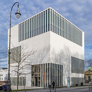
The NS-Dokumentationszentrum (NSDOKU) is a museum in the Maxvorstadt area of Munich, Germany, which focuses on the history and consequences of the National Socialist (Nazi) regime and the role of Munich as Hauptstadt der Bewegung.
The Ostfriedhof is a cemetery in Munich, situated in the district of Obergiesing, established in 1821 and still in use. It contains an area of more than 30 hectares and approximately 34,700 burial plots.
Nockherberg is the name of a small terrace on the slope of the eastern bank of the Isar in Munich, situated in the urban district of Au. An annual beer festival rich in tradition takes place there in the Paulaner Brewery - the Salvator-Ausschank auf dem Nockherberg The name of the raised terrace is often used synonymously for this festival or its opening event, the tapping of the first barrel of a strong, seasonal beer (Starkbieranstich).
The Nockherstraße is a road located in the south of Au-Haidhausen, the 5th district of Munich, Germany. The former suburb of Au is located in the original flooding area of the Isar. The 500-meter-long road runs between the end of the Ohlmüllerstraße and the Kolumbusplatz at the foot of the Isar river terrace. About 400 people live in Nockherstraße.
Boschetsrieder Straße is an inner city street in the Munich districts of Thalkirchen, Obersendling and Forstenried/Am Waldfriedhof, which runs west from Bundesstraße 11 on the Isar hillside to Kreuzhof, where it continues as the Fürstenrieder Straße.
Candidstraße is an inner-city street in Munich and a section of the Mittlerer Ring.
The Campus Garching is a campus of the Technical University of Munich and a number of other research institutes, located around 10 km north of Munich in Garching. At the same time, it constitutes a district of the city. With more than 7,500 employees and around 17,000 students, it is one of the largest centers for science, research and teaching in Germany.
This page is based on this Wikipedia article Text is available under the CC BY-SA 4.0 license; additional terms may apply. Images, videos and audio are available under their respective licenses.