The Netherlands is a country located mainly in Northwestern Europe. The European portion of the Netherlands consists of twelve separate provinces that border Germany to the east, Belgium to the south, and the North Sea to the northwest, with maritime borders in the North Sea with Belgium, Germany and the United Kingdom. Together with three island territories in the Caribbean Sea—Bonaire, Sint Eustatius and Saba— it forms a constituent country of the Kingdom of the Netherlands. The official language is Dutch, but a secondary official language in the province of Friesland is West Frisian.
Hof van Twente is a municipality in the eastern Netherlands, province Overijssel. The municipality was established 1 January 2001 as the result of the merger of the municipalities of Diepenheim, Goor, Markelo, Ambt Delden, and Stad Delden.
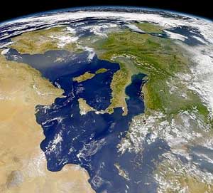
Overijssel is a province of the Netherlands located in the eastern part of the country. The province's name translates to "across the IJssel", from the perspective of the Episcopal principality of Utrecht by which it was held until 1528. The capital city of Overijssel is Zwolle and the largest city is Enschede. The province had a population of 1,142,360 in 2015.
Markvelde includes a school, a community center, and a number of hog and cattle farms.
A geographic coordinate system is a coordinate system that enables every location on Earth to be specified by a set of numbers, letters or symbols. The coordinates are often chosen such that one of the numbers represents a vertical position and two or three of the numbers represent a horizontal position; alternatively, a geographic position may be expressed in a combined three-dimensional Cartesian vector. A common choice of coordinates is latitude, longitude and elevation. To specify a location on a plane requires a map projection.
This page is based on this Wikipedia article Text is available under the CC BY-SA 4.0 license; additional terms may apply. Images, videos and audio are available under their respective licenses.
Related Research Articles
Italy is located in southern Europe and comprises the long, boot-shaped Italian Peninsula, the southern side of Alps, the large plain of the Po Valley and some islands including Sicily and Sardinia. Corsica, although belonging to the Italian geographical region, has been a part of France since 1769. Italy is part of the Northern Hemisphere.
Neede is a former municipality and a town in the eastern Netherlands.
Rouveen is a village in the Dutch province of Overijssel. It is located in the municipality of Staphorst, about 4 km southwest of that town.
Vriezenveen [vrizə(ɱ)ˈveːn] is a town in the Dutch province of Overijssel. It is located in the municipality of Twenterand, about 7 km north of Almelo.
Nieuwlande is a small Dutch village. The population, as of 1 January 2004, is 1,250. It is located in the north-eastern province of Drenthe. In the Drents dialect, the town is called Neilande. The town is situated in the municipality of Hoogeveen. It is one of only two villages in the world that collectively received Righteous Among the Nations award for all 117 inhabitants of the village for saving Jews during World War II, the other being the French Le Chambon-sur-Lignon.
Cabezarrubias del Puerto is a municipality in Ciudad Real, Castile-La Mancha, Spain. It has a population of 624.
Avereest is a former municipality in the Dutch province of Overijssel. The largest town in the municipality was Dedemsvaart.
Domadice is a village and municipality in the Levice District in the Nitra Region of Slovakia.
Geesbrug is a village in the Netherlands and it is part of the Coevorden municipality in Drenthe. Geesbrug had a population of 720 in 2004. Its altitude is 14 meters (49 feet).
Langerak is a village in the Netherlands and it is part of the Coevorden municipality in Drenthe. Langerak has an altitude of 14 meters (49 feet).
Eldersloo is a village in the Netherlands and is part of the Aa en Hunze municipality in Drenthe. Eldersloo has an altitude of about 14 meters.
It has a population of around 50.
Faraján is a town and municipality in the province of Málaga, part of the autonomous community of Andalusia in southern Spain. The municipality is situated approximately 25 kilometers from Ronda and 144 km from the city of Málaga. It is located west of Málaga in the Genal valley. It is one of the towns that make up the comarca of the Serranía de Ronda.
Voorthuizen is a village in the municipality of Barneveld, in the Dutch province of Gelderland. Voorthuizen was founded, according to legend, near a crossing of a ford ('Voorde') of the Ganzenbeek, a brook that no longer exists, on the road from Amsterdam to Deventer. This road was called a "Hessenweg" because seasonal labourers from Westphalia would travel along this road into the Netherlands. Another important road that lead through this place was the trade route from Harderwijk to Wageningen. This made Voorthuizen an important stop along these two routes.
Agárd is a small village on the shores of Lake Velence in Hungary, administratively belongs to the municipality (town) of Gárdony. It is a popular tourist destination amongst Hungarians.
Przewóz Nurski is a village in the administrative district of Gmina Ceranów, within Sokołów County, Masovian Voivodeship, in east-central Poland.
Məşədiqaralar is a village and municipality in the Goranboy Rayon of Azerbaijan. It has a population of 595.
Bala Şahağac is a village and municipality in the Astara Rayon of Azerbaijan. It has a population of 1,379. The municipality consists of the villages of Bala Şahağac and Qamışovka.
Svojetín is a village and municipality in Rakovník District in the Central Bohemian Region of the Czech Republic.
Coatzingo (municipality) is a town and municipality in Puebla in south-eastern Mexico.
Oblička Sena is a village in the municipality of Vranje, Serbia. According to the 2002 census, the village has a population of 52 people.