See also
- Marmato , a 2014 American documentary film
| This disambiguation page lists articles associated with the title Marmat. If an internal link led you here, you may wish to change the link to point directly to the intended article. |
Marmat is a village in Mazandaran Province, Iran.
Marmat may also refer to:
| This disambiguation page lists articles associated with the title Marmat. If an internal link led you here, you may wish to change the link to point directly to the intended article. |

Khaira is a village in Ludhiana district in the Indian state of Punjab.

Doda is a district in eastern part of Jammu Division of the Indian Union territory of Jammu and Kashmir. The district consists of 17 Tehsils: Thathri, Bhaderwah, Doda, Mahalla, Bhagwa, Assar, Bhalla, Gundana, Marmat, Kahara, Gandoh (Bhalessa), Bhella, Bharth Bagla, Chiralla, Chilli Pingal, Phagsoo(Fagsu) and Kashtigarh.

Mahendragarh is a town and a municipal committee in Mahendragarh district in the north Indian state of Haryana. It is 100 kilometres (62 mi) from Gurgaon and comes under National Capital Region (India).

Udaipur district is one of the 33 districts of Rajasthan state in western India. The historic city of Udaipur is the administrative headquarters of the district. The district is part of the Mewar region of Rajasthan.

Ludhiana District is one of the 22 districts in the Indian state of Punjab. It is the largest district of Punjab, by both area and population. Ludhiana city, the district headquarters, is the hub of industry in Punjab. The main industries are bicycle parts and hosiery. Ludhiana is the biggest city of the state. It has eight tehsils, seven sub-tehsils and twelve development blocks.
A block is an administrative division of some South Asian countries.
Hussainpur is a census town in Jalandhar district in the Indian state of Punjab. It is situated in Jalandhar II Tehsil. The village code is 030405.
Shahkot is a city and a tehsil among 5 tehsils of Jalandhar district, Punjab, India. Shahkot is situated on Jalandhar-Moga-Barnala-Sirsa National Highway 703. Shahkot is administered by the Municipal Committee. About 250 villages belong to Shahkot tehsil. Shahkot is famous for its red chilli peppers. Red roofs are a common sight in Shahkot during chilli harvesting season.

Kotli Sattian Sattian is a tehsil (subdivision) of Rawalpindi District in the North Punjab province of Pakistan. The people of Kotli Sattian are referred to as Pahari people. The language of this region and the neighbouring areas of Pakistan administered Kashmir and some areas of east Kpk is Pahari language. The people of Kotli Sattian are generally well built and of balanced height, sturdy and strong, hardworking and fair in complexion. They are proud of their ancestors pure-blood. The people of this region are inborn soldiers and belong to the martial races in the northwest of the sub-continent. They possess a distinctive place and role in Armed Forces of Pakistan.village Dani Begal most person serve in armed forces,His are very hard worker and a brave.

Kabal is a town in Swat District, Khyber-Pakhtunkhwa province of Pakistan located 10 kilometres (6 mi) from Mingora city. The old name of kabal was Chendakhwara. Population of the city 118,103 District Swat has 7 Tehsils: Tehsil Kabal, Tehsil Babuzai, Tehsil Matta, Tehsil Khwaza Khela, Tehsil Barikot, Tehsil Charbagh and Tehsil Bahrain. Each Tehsil comprises certain numbers of Union council. There are 65 Union council in district Swat, 56 rural and 09 urban.
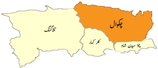
Chakwal Tehsil, is an administrative subdivision (tehsil) of Chakwal District in the Punjab province of Pakistan. The tehsil is subdivided into 30 Union Councils - five of which form the capital Chakwal. During British rule the tehsil was part of Jhelum District, according to the 1901 census the population was 160,316 compared to 164,912 in 1891. At the time the tehsil contained 248 villages.
A tehsil is an administrative division in some countries of the Indian subcontinent that is usually translated to "township". It is a subdivision of the area within a district including the designated city, town, hamlet, or other populated place that serves as its administrative centre, with possible additional towns, and usually a number of villages. The terms in India have replaced earlier geographical terms, such as pargana and thana.
Domeli is a village and union council of tehsil Sohawa, Jhelum District in the Punjab province of Pakistan.
Samundri is an administrative subdivision, or tehsil, of Faisalabad District in the Punjab province of Pakistan. Samundri Tehsil farms are irrigated by Gugera Branch Canal and Burala Branch Canal.
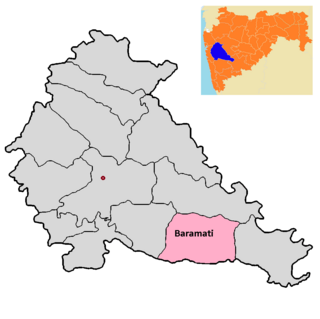
Baramati taluka is a taluka in Baramati subdivision of Pune district of state of Maharashtra in India.

Marmat is a village in Miandorud-e Kuchak Rural District, in the Central District of Sari County, Mazandaran Province, Iran. At the 2006 census, its population was 1,712, in 404 families.

Boniyar is a town and a municipal committee in tehsil Boniyar, Baramulla district in India's northernmost union territory of Jammu and Kashmir. It is located 20 km towards west from district headquarters Baramulla. Boniyar was given tehsil status in 2006. Prominent villages in tehsil Boniyar are Wopal Haq Marg Athishampora Bijhama, Trikanjan, Barnate, Uranbuha, Chandanwari Chahla and Nowshera. A major site of attraction is Lower Jhelum hydropower project at Chalah Boniyar having a capacity of generating 105 MW. Lachipora wildlife sanctuary has been established for conserving markhoor and other vulnerable animals.
Marmat is a village and tehsil in Doda district, Jammu and Kashmir, consisting of 18 villages. It occupies an area of 222.588 km2 (86 sq mi), and is located 45 km south of the district headquarters of Doda.